Directions to Citizens Wellesley - Linden St. with public transportation
The following transit lines have routes that pass near Citizens Wellesley - Linden St.
 Bus: 01, MBRS.
- Train: FRAMINGHAM/WORCESTER.
How to get to Citizens Wellesley - Linden St. by bus?
Click on the bus route to see step by step directions with maps, line arrival times and updated time schedules.
How to get to Citizens Wellesley - Linden St. by train?
Click on the train route to see step by step directions with maps, line arrival times and updated time schedules.
Bus stop near Citizens Wellesley - Linden St.
- Cross St (Central St/Cross St), 13 min walk,VIEW
Train station near Citizens Wellesley - Linden St.
- Wellesley Hills, 39 min walk,VIEW
Bus lines to Citizens Wellesley - Linden St.
- 01, Natick Mall - Wegmans,VIEW
What are the closest stations to Citizens Wellesley - Linden St.?
The closest stations to Citizens Wellesley - Linden St. are:
- Cross St (Central St/Cross St) is 1097 yards away, 13 min walk.
- Wellesley Hills is 3317 yards away, 39 min walk.
Which bus lines stop near Citizens Wellesley - Linden St.?
These bus lines stop near Citizens Wellesley - Linden St.: 01, MBRS.
Which train line stops near Citizens Wellesley - Linden St.?
FRAMINGHAM/WORCESTER (#529 | Worcester)
What’s the nearest bus station to Citizens Wellesley - Linden St.?
The nearest bus station to Citizens Wellesley - Linden St. is Cross St (Central St/Cross St). It’s a 13 min walk away.
What time is the first train to Citizens Wellesley - Linden St.?
The FRAMINGHAM/WORCESTER is the first train that goes to Citizens Wellesley - Linden St.. It stops nearby at 5:09 AM.
What time is the last train to Citizens Wellesley - Linden St.?
The FRAMINGHAM/WORCESTER is the last train that goes to Citizens Wellesley - Linden St.. It stops nearby at 12:32 AM.
What time is the first bus to Citizens Wellesley - Linden St.?
The 01 is the first bus that goes to Citizens Wellesley - Linden St.. It stops nearby at 5:58 AM.
What time is the last bus to Citizens Wellesley - Linden St.?
The 01 is the last bus that goes to Citizens Wellesley - Linden St.. It stops nearby at 8:56 PM.
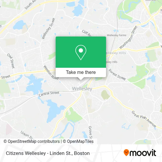
See Citizens Wellesley - Linden St. on the map
Public Transportation to Citizens Wellesley - Linden St.
Wondering how to get to Citizens Wellesley - Linden St.? Moovit helps you find the best way to get to Citizens Wellesley - Linden St. with step-by-step directions from the nearest public transit station.
Moovit provides free maps and live directions to help you navigate through your city. View schedules, routes, timetables, and find out how long does it take to get to Citizens Wellesley - Linden St. in real time.
Looking for the nearest stop or station to Citizens Wellesley - Linden St.? Check out this list of stops closest to your destination: Cross St (Central St/Cross St); Wellesley Hills.
Bus: 01, MBRS.Train: FRAMINGHAM/WORCESTER.
Want to see if there’s another route that gets you there at an earlier time? Moovit helps you find alternative routes or times. Get directions from and directions to Citizens Wellesley - Linden St. easily from the Moovit App or Website.
We make riding to Citizens Wellesley - Linden St. easy, which is why over 1.7 million users, including users in Wellesley, trust Moovit as the best app for public transit. You don’t need to download an individual bus app or train app, Moovit is your all-in-one transit app that helps you find the best bus time or train time available.
For information on prices of bus, train and subway, costs and ride fares to Citizens Wellesley - Linden St., please check the Moovit app.
Use the app to navigate to popular places including to the airport, hospital, stadium, grocery store, mall, coffee shop, school, college, and university.
Citizens Wellesley - Linden St. Address: 182 Linden St street in Wellesley
- Erasmo Alvarenga Real Estate,
- The Cottage (Cottage Wellesley),
- Stepping Stone Acupuncture and Wellness,
- De Shaw & Co.,
- Pureggs,
- Framebridge,
- Playa Bowls,
- Copland Caryl Chirprtr,
- Frankel Mark MD,
- Donadio Georgianna Doctor,
- Grignaffini Earthscape,
- Miller Leslie Phys Therapist,
- Citizens Bank & Trust,
- Santander,
- Door No. 7,
- Ace Hardware,
- Glowgolf,
- Orvis,
- Libertyx Bitcoin ATM,
- Goddard School
Places Near Citizens Wellesley - Linden St.
- Boston Common, Boston,
- Boston Convention & Exhibition Center, Boston,
- Leader Bank Pavilion (Leader Bank Pavillion), Boston,
- Td Garden, Boston,
- Faneuil Hall, Boston,
- Wang Theater, Boston,
- Museum Of Science, Boston,
- Mgm Music Hall, Boston,
- Isabella Stewart Gardner Museum, Boston,
- Wilbur Theatre, Boston,
- Massachusetts General Hospital, Boston,
- Boston Children's Hospital, Boston,
- North End, Boston,
- Prudential Center, Boston,
- Castle Island, Boston,
- Cheers, Boston,
- House Of Blues, Boston,
- Boston Medical Center, Boston,
- Seaport District, Boston,
- Quincy Market, Boston
How to get to popular places in Boston with public transit
Get around Wellesley by public transit!
Traveling around Wellesley has never been so easy. See step by step directions as you travel to any attraction, street or major public transit station. View bus and train schedules, arrival times, service alerts and detailed routes on a map, so you know exactly how to get to anywhere in Wellesley.
When traveling to any destination around Wellesley use Moovit's Live Directions with Get Off Notifications to know exactly where and how far to walk, how long to wait for your line, and how many stops are left. Moovit will alert you when it's time to get off — no need to constantly re-check whether yours is the next stop.
Wondering how to use public transit in Wellesley or how to pay for public transit in Wellesley? Moovit public transit app can help you navigate your way with public transit easily, and at minimum cost. It includes public transit fees, ticket prices, and costs. Looking for a map of Wellesley public transit lines? Moovit public transit app shows all public transit maps in Wellesley with all Bus, Train, Subway and Ferry routes and stops on an interactive map.
Boston has 4 transit type(s), including: Bus, Train, Subway and Ferry, operated by several transit agencies, including MBTA, Southeastern Regional Transit Authority, MetroWest Regional Transit Authority, Rhode Island Public Transit Authority, WRTA, Lowell Regional Transit Authority, Merrimack Valley Transit, Montachusett Regional Transit Authority, Cape Cod Regional Transit Authority, Brockton Area Transit Authority, Martha's Vineyard Transit Authority, the WAVE - Nantucket Regional Transit Authority, GATRA, Cape Ann Transportation Authority and Massport