See City Creek Center, Salt Lake City, on the map
Directions to City Creek Center (Salt Lake City) with public transportation
The following transit lines have routes that pass near City Creek Center
 Bus:
Bus: - Light Rail:
How to get to City Creek Center by bus?
Click on the bus route to see step by step directions with maps, line arrival times and updated time schedules.
Light Rail stations near City Creek Center in Salt Lake City
- City Center Station,2 min walk,
Bus stations near City Creek Center in Salt Lake City
- State St / 50 S (Sb),3 min walk,
- 100 S / Main St (Eb),3 min walk,
- 100 S / Main St (Wb),3 min walk,
- North Temple / Main St (Eb),7 min walk,
Bus lines to City Creek Center in Salt Lake City
- 200,Murray Central Station,
- 209,Salt Lake Central Station,
- 451,Tooele,
- 455,Ogden Via Weber State,
- 470,Ogden,
- 472,Riverdale,
- 473,U Of U (Research Park),
- 4,Olympus Cove P+R,
- 1,South Temple,
- 2,200 SOUTH,
- 205,500 EAST,
- 220,HIGHLAND DRIVE / 1300 EAST,
- 223,Holladay (Cottonwood Corporate Center),
What are the closest stations to City Creek Center?
The closest stations to City Creek Center are:
- City Center Station is 121 yards away, 2 min walk.
- State St / 50 S (Sb) is 200 yards away, 3 min walk.
- 100 S / Main St (Eb) is 201 yards away, 3 min walk.
- 100 S / Main St (Wb) is 202 yards away, 3 min walk.
- North Temple / Main St (Eb) is 510 yards away, 7 min walk.
Which bus lines stop near City Creek Center?
These bus lines stop near City Creek Center: 1, 200, 205, 4, 470.
Which light rail lines stop near City Creek Center?
These light rail lines stop near City Creek Center: 701, 704.
What’s the nearest light rail station to City Creek Center in Salt Lake City?
The nearest light rail station to City Creek Center in Salt Lake City is City Center Station. It’s a 2 min walk away.
What’s the nearest bus stop to City Creek Center in Salt Lake City?
The nearest bus stops to City Creek Center in Salt Lake City are State St / 50 S (Sb), 100 S / Main St (Eb) and 100 S / Main St (Wb). The closest one is a 3 min walk away.
What time is the first light rail to City Creek Center in Salt Lake City?
The 704 is the first light rail that goes to City Creek Center in Salt Lake City. It stops nearby at 5:00 AM.
What time is the last light rail to City Creek Center in Salt Lake City?
The 704 is the last light rail that goes to City Creek Center in Salt Lake City. It stops nearby at 11:47 PM.
What time is the first bus to City Creek Center in Salt Lake City?
The 1 is the first bus that goes to City Creek Center in Salt Lake City. It stops nearby at 4:09 AM.
What time is the last bus to City Creek Center in Salt Lake City?
The 470 is the last bus that goes to City Creek Center in Salt Lake City. It stops nearby at 1:40 AM.
See City Creek Center, Salt Lake City, on the map
Public Transit to City Creek Center in Salt Lake City
Wondering how to get to City Creek Center in Salt Lake City, United States? Moovit helps you find the best way to get to City Creek Center with step-by-step directions from the nearest public transit station.
Moovit provides free maps and live directions to help you navigate through your city. View schedules, routes, timetables, and find out how long does it take to get to City Creek Center in real time.
Looking for the nearest stop or station to City Creek Center? Check out this list of stops closest to your destination: City Center Station; State St / 50 S (Sb); 100 S / Main St (Eb); 100 S / Main St (Wb); North Temple / Main St (Eb).
Bus:Light Rail:
Want to see if there’s another route that gets you there at an earlier time? Moovit helps you find alternative routes or times. Get directions from and directions to City Creek Center easily from the Moovit App or Website.
We make riding to City Creek Center easy, which is why over 1.5 million users, including users in Salt Lake City, trust Moovit as the best app for public transit. You don’t need to download an individual bus app or train app, Moovit is your all-in-one transit app that helps you find the best bus time or train time available.
For information on prices of bus and light rail, costs and ride fares to City Creek Center, please check the Moovit app.
Use the app to navigate to popular places including to the airport, hospital, stadium, grocery store, mall, coffee shop, school, college, and university.
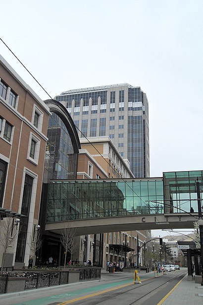
City Creek Center Address: Main Street street in Salt Lake City
Attractions near City Creek Center
TRAX City Center,Steve Madden,City Creek Center Skybridge,Wasatch It,The Utah State Bar,Dish TV Network,Alo - Coming Soon,Bingo Locksmith,Bda Bridal,Barbell Apparel,Lids,MK Power,ATHLETA,Haagen-Dazs,Pearl Milk Tea Club at City Creek Mall,City Creek Reserves LDS Church,City Creek Center,Go! Calendars, Games,Ridgeview Apartments,Capriotti's Sandwich ShopHow to get to popular attractions in Salt Lake City with public transit
St. Regis Deer Valley, Park City,3900 S. Wasatch Park'N Ride, Millcreek,Greyhound: Bus Stop - Ogden Transit Center, Ogden,1600 North Park & Ride, Lindon,The Royal Bank of Scotland-RBS, Taylorsville,UVU Wrestling Room, Orem,Route 47 To Trax, Taylorsville,Rice-Eccles Stadium, Salt Lake City,University Of Utah Hospital, Salt Lake City,State Street, Orem,Chevron, Ogden,1940 West North Temple, Salt Lake City,Snowbird Ski & Summer Resort,Riverton Office Building (LDS Church ICS), Riverton,Bountiful Utah Temple, Bountiful,Salt Lake Tribune/Deseret News, West Valley City,Provo YSA Asian Ward, Provo,Wendover Utah Trailways FUN BUS Stop, Salt Lake City,Snowbasin Cross Country Ski Park,Park City Mountain Resort, Park CityGet around Salt Lake City by public transit!
Traveling around Salt Lake City has never been so easy. See step by step directions as you travel to any attraction, street or major public transit station. View bus and train schedules, arrival times, service alerts and detailed routes on a map, so you know exactly how to get to anywhere in Salt Lake City.
When traveling to any destination around Salt Lake City use Moovit's Live Directions with Get Off Notifications to know exactly where and how far to walk, how long to wait for your line, and how many stops are left. Moovit will alert you when it's time to get off — no need to constantly re-check whether yours is the next stop.
Wondering how to use public transit in Salt Lake City or how to pay for public transit in Salt Lake City? Moovit public transit app can help you navigate your way with public transit easily, and at minimum cost. It includes public transit fees, ticket prices, and costs. Looking for a map of Salt Lake City public transit lines? Moovit public transit app shows all public transit maps in Salt Lake City with all bus or light rail routes and stops on an interactive map.
Salt Lake City has 2 transit type(s), including: bus or light rail, operated by several transit agencies, including UTA, UTA, UTA, Park City, Amtrak, Greyhound-us and FlixBus-us