Directions to City Of Lynn Election with public transportation
The following transit lines have routes that pass near City Of Lynn Election
 Bus: 426, 455, 429, 436, 442.
- Train: NEWBURYPORT/ROCKPORT.
- Ferry: LYNN FERRY.
How to get to City Of Lynn Election by bus?
Click on the bus route to see step by step directions with maps, line arrival times and updated time schedules.
From Constitution Beach
61 minFrom Melrose, MA
68 minFrom Massachusetts Water Resource Authority (MWRA)
50 minFrom Chelsea, MA
53 minFrom Melrose Wakefield Hospital
61 minFrom Courtyard by Marriott Boston Logan Airport
35 minFrom Hilton Garden Inn Boston Logan Airport
33 minFrom Four Points by Sheraton Boston Logan Airport
37 min
How to get to City Of Lynn Election by train?
Click on the train route to see step by step directions with maps, line arrival times and updated time schedules.
Bus stops near City Of Lynn Election
Train station near City Of Lynn Election
- Lynn Interim, 17 min walk,VIEW
Ferry station near City Of Lynn Election
- Blossom Street Pier, 37 min walk,VIEW
Bus lines to City Of Lynn Election
- 429, Kings Lynn,VIEW
- 426, Haymarket via Cliftondale - Central Square via Cliftondale,VIEW
- 436, Central Square via Malls & Lynnfield St - Liberty Tree via North Shore Mall & Lynnfield St,VIEW
- 442, Wonderland via Central Square & Humphrey St - Marblehead via Central Square & Humphrey St,VIEW
- 455, Wonderland via Central Square - Salem Depot via Central Square,VIEW
- 435, Central Square Via Malls,VIEW
- 441, Marblehead Via Central Square & Paradise Rd,VIEW
What are the closest stations to City Of Lynn Election?
The closest stations to City Of Lynn Election are:
- Franklin St @ Hanover St is 387 yards away, 5 min walk.
- N Common St @ Franklin St is 412 yards away, 5 min walk.
- Washington St @ Beacon Hill Ave is 496 yards away, 6 min walk.
- S Common St @ Market St is 760 yards away, 10 min walk.
- Lynn Interim is 1426 yards away, 17 min walk.
- Blossom Street Pier is 3088 yards away, 37 min walk.
Which bus lines stop near City Of Lynn Election?
These bus lines stop near City Of Lynn Election: 426, 455.
Which train line stops near City Of Lynn Election?
NEWBURYPORT/ROCKPORT (#27 | Rockport)
What’s the nearest train station to City Of Lynn Election?
The nearest train station to City Of Lynn Election is Lynn Interim. It’s a 17 min walk away.
What’s the nearest bus station to City Of Lynn Election?
The nearest bus stations to City Of Lynn Election are Franklin St @ Hanover St and N Common St @ Franklin St. The closest one is a 5 min walk away.
What time is the first train to City Of Lynn Election?
The NEWBURYPORT/ROCKPORT is the first train that goes to City Of Lynn Election. It stops nearby at 5:27 AM.
What time is the last train to City Of Lynn Election?
The NEWBURYPORT/ROCKPORT is the last train that goes to City Of Lynn Election. It stops nearby at 12:20 AM.
What time is the first bus to City Of Lynn Election?
The 455 is the first bus that goes to City Of Lynn Election. It stops nearby at 4:46 AM.
What time is the last bus to City Of Lynn Election?
The 426 is the last bus that goes to City Of Lynn Election. It stops nearby at 1:44 AM.
What time is the first ferry to City Of Lynn Election?
The LYNN FERRY is the first ferry that goes to City Of Lynn Election. It stops nearby at 6:00 AM.
What time is the last ferry to City Of Lynn Election?
The LYNN FERRY is the last ferry that goes to City Of Lynn Election. It stops nearby at 7:55 PM.
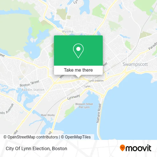
See City Of Lynn Election on the map
Public Transportation to City Of Lynn Election
Wondering how to get to City Of Lynn Election? Moovit helps you find the best way to get to City Of Lynn Election with step-by-step directions from the nearest public transit station.
Moovit provides free maps and live directions to help you navigate through your city. View schedules, routes, timetables, and find out how long does it take to get to City Of Lynn Election in real time.
Looking for the nearest stop or station to City Of Lynn Election? Check out this list of stops closest to your destination: Franklin St @ Hanover St; N Common St @ Franklin St; Washington St @ Beacon Hill Ave; S Common St @ Market St; Lynn Interim; Blossom Street Pier.
Bus: 426, 455, 429, 436, 442, 435, 441.Train: NEWBURYPORT/ROCKPORT.Ferry: LYNN FERRY.
Want to see if there’s another route that gets you there at an earlier time? Moovit helps you find alternative routes or times. Get directions from and directions to City Of Lynn Election easily from the Moovit App or Website.
We make riding to City Of Lynn Election easy, which is why over 1.7 million users, including users in Lynn, trust Moovit as the best app for public transit. You don’t need to download an individual bus app or train app, Moovit is your all-in-one transit app that helps you find the best bus time or train time available.
For information on prices of bus, train and subway, costs and ride fares to City Of Lynn Election, please check the Moovit app.
Use the app to navigate to popular places including to the airport, hospital, stadium, grocery store, mall, coffee shop, school, college, and university.
City Of Lynn Election Address: 3 City Hall Sq street in Lynn
- Lynn City Hall and Memorial Auditorium,
- Lynn Auditorium,
- English High School,
- Lynn Memorial Auditorium,
- Marblehead Opticians,
- Electrical Stimulation Physical Therapy Therapist,
- Lynn Anytime Emergency Locksmith,
- K'Prichos,
- Botanica Yemaya Y los 7 Mares,
- Ians Jewelry Services and Collectibles,
- Evelins Closet 2,
- Lynn District Court,
- Law Office of Thomas O. Mason,
- Isabella Med Spa,
- J & M Dollar Store,
- District Attorney Office Salem,
- Lafountain & Wollman P.C.,
- Sunny Patch Daycare,
- Mihos John C,
- DUNKIN'
Places Near City Of Lynn Election
- Leader Bank Pavilion (Leader Bank Pavillion), Boston,
- Castle Island, Boston,
- Quincy Market, Boston,
- House Of Blues, Boston,
- Wang Theater, Boston,
- Faneuil Hall, Boston,
- Td Garden, Boston,
- Cheers, Boston,
- Seaport District, Boston,
- Wilbur Theatre, Boston,
- Isabella Stewart Gardner Museum, Boston,
- Boston Common, Boston,
- Museum Of Science, Boston,
- Boston Medical Center, Boston,
- Boston Children's Hospital, Boston,
- Massachusetts General Hospital, Boston,
- North End, Boston,
- Boston Convention & Exhibition Center, Boston,
- Prudential Center, Boston,
- Mgm Music Hall, Boston
How to get to popular places in Boston with public transit
Get around Lynn by public transit!
Traveling around Lynn has never been so easy. See step by step directions as you travel to any attraction, street or major public transit station. View bus and train schedules, arrival times, service alerts and detailed routes on a map, so you know exactly how to get to anywhere in Lynn.
When traveling to any destination around Lynn use Moovit's Live Directions with Get Off Notifications to know exactly where and how far to walk, how long to wait for your line, and how many stops are left. Moovit will alert you when it's time to get off — no need to constantly re-check whether yours is the next stop.
Wondering how to use public transit in Lynn or how to pay for public transit in Lynn? Moovit public transit app can help you navigate your way with public transit easily, and at minimum cost. It includes public transit fees, ticket prices, and costs. Looking for a map of Lynn public transit lines? Moovit public transit app shows all public transit maps in Lynn with all Bus, Train, Subway and Ferry routes and stops on an interactive map.
Boston has 4 transit type(s), including: Bus, Train, Subway and Ferry, operated by several transit agencies, including MBTA, Southeastern Regional Transit Authority, MetroWest Regional Transit Authority, Rhode Island Public Transit Authority, WRTA, Lowell Regional Transit Authority, Merrimack Valley Transit, Montachusett Regional Transit Authority, Cape Cod Regional Transit Authority, Brockton Area Transit Authority, Martha's Vineyard Transit Authority, the WAVE - Nantucket Regional Transit Authority, GATRA, Cape Ann Transportation Authority and Massport
Public transit lines with stations closest to City Of Lynn Election
Train lines with stations closest to City Of Lynn Election
Bus lines with stations closest to City Of Lynn Election
N Common St @ Franklin St
- 426Haymarket via Cliftondale - Central Square via Cliftondale
- 436Central Square via Malls & Lynnfield St - Liberty Tree via North Shore Mall & Lynnfield St
- 442Wonderland via Central Square & Humphrey St - Marblehead via Central Square & Humphrey St
- 455Wonderland via Central Square - Salem Depot via Central Square