See City Point I, Brooklyn, on the map
Directions to City Point I (Brooklyn) with public transportation
The following transit lines have routes that pass near City Point I
 Bus:
Bus: - Train:
- Subway:
How to get to City Point I by bus?
Click on the bus route to see step by step directions with maps, line arrival times and updated time schedules.
How to get to City Point I by train?
Click on the train route to see step by step directions with maps, line arrival times and updated time schedules.
How to get to City Point I by subway?
Click on the subway route to see step by step directions with maps, line arrival times and updated time schedules.
Bus stations near City Point I in Brooklyn
- Fulton St/Bond St, 2 min walk,
- Livingston St/Hoyt St, 5 min walk,
- Myrtle Av/Fleet Pl, 6 min walk,
Subway stations near City Point I in Brooklyn
- Dekalb Av, 3 min walk,
- Hoyt St, 4 min walk,
- Nevins St, 6 min walk,
- Hoyt-Schermerhorn Sts, 6 min walk,
- Jay St-Metrotech, 8 min walk,
Bus lines to City Point I in Brooklyn
- B25, Broadway Jct Alabama Av Via Fulton,
- B26, Ridgewood Term Via Halsey,
- B38, Ltd Ridgewood Catalpa Av,
- B52, Downtown Bklyn Tillary St Via Gates,
- B41, Kings Plaza Via Flatbush,
- B45, Crown Heights Ralph Av,
- B67, Kensington Cortelyou Rd Via 7 Av,
- B93, G Train To Jay St-Metro Tech,
- B103, Limited Canarsie - Williams Ave Via Avenue H Via Avenue M,
- B54, Ridgewood Term Via Myrtle,
What are the closest stations to City Point I?
The closest stations to City Point I are:
- Fulton St/Bond St is 127 yards away, 2 min walk.
- Dekalb Av is 159 yards away, 3 min walk.
- Hoyt St is 277 yards away, 4 min walk.
- Livingston St/Hoyt St is 377 yards away, 5 min walk.
- Nevins St is 411 yards away, 6 min walk.
- Myrtle Av/Fleet Pl is 422 yards away, 6 min walk.
- Hoyt-Schermerhorn Sts is 423 yards away, 6 min walk.
- Jay St-Metrotech is 621 yards away, 8 min walk.
Which bus lines stop near City Point I?
These bus lines stop near City Point I: B38, B62.
Which train line stops near City Point I?
HEMPSTEAD
Which subway lines stop near City Point I?
These subway lines stop near City Point I: B, Q.
What’s the nearest subway station to City Point I in Brooklyn?
The nearest subway station to City Point I in Brooklyn is Dekalb Av. It’s a 3 min walk away.
What’s the nearest bus stop to City Point I in Brooklyn?
The nearest bus stop to City Point I in Brooklyn is Fulton St/Bond St. It’s a 2 min walk away.
What time is the first subway to City Point I in Brooklyn?
The D is the first subway that goes to City Point I in Brooklyn. It stops nearby at 3:00 AM.
What time is the last subway to City Point I in Brooklyn?
The 2 is the last subway that goes to City Point I in Brooklyn. It stops nearby at 4:21 AM.
What time is the first bus to City Point I in Brooklyn?
The B38 is the first bus that goes to City Point I in Brooklyn. It stops nearby at 3:00 AM.
What time is the last bus to City Point I in Brooklyn?
The B38 is the last bus that goes to City Point I in Brooklyn. It stops nearby at 3:28 AM.
How much is the subway fare to City Point I?
The subway fare to City Point I costs about $2.75.
See City Point I, Brooklyn, on the map
Public Transit to City Point I in Brooklyn
Wondering how to get to City Point I in Brooklyn, United States? Moovit helps you find the best way to get to City Point I with step-by-step directions from the nearest public transit station.
Moovit provides free maps and live directions to help you navigate through your city. View schedules, routes, timetables, and find out how long does it take to get to City Point I in real time.
Looking for the nearest stop or station to City Point I? Check out this list of stops closest to your destination: Fulton St/Bond St; Dekalb Av; Hoyt St; Livingston St/Hoyt St; Nevins St; Myrtle Av/Fleet Pl; Hoyt-Schermerhorn Sts; Jay St-Metrotech.
Bus:Train:Subway:
Want to see if there’s another route that gets you there at an earlier time? Moovit helps you find alternative routes or times. Get directions from and directions to City Point I easily from the Moovit App or Website.
We make riding to City Point I easy, which is why over 1.5 million users, including users in Brooklyn, trust Moovit as the best app for public transit. You don’t need to download an individual bus app or train app, Moovit is your all-in-one transit app that helps you find the best bus time or train time available.
For information on prices of subway, bus and train, costs and ride fares to City Point I, please check the Moovit app.
Use the app to navigate to popular places including to the airport, hospital, stadium, grocery store, mall, coffee shop, school, college, and university.
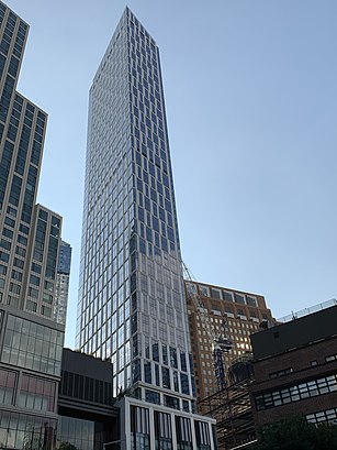
City Point I Address: Fleet Street street in Brooklyn
Attractions near City Point I
City Point,Dekalb Market,445 Gold Street,445 Albee Square West,#4,Target,City Point,Andrew's,Alamo Drafthouse Cinema - Brooklyn,Dekalb Market Hall,Trader Joe's- Brooklyn, NY,Target Brooklyn Fulton St,Flying Tiger Copenhagen,Wiki Wiki,Bunker,1 Dekalb Avenue,Al B's Tacoville,Albee Square,City Point Terrace,SillHow to get to popular attractions in Brooklyn with public transit
The 13th Step, Manhattan,Long Island, NY, Huntington Station, Ny,Nan Xiang Xiao Long Bao, Queens,Tacombi at Fonda Nolita, Manhattan,I-80 (Interstate 80), Paterson, Nj,MTA Subway - Fulton St (A / C/J / Z/2 / 3/4 / 5), Manhattan,Rattle N Hum, Manhattan,Fette Sau,Ferrara Bakery, Manhattan,MTA Subway - Broadway (N/W), Queens,Sheep Meadow, Manhattan,24 Hour Fitness, Manhattan,5 Napkin Burger, Manhattan,MTA Subway - 42nd St / Bryant Park (B / D/F / M/7), Manhattan,Veselka, Manhattan,J.G. Melon, Manhattan,MTA Subway - 30th Ave (N/W), Queens,The Grey Dog, Manhattan,Grimaldi's Pizzeria,Doughnut Plant, ManhattanGet around Brooklyn by public transit!
Traveling around Brooklyn has never been so easy. See step by step directions as you travel to any attraction, street or major public transit station. View bus and train schedules, arrival times, service alerts and detailed routes on a map, so you know exactly how to get to anywhere in Brooklyn.
When traveling to any destination around Brooklyn use Moovit's Live Directions with Get Off Notifications to know exactly where and how far to walk, how long to wait for your line, and how many stops are left. Moovit will alert you when it's time to get off — no need to constantly re-check whether yours is the next stop.
Wondering how to use public transit in Brooklyn or how to pay for public transit in Brooklyn? Moovit public transit app can help you navigate your way with public transit easily, and at minimum cost. It includes public transit fees, ticket prices, and costs. Looking for a map of Brooklyn public transit lines? Moovit public transit app shows all public transit maps in Brooklyn with all subway, bus or train routes and stops on an interactive map.
Brooklyn has 3 transit type(s), including: subway, bus or train, operated by several transit agencies, including MTA Subway, Metro-North Railroad, LIRR, PATH, Shore Line East, MTA Bus Company, MTA New York City Transit - Express routes, MTA Bus, NJ Transit, NYC Ferry, NICE bus, Bee-Line Bus, NJ Transit Rail, NJ Transit Rail and Norwalk Transit District