See City of Pasadena on the map
Directions to City of Pasadena with public transportation
The following transit lines have routes that pass near City of Pasadena
 Bus:
Bus: - Light Rail:
How to get to City of Pasadena by bus?
Click on the bus route to see step by step directions with maps, line arrival times and updated time schedules.
Bus stations near City of Pasadena
- Lake Ave & Santa Barbara St,1 min walk,
- Lake / Villa,3 min walk,
- Villa St & Lake Ave,3 min walk,
- Lake Ave & Corson St,6 min walk,
Light Rail stations near City of Pasadena
- Fillmore Station,11 min walk,
Bus lines to City of Pasadena
- 20CC,Lake & Woodbury,
- 20CW,Lake & Fair Oaks,
- 662,NB Lake - SB Lincoln via Del Mar Station,
- 40,Old Pasadena,
- CE549,Westbound,
What are the closest stations to City of Pasadena?
The closest stations to City of Pasadena are:
- Lake Ave & Santa Barbara St is 35 yards away, 1 min walk.
- Lake / Villa is 210 yards away, 3 min walk.
- Villa St & Lake Ave is 223 yards away, 3 min walk.
- Lake Ave & Corson St is 445 yards away, 6 min walk.
- Fillmore Station is 909 yards away, 11 min walk.
Which bus lines stop near City of Pasadena?
These bus lines stop near City of Pasadena: 187, AMTRAK THRUWAY CONNECTING SERVICE, CE549.
Which light rail line stops near City of Pasadena?
METRO A LINE
What’s the nearest light rail station to City of Pasadena?
The nearest light rail station to City of Pasadena is Fillmore Station. It’s a 11 min walk away.
What’s the nearest bus stop to City of Pasadena?
The nearest bus stop to City of Pasadena is Lake Ave & Santa Barbara St. It’s a 1 min walk away.
What time is the first light rail to City of Pasadena?
The METRO A LINE is the first light rail that goes to City of Pasadena. It stops nearby at 3:46 AM.
What time is the last light rail to City of Pasadena?
The METRO A LINE is the last light rail that goes to City of Pasadena. It stops nearby at 1:21 AM.
What time is the first bus to City of Pasadena?
The CE549 is the first bus that goes to City of Pasadena. It stops nearby at 6:00 AM.
What time is the last bus to City of Pasadena?
The 40 is the last bus that goes to City of Pasadena. It stops nearby at 8:12 PM.
How much is the bus fare to City of Pasadena?
The bus fare to City of Pasadena costs about $0.25 - $0.35.
How much is the train fare to City of Pasadena?
The train fare to City of Pasadena costs about $2.50 - $14.00.
How much is the subway fare to City of Pasadena?
The subway fare to City of Pasadena costs about $1.75.
How much is the light rail fare to City of Pasadena?
The light rail fare to City of Pasadena costs about $1.75.
See City of Pasadena on the map
Public Transportation to City of Pasadena
Wondering how to get to City of Pasadena, United States? Moovit helps you find the best way to get to City of Pasadena with step-by-step directions from the nearest public transit station.
Moovit provides free maps and live directions to help you navigate through your city. View schedules, routes, timetables, and find out how long does it take to get to City of Pasadena in real time.
Looking for the nearest stop or station to City of Pasadena? Check out this list of stops closest to your destination: Lake Ave & Santa Barbara St; Lake / Villa; Villa St & Lake Ave; Lake Ave & Corson St; Fillmore Station.
Bus:Light Rail:
Want to see if there’s another route that gets you there at an earlier time? Moovit helps you find alternative routes or times. Get directions from and directions to City of Pasadena easily from the Moovit App or Website.
We make riding to City of Pasadena easy, which is why over 1.5 million users, including users in Pasadena, trust Moovit as the best app for public transit. You don’t need to download an individual bus app or train app, Moovit is your all-in-one transit app that helps you find the best bus time or train time available.
For information on prices of bus, light rail, subway and train, costs and ride fares to City of Pasadena, please check the Moovit app.
Use the app to navigate to popular places including to the airport, hospital, stadium, grocery store, mall, coffee shop, school, college, and university.
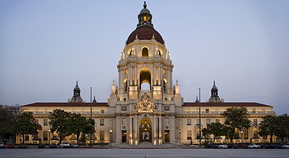
City of Pasadena Address: 515 N Lake Ave Pasadena, CA 91101 street in Pasadena
Attractions near City of Pasadena
Business Equipment Service Techncns,Metro by T-Mobile,Head Start Pasadena Covenant CCFS,Pristine Cabinets,Villa Gardens,Titlemax Title Loans,Carnegie Institution of Washington,Dr Chen's Acupuncture & Wellness Center,Lake Avenue Community Foundation,Fairmount,76,Metro Gold Line - Lake Station,Sausalito's Mexican Restaurant ,Beacon,Alisha Wesser - RBC Wealth Management Financial Advisor (Interchange Financial Service),Entrance I-210 W,Milton D Chan,Entrance I-210 E,N Madison Ave,People Helping People (PHP - People Hiring People)How to get to popular attractions in Pasadena with public transit
City of Laguna Beach, Laguna Beach,City of Murrieta, Murrieta,24 Hour Fitness, Industry,Sleeping Beauty Castle, Anaheim,Northridge, CA, Northridge, La,Apple South Coast Plaza, Costa Mesa,Diamond Bar, CA, Diamond Bar,Target, Huntington Beach,Costco Wholesale, Tustin,Honda Center, Anaheim,Monsters, Inc. Mike & Sulley to the Rescue!, Anaheim,Universal CityWalk Hollywood, Universal City, La,Tomorrowland, Anaheim,AMC Promenade 16, Woodland Hills, La,City of Rancho Cucamonga, Rancho Cucamonga,Harbor Pointe, Anaheim,In-N-Out Burger, Palms, La,SLS Hotel, a Luxury Collection Hotel, Beverly Hills, Beverly Grove, La,Disneyland Park, Anaheim,California Screamin', AnaheimGet around Pasadena by public transit!
Traveling around Pasadena has never been so easy. See step by step directions as you travel to any attraction, street or major public transit station. View bus and train schedules, arrival times, service alerts and detailed routes on a map, so you know exactly how to get to anywhere in Pasadena.
When traveling to any destination around Pasadena use Moovit's Live Directions with Get Off Notifications to know exactly where and how far to walk, how long to wait for your line, and how many stops are left. Moovit will alert you when it's time to get off — no need to constantly re-check whether yours is the next stop.
Wondering how to use public transit in Pasadena or how to pay for public transit in Pasadena? Moovit public transit app can help you navigate your way with public transit easily, and at minimum cost. It includes public transit fees, ticket prices, and costs. Looking for a map of Pasadena public transit lines? Moovit public transit app shows all public transit maps in Pasadena with all bus, light rail, subway or train routes and stops on an interactive map.
Pasadena has 4 transit type(s), including: bus, light rail, subway or train, operated by several transit agencies, including Metro - Los Angeles, Metro - Los Angeles, Metrolink Trains, METRO, Long Beach Transit, LADOT, OCTA, Foothill Transit, Big Blue Bus, Riverside Transit Agency, LAX FlyAway, Airporter Shuttle, Playa Vista Shuttle, Amtrak and OMNITRANS