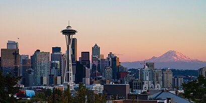
See City of Seattle on the map
Directions to City of Seattle with public transportation
The following transit lines have routes that pass near City of Seattle
 Bus:
Bus:
How to get to City of Seattle by bus?
Click on the bus route to see step by step directions with maps, line arrival times and updated time schedules.
Bus stations near City of Seattle
- Valley St & Taylor Ave N,3 min walk,
Bus lines to City of Seattle
- 3,Downtown Seattle,
- 4,Downtown Only,
What are the closest stations to City of Seattle?
The closest stations to City of Seattle are:
- Valley St & Taylor Ave N is 197 yards away, 3 min walk.
Which bus lines stop near City of Seattle?
These bus lines stop near City of Seattle: 3, 309.
What’s the nearest bus stop to City of Seattle?
The nearest bus stop to City of Seattle is Valley St & Taylor Ave N. It’s a 3 min walk away.
See City of Seattle on the map
Public Transportation to City of Seattle
Wondering how to get to City of Seattle, United States? Moovit helps you find the best way to get to City of Seattle with step-by-step directions from the nearest public transit station.
Moovit provides free maps and live directions to help you navigate through your city. View schedules, routes, timetables, and find out how long does it take to get to City of Seattle in real time.
Looking for the nearest stop or station to City of Seattle? Check out this list of stops closest to your destination: Valley St & Taylor Ave N.
Bus:
Want to see if there’s another route that gets you there at an earlier time? Moovit helps you find alternative routes or times. Get directions from and directions to City of Seattle easily from the Moovit App or Website.
We make riding to City of Seattle easy, which is why over 1.5 million users, including users in Seattle, trust Moovit as the best app for public transit. You don’t need to download an individual bus app or train app, Moovit is your all-in-one transit app that helps you find the best bus time or train time available.
For information on prices of bus, costs and ride fares to City of Seattle, please check the Moovit app.
Use the app to navigate to popular places including to the airport, hospital, stadium, grocery store, mall, coffee shop, school, college, and university.
City of Seattle Address: 700 5th Ave N street in Seattle
Attractions near City of Seattle
Insurance Claims Auto Glass,Hampton Inn Suites Seattledown,Hampton Inn & Suites,Hampton Inn & Suites Seattle Downtown,712 5th Ave N,5th Ave N & Valley St,Hampton Inn,Quality Cleaning Etc,Lumen Condo,MB Imports,Geneagraphy,Clearwater Leak Detection,Lumen Condominiums Associates,Silver Platters,New York Pizza & Bar And Grill Seattle,Hawthorn Suites Hotel,503 Roy St,800 5th Ave N,Redbox,Valley St & Taylor Ave NHow to get to popular attractions in Seattle with public transit
Costco Wholesale, Tacoma,Downtown Tacoma, Tacoma,Walmart Supercenter, Puyallup,Watertown Hotel, Seattle,Seattle-Tacoma International Airport, Seatac,Woodinville Park and Ride, Woodinville,Pike Place Market, Seattle,Thurston County Courthouse, Olympia,Tacoma Dome Sounder Station, Tacoma,TCC Transit Center, Tacoma,Alderwood Mall, Lynnwood,Tulalip Casino Resort,City of SeaTac, Seatac,North Bend, WA, North Bend,Starbucks, Seattle,South Seattle College, Seattle,Seattle Central College, Seattle,Jack J. Lobdell Apartments, Auburn,QFC, Seattle,PCC Community Markets - Edmonds, EdmondsGet around Seattle by public transit!
Traveling around Seattle has never been so easy. See step by step directions as you travel to any attraction, street or major public transit station. View bus and train schedules, arrival times, service alerts and detailed routes on a map, so you know exactly how to get to anywhere in Seattle.
When traveling to any destination around Seattle use Moovit's Live Directions with Get Off Notifications to know exactly where and how far to walk, how long to wait for your line, and how many stops are left. Moovit will alert you when it's time to get off — no need to constantly re-check whether yours is the next stop.
Wondering how to use public transit in Seattle or how to pay for public transit in Seattle? Moovit public transit app can help you navigate your way with public transit easily, and at minimum cost. It includes public transit fees, ticket prices, and costs. Looking for a map of Seattle public transit lines? Moovit public transit app shows all public transit maps in Seattle with all bus routes and stops on an interactive map.
Seattle has 1 transit type(s), including: bus, operated by several transit agencies, including Sound Transit, Seattle Streetcar, Sound Transit, Metro Transit, Metro Transit, Sound Transit, Whatcom Transportation Authority, Mason Transit Authority, Snoqualmie Valley Transportation (SVT), Snoqualmie Valley Transportation, Amtrak, Island Transit, Kitsap Transit, Intercity Transit and Everett Transit