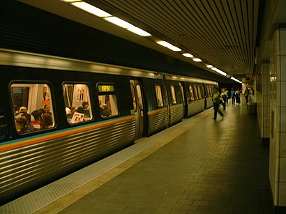
Civic Center Marta Station stop - Sunday schedule
| Line | Direction | Time |
|---|---|---|
| 103 | Downtown Atlanta | 5:52 AM |
| 101 | Downtown Atlanta | 6:12 AM |
| 102 | Downtown Atlanta | 6:12 AM |
| 103 | Downtown Atlanta | 6:17 AM |
| 103 | Downtown Atlanta | 6:37 AM |
| 101 | Downtown Atlanta | 6:42 AM |
| 102 | Downtown Atlanta | 6:42 AM |
| 103 | Downtown Atlanta | 7:07 AM |
| 101 | Downtown Atlanta | 7:12 AM |
| 102 | Downtown Atlanta | 7:12 AM |
| 103 | Downtown Atlanta | 7:29 AM |
| 103 | Downtown Atlanta | 7:39 AM |
| 102 | Downtown Atlanta | 7:45 AM |
| 101 | Downtown Atlanta | 7:47 AM |
| 103 | Downtown Atlanta | 7:52 AM |
| 102 | Downtown Atlanta | 8:15 AM |
| 103 | Downtown Atlanta | 8:15 AM |
| 101 | Downtown Atlanta | 8:22 AM |
| 103 | Downtown Atlanta | 8:35 AM |
| 101 | Downtown Atlanta | 8:37 AM |
| 102 | Downtown Atlanta | 8:42 AM |
| 103 | Downtown Atlanta | 8:52 AM |
| 101 | Downtown Atlanta | 8:55 AM |
| 103 | Downtown Atlanta | 9:02 AM |
| 103 | Downtown Atlanta | 9:12 AM |
See Civic Center Marta Station, Atlanta, on the map
Directions to Civic Center Marta Station (Atlanta) with public transportation
The following transit lines have routes that pass near Civic Center Marta Station
 Bus:
Bus: - Subway:
How to get to Civic Center Marta Station by bus?
Click on the bus route to see step by step directions with maps, line arrival times and updated time schedules.
How to get to Civic Center Marta Station by subway?
Click on the subway route to see step by step directions with maps, line arrival times and updated time schedules.
Bus stations near Civic Center Marta Station in Atlanta
- Civic Center Station (West Peachtreet Street),1 min walk,
- Atlanta Downtown (Civic Center),2 min walk,
- Civic Center Marta Station,3 min walk,
- Peachtree St @ Pine St NE,4 min walk,
- Peachtree Center Ave @ Peachtree St,6 min walk,
- Peachtree St at Renaissance Pkwy,6 min walk,
- Centennial Olympic Park Dr @ Hunnicutt St,11 min walk,
Subway stations near Civic Center Marta Station in Atlanta
- North Avenue Station,8 min walk,
Light Rail stations near Civic Center Marta Station in Atlanta
- Centennial Olympic Park,9 min walk,
Bus lines to Civic Center Marta Station in Atlanta
- 100,Busbee Park & Ride,
- 101,Marietta Transfer Center,
- 419,419 Downtown,
- 426,426 Downtown,
- 430,430 Downtown,
- 431,431 Stockbridge / Brandsmart,
- 432,432 Downtown,
- 440,440 Hampton / Jonesboro,
- 441,441 Downtown / Midtown,
- 442,442 Downtown,
- 453,453 Downtown / Midtown,
- 463,West Douglas / Douglas Mmtc,
- 476,476 Downtown / Midtown,
- FLIXBUS 2415,Orlando (The Florida Mall),
- FLIXBUS N2415,Atlanta Downtown (Civic Center),
- FLIXBUS N2470,New York Midtown (31st St & 8th Ave),
- 411,411 Midtown,
- 412,412 Midtown,
- 414,414 Hamilton Mill / Mall Of Georgia / Sugarloaf Mi,
- 423,423 Panola / West Conyers / East Conyers,
What are the closest stations to Civic Center Marta Station?
The closest stations to Civic Center Marta Station are:
- Civic Center Station (West Peachtreet Street) is 60 yards away, 1 min walk.
- Atlanta Downtown (Civic Center) is 152 yards away, 2 min walk.
- Civic Center Marta Station is 219 yards away, 3 min walk.
- Peachtree St @ Pine St NE is 323 yards away, 4 min walk.
- Peachtree Center Ave @ Peachtree St is 430 yards away, 6 min walk.
- Peachtree St at Renaissance Pkwy is 447 yards away, 6 min walk.
- North Avenue Station is 599 yards away, 8 min walk.
- Centennial Olympic Park is 723 yards away, 9 min walk.
- Centennial Olympic Park Dr @ Hunnicutt St is 855 yards away, 11 min walk.
Which bus lines stop near Civic Center Marta Station?
These bus lines stop near Civic Center Marta Station: 101, 40, 440, 463, 476, 50.
Which subway lines stop near Civic Center Marta Station?
These subway lines stop near Civic Center Marta Station: GOLD, RED.
What’s the nearest light rail station to Civic Center Marta Station in Atlanta?
The nearest light rail station to Civic Center Marta Station in Atlanta is Centennial Olympic Park. It’s a 9 min walk away.
What’s the nearest subway station to Civic Center Marta Station in Atlanta?
The nearest subway station to Civic Center Marta Station in Atlanta is North Avenue Station. It’s a 8 min walk away.
What’s the nearest bus stop to Civic Center Marta Station in Atlanta?
The nearest bus stop to Civic Center Marta Station in Atlanta is Civic Center Station (West Peachtreet Street). It’s a 1 min walk away.
What time is the first light rail to Civic Center Marta Station in Atlanta?
The ATLSC is the first light rail that goes to Civic Center Marta Station in Atlanta. It stops nearby at 8:25 AM.
What time is the last light rail to Civic Center Marta Station in Atlanta?
The ATLSC is the last light rail that goes to Civic Center Marta Station in Atlanta. It stops nearby at 11:03 PM.
What time is the first subway to Civic Center Marta Station in Atlanta?
The RED is the first subway that goes to Civic Center Marta Station in Atlanta. It stops nearby at 5:00 AM.
What time is the last subway to Civic Center Marta Station in Atlanta?
The GOLD is the last subway that goes to Civic Center Marta Station in Atlanta. It stops nearby at 1:41 AM.
What time is the first bus to Civic Center Marta Station in Atlanta?
The 51 is the first bus that goes to Civic Center Marta Station in Atlanta. It stops nearby at 4:58 AM.
What time is the last bus to Civic Center Marta Station in Atlanta?
The FLIXBUS N2470 is the last bus that goes to Civic Center Marta Station in Atlanta. It stops nearby at 9:15 AM.
How much is the subway fare to Civic Center Marta Station?
The subway fare to Civic Center Marta Station costs about $2.50.
How much is the bus fare to Civic Center Marta Station?
The bus fare to Civic Center Marta Station costs about $2.50.
See Civic Center Marta Station, Atlanta, on the map
Public transit to Civic Center Marta Station stop (ID: 20) in Atlanta
Looking for directions to Civic Center Marta Station in Atlanta, United States?
Download the Moovit App to find the current schedule and step-by-step directions for Bus or Subway routes that pass through Civic Center Marta Station.
Looking for the nearest stops closest to Civic Center Marta Station ? Check out this list of closest stops to your destination: Civic Center Station (West Peachtreet Street); Atlanta Downtown (Civic Center); Civic Center Marta Station; Peachtree St @ Pine St NE; Peachtree Center Ave @ Peachtree St; Peachtree St at Renaissance Pkwy; North Avenue Station; Centennial Olympic Park; Centennial Olympic Park Dr @ Hunnicutt St.
Bus:Subway:
We make riding on public transit to Civic Center Marta Station easy, which is why over 1.5 million users, including users in Atlanta trust Moovit as the best app for public transit.
Use the app to navigate to popular places including to the airport, hospital, stadium, grocery store, mall, coffee shop, school, college, and university.
Civic Center Marta Station stop’s code is 20
The first line to this stop is 103, at 5:52 AM, and the last line is SWPR at 8:09 PM.
James Wendell George Parkway, Atlanta, GA, USA
This stop serves Ride Gwinnett’s lines
Popular routes from Civic Center Marta Station, Atlanta
Bus stops near Civic Center Marta Station
Civic Center Station (West Peachtreet Street),Atlanta Downtown (Civic Center),Civic Center Marta Station,Peachtree St @ Pine St NE,Peachtree Center Ave @ Peachtree St,Peachtree St at Renaissance Pkwy,Centennial Olympic Park Dr @ Hunnicutt StSubway station near Civic Center Marta Station
North Avenue StationLight Rail station near Civic Center Marta Station
Centennial Olympic ParkPopular public transit stations in Atlanta
Bouldercrest Rd SE @ Cherry Valley Dr,Centennial Olympic Park Dr at Andrew Young Intl Bl,Valley Hill Rd @ Jonathan Rd,Snapfinger Woods Dr @ Shell Bark Rd,Panthersville Rd @ Clifton Springs Rd,Perimeter Ctr W @ 111,Buffington Rd @ Sable Chase Ln,Alpharetta St@Elizabeth Way,Roosevelt Hwy @ Highpoint Rd,Lee St Sw@Ralph David Abernath Blvd,Glenwood Ave Se@Patterson Ave SE,Pryor Rd @ Claire Dr,Moreland Ave SE @ Merlin Ave SE,Old National Hwy @ Old Bill Cook Rd,Donnelly Ave SW @ Beecher St SW,Valley View Rd Se@Stonewall Dr SE,Fairburn Rd@Bolton Rd,Snapfinger Woods Dr @ Wesley Chapel Rd,Amc Theater Marquee @ N. Dekalb Mall,Mcdaniel St Sw@Glenn St SWGet around Atlanta by public transit!
Traveling around Atlanta has never been so easy. See step by step directions as you travel to any attraction, street or major public transit station. View bus and train schedules, arrival times, service alerts and detailed routes on a map, so you know exactly how to get to anywhere in Atlanta.
When traveling to any destination around Atlanta use Moovit's Live Directions with Get Off Notifications to know exactly where and how far to walk, how long to wait for your line, and how many stops are left. Moovit will alert you when it's time to get off — no need to constantly re-check whether yours is the next stop.
Wondering how to use public transit in Atlanta or how to pay for public transit in Atlanta? Moovit public transit app can help you navigate your way with public transit easily, and at minimum cost. It includes public transit fees, ticket prices, and costs. Looking for a map of Atlanta public transit lines? Moovit public transit app shows all public transit maps in Atlanta with all bus or subway routes and stops on an interactive map.
Atlanta has 2 transit type(s), including: bus or subway, operated by several transit agencies, including MARTA, MARTA, Metropolitan Atlanta Rapid Transit Authority, Xpress, Atlantic Station Shuttle, CobbLinc, Ride Gwinnett, Connect Douglas, Amtrak, Stinger Bus and Tech Trolley, Emory University Transportation , Panther Express, Atlanta University Center Shuttle , Rome Transit Department and FlixBus-us