Directions to Clark Division Station (Chicago) with public transportation
The following transit lines have routes that pass near Clark Division Station
How to get to Clark Division Station by bus?
Click on the bus route to see step by step directions with maps, line arrival times and updated time schedules.
How to get to Clark Division Station by train?
Click on the train route to see step by step directions with maps, line arrival times and updated time schedules.
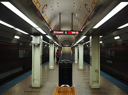
How to get to Clark Division Station by Chicago 'L'?
Click on the Chicago 'L' route to see step by step directions with maps, line arrival times and updated time schedules.
Bus stations near Clark Division Station in Chicago
- Division & Dearborn (West), 2 min walk,
- Division & Lasalle (East), 3 min walk,
- Lasalle & Division (North), 3 min walk,
- Clark & Goethe (North), 3 min walk,
Chicago 'l' stations near Clark Division Station in Chicago
- Grand-Red, 3 min walk,
- Sedgwick, 8 min walk,
Bus lines to Clark Division Station in Chicago
- 36, Financial Place & Ida B Wells Drive (Lasalle St Station) (North),
- 70, Division & Austin Terminal (Se),
- 156, Stockton & Fullerton (North),
- 22, Paulina & Howard Terminal,
What are the closest stations to Clark Division Station?
The closest stations to Clark Division Station are:
- Division & Dearborn (West) is 137 yards away, 2 min walk.
- Division & Lasalle (East) is 177 yards away, 3 min walk.
- Lasalle & Division (North) is 191 yards away, 3 min walk.
- Clark & Goethe (North) is 215 yards away, 3 min walk.
- Grand-Red is 250 yards away, 3 min walk.
- Sedgwick is 680 yards away, 8 min walk.
Which bus lines stop near Clark Division Station?
These bus lines stop near Clark Division Station: 22, 36, 70.
Which train lines stop near Clark Division Station?
These train lines stop near Clark Division Station: ME, UP-N, UP-NW.
Which Chicago 'L' line stops near Clark Division Station?
RED LINE
What’s the nearest Chicago 'L' station to Clark Division Station in Chicago?
The nearest Chicago 'L' station to Clark Division Station in Chicago is Grand-Red. It’s a 3 min walk away.
What’s the nearest bus stop to Clark Division Station in Chicago?
The nearest bus stop to Clark Division Station in Chicago is Division & Dearborn (West). It’s a 2 min walk away.
What time is the first Chicago 'L' to Clark Division Station in Chicago?
The RED LINE is the first Chicago 'L' that goes to Clark Division Station in Chicago. It stops nearby at 3:00 AM.
What time is the last Chicago 'L' to Clark Division Station in Chicago?
The RED LINE is the last Chicago 'L' that goes to Clark Division Station in Chicago. It stops nearby at 3:20 AM.
What time is the first bus to Clark Division Station in Chicago?
The 22 is the first bus that goes to Clark Division Station in Chicago. It stops nearby at 3:09 AM.
What time is the last bus to Clark Division Station in Chicago?
The 22 is the last bus that goes to Clark Division Station in Chicago. It stops nearby at 3:10 AM.
How much is the bus fare to Clark Division Station?
The bus fare to Clark Division Station costs about $2.25.
How much is the Chicago 'L' fare to Clark Division Station?
The Chicago 'L' fare to Clark Division Station costs about $2.50 - $5.00.
See Clark Division Station, Chicago, on the map
Public Transit to Clark Division Station in Chicago
Wondering how to get to Clark Division Station in Chicago, United States? Moovit helps you find the best way to get to Clark Division Station with step-by-step directions from the nearest public transit station.
Moovit provides free maps and live directions to help you navigate through your city. View schedules, routes, timetables, and find out how long does it take to get to Clark Division Station in real time.
Looking for the nearest stop or station to Clark Division Station? Check out this list of stops closest to your destination: Division & Dearborn (West); Division & Lasalle (East); Lasalle & Division (North); Clark & Goethe (North); Grand-Red; Sedgwick.
Bus: 22, 36, 70, 156.Train: ME, UP-N, UP-NW.Chicago 'L': RED LINE, BROWN LINE, PURPLE LINE.
Want to see if there’s another route that gets you there at an earlier time? Moovit helps you find alternative routes or times. Get directions from and directions to Clark Division Station easily from the Moovit App or Website.
We make riding to Clark Division Station easy, which is why over 1.5 million users, including users in Chicago, trust Moovit as the best app for public transit. You don’t need to download an individual bus app or train app, Moovit is your all-in-one transit app that helps you find the best bus time or train time available.
For information on prices of bus, Chicago 'L' and train, costs and ride fares to Clark Division Station, please check the Moovit app.
Use the app to navigate to popular places including to the airport, hospital, stadium, grocery store, mall, coffee shop, school, college, and university.
Location: Chicago
Attractions near Clark Division Station
W Division St / N Clark St,Scrap Metal Recycling,One Night Band Chicago,Gym Shoes Professional Dog Services,View Apartments Now,Press Cleaners,CTA #X28 Stony Island Express Bus (Northbound to Union Station),Clark & Division (Red Line),Cmit Solutions-Chicago,1165 N Clark Building (The Clark Apartments),Live Marketing,Structure Management,Equal Housing Opportunity,1165 N Clark St,Libertyx Bitcoin ATM,Law Offices of Howard C. Berkson,Dayna Schroeder Photography,PAul Urdan Design Concepts 1, LLC Online Store,Coating & Systems Integration,Novy Knows ChicagoHow to get to popular attractions in Chicago with public transit
Lighthouse Place Premium Outlets (Michigan City Outlet Mall),TTTT, Chicago,E Ida B Wells Dr / W Ida B Wells Dr, Chicago,Palmer House, Chicago,Cambria Hotel and Suites, Chicago,Homewood Suites by Hilton Chicago Downtown South Loop, Chicago,West Town, Chicago,Blue Planet Tours, Cicero,Avid Hotel Chicago O'Hare - des Plaines, an Ihg Hotel, Des Plaines,W Huron St, Chicago,Wrigley Building, Chicago,Ice Cream Shop, Chicago,AMA Plaza Free Enterprise Shuttle, Chicago,I-94 Dempster Exit, Morton Grove,Naval Station Great Lakes-RTC Gate 8, North Chicago,Ameristar Casino East Chicago, East Chicago,South Side, Chicago,Dirksen Federal Building, Chicago,122 South Michigan, Chicago,Garfield Park Conservatory, ChicagoGet around Chicago by public transit!
Traveling around Chicago has never been so easy. See step by step directions as you travel to any attraction, street or major public transit station. View bus and train schedules, arrival times, service alerts and detailed routes on a map, so you know exactly how to get to anywhere in Chicago.
When traveling to any destination around Chicago use Moovit's Live Directions with Get Off Notifications to know exactly where and how far to walk, how long to wait for your line, and how many stops are left. Moovit will alert you when it's time to get off — no need to constantly re-check whether yours is the next stop.
Wondering how to use public transit in Chicago or how to pay for public transit in Chicago? Moovit public transit app can help you navigate your way with public transit easily, and at minimum cost. It includes public transit fees, ticket prices, and costs. Looking for a map of Chicago public transit lines? Moovit public transit app shows all public transit maps in Chicago with all Bus, Train and Chicago 'L' routes and stops on an interactive map.
Chicago has 3 transit type(s), including: Bus, Train and Chicago 'L', operated by several transit agencies, including CTA 'L', Metra, Northern Indiana Commuter Transportation District, CTA, PACE, Gary Public Transit, Amtrak, River Valley Metro, Valpo Transit, DeKalb Public Transit, FlixBus-us, Greyhound-us, Van Galder (Coach USA), Wisconsin Coach Lines