Directions to Clerville (Brockton) with public transportation
The following transit lines have routes that pass near Clerville
 Bus: 12, 2, 8.
- Train: FALL RIVER/NEW BEDFORD, CAPEFLYER.
How to get to Clerville by bus?
Click on the bus route to see step by step directions with maps, line arrival times and updated time schedules.
How to get to Clerville by train?
Click on the train route to see step by step directions with maps, line arrival times and updated time schedules.
Bus stops near Clerville in Brockton
Train station near Clerville in Brockton
- Brockton, 31 min walk,VIEW
What are the closest stations to Clerville?
The closest stations to Clerville are:
- Main St And South St is 79 yards away, 2 min walk.
- Plain St And Montello St Ext is 119 yards away, 2 min walk.
- Brockton is 2606 yards away, 31 min walk.
Which bus lines stop near Clerville?
These bus lines stop near Clerville: 12, 2.
Which train line stops near Clerville?
FALL RIVER/NEW BEDFORD (#1909 | Fall River)
What’s the nearest bus station to Clerville in Brockton?
The nearest bus stations to Clerville in Brockton are Main St And South St and Plain St And Montello St Ext. The closest one is a 2 min walk away.
What time is the first train to Clerville in Brockton?
The FALL RIVER/NEW BEDFORD is the first train that goes to Clerville in Brockton. It stops nearby at 5:07 AM.
What time is the last train to Clerville in Brockton?
The FALL RIVER/NEW BEDFORD is the last train that goes to Clerville in Brockton. It stops nearby at 12:42 AM.
What time is the first bus to Clerville in Brockton?
The 8 is the first bus that goes to Clerville in Brockton. It stops nearby at 6:07 AM.
What time is the last bus to Clerville in Brockton?
The 2 is the last bus that goes to Clerville in Brockton. It stops nearby at 9:44 PM.
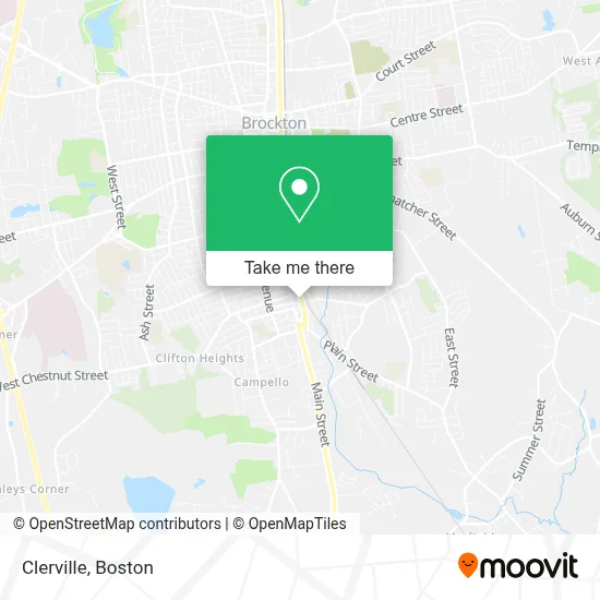
See Clerville, Brockton, on the map
Public Transit to Clerville in Brockton
Wondering how to get to Clerville in Brockton? Moovit helps you find the best way to get to Clerville with step-by-step directions from the nearest public transit station.
Moovit provides free maps and live directions to help you navigate through your city. View schedules, routes, timetables, and find out how long does it take to get to Clerville in real time.
Looking for the nearest stop or station to Clerville? Check out this list of stops closest to your destination: Main St And South St; Plain St And Montello St Ext; Brockton.
Bus: 12, 2, 8.Train: FALL RIVER/NEW BEDFORD, CAPEFLYER.
Want to see if there’s another route that gets you there at an earlier time? Moovit helps you find alternative routes or times. Get directions from and directions to Clerville easily from the Moovit App or Website.
We make riding to Clerville easy, which is why over 1.7 million users, including users in Brockton, trust Moovit as the best app for public transit. You don’t need to download an individual bus app or train app, Moovit is your all-in-one transit app that helps you find the best bus time or train time available.
For information on prices of bus and train, costs and ride fares to Clerville, please check the Moovit app.
Use the app to navigate to popular places including to the airport, hospital, stadium, grocery store, mall, coffee shop, school, college, and university.
Clerville Address: 1081 Montello St street in Brockton
- All Pro Physical Therapy,
- Belissima Cosmetic,
- Nomis,
- Mass Mobile Solutions,
- Diamond Life United Services,
- Monty Construction,
- JJM Business Services,
- Flex Jamaican Cuisine,
- Adt Security Services,
- Iglesia Pentecostal Jehova Nuestro Libertador, Inc.,
- Vha Retail,
- Shawmut Bank,
- Cv Electronics,
- Murray & Murray Auctions,
- WL Auto Collision,
- Rockitcoin,
- Lorick,
- Buckley Playground,
- Rosario's Office,
- Carrie Leone Mortgage Loan
Places Near Clerville (Brockton)
- Wilbur Theatre, Boston,
- Massachusetts General Hospital, Boston,
- Mgm Music Hall, Boston,
- Seaport District, Boston,
- Faneuil Hall, Boston,
- Isabella Stewart Gardner Museum, Boston,
- Leader Bank Pavilion (Leader Bank Pavillion), Boston,
- Boston Children's Hospital, Boston,
- House Of Blues, Boston,
- Boston Medical Center, Boston,
- Boston Convention & Exhibition Center, Boston,
- Castle Island, Boston,
- Td Garden, Boston,
- Quincy Market, Boston,
- Cheers, Boston,
- Boston Common, Boston,
- Museum Of Science, Boston,
- Wang Theater, Boston,
- North End, Boston,
- Prudential Center, Boston
How to get to popular places in Boston with public transit
Get around Brockton by public transit!
Traveling around Brockton has never been so easy. See step by step directions as you travel to any attraction, street or major public transit station. View bus and train schedules, arrival times, service alerts and detailed routes on a map, so you know exactly how to get to anywhere in Brockton.
When traveling to any destination around Brockton use Moovit's Live Directions with Get Off Notifications to know exactly where and how far to walk, how long to wait for your line, and how many stops are left. Moovit will alert you when it's time to get off — no need to constantly re-check whether yours is the next stop.
Wondering how to use public transit in Brockton or how to pay for public transit in Brockton? Moovit public transit app can help you navigate your way with public transit easily, and at minimum cost. It includes public transit fees, ticket prices, and costs. Looking for a map of Brockton public transit lines? Moovit public transit app shows all public transit maps in Brockton with all Bus, Train, Subway and Ferry routes and stops on an interactive map.
Boston has 4 transit type(s), including: Bus, Train, Subway and Ferry, operated by several transit agencies, including MBTA, Southeastern Regional Transit Authority, MetroWest Regional Transit Authority, Rhode Island Public Transit Authority, WRTA, Lowell Regional Transit Authority, Merrimack Valley Transit, Montachusett Regional Transit Authority, Cape Cod Regional Transit Authority, Brockton Area Transit Authority, Martha's Vineyard Transit Authority, the WAVE - Nantucket Regional Transit Authority, GATRA, Cape Ann Transportation Authority and Massport