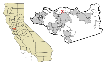
See Clyde Calif on the map
Directions to Clyde Calif with public transportation
The following transit lines have routes that pass near Clyde Calif
 Bus:
Bus: - BART:
How to get to Clyde Calif by bus?
Click on the bus route to see step by step directions with maps, line arrival times and updated time schedules.
How to get to Clyde Calif by BART?
Click on the BART route to see step by step directions with maps, line arrival times and updated time schedules.
Bus stations near Clyde Calif
- Bates Ave Between Commercial Cir,23 min walk,
Bus lines to Clyde Calif
- 99X,Martinez Amtrak via Mason Circle,
What are the closest stations to Clyde Calif?
The closest stations to Clyde Calif are:
- Bates Ave Between Commercial Cir is 1917 yards away, 23 min walk.
Which bus lines stop near Clyde Calif?
These bus lines stop near Clyde Calif: 17, 99X.
Which BART line stops near Clyde Calif?
YELLOW
See Clyde Calif on the map
Public Transportation to Clyde Calif
Wondering how to get to Clyde Calif, United States? Moovit helps you find the best way to get to Clyde Calif with step-by-step directions from the nearest public transit station.
Moovit provides free maps and live directions to help you navigate through your city. View schedules, routes, timetables, and find out how long does it take to get to Clyde Calif in real time.
Looking for the nearest stop or station to Clyde Calif? Check out this list of stops closest to your destination: Bates Ave Between Commercial Cir.
Bus:BART:
Want to see if there’s another route that gets you there at an earlier time? Moovit helps you find alternative routes or times. Get directions from and directions to Clyde Calif easily from the Moovit App or Website.
We make riding to Clyde Calif easy, which is why over 1.5 million users, including users in Clyde, trust Moovit as the best app for public transit. You don’t need to download an individual bus app or train app, Moovit is your all-in-one transit app that helps you find the best bus time or train time available.
For information on prices of bus and BART, costs and ride fares to Clyde Calif, please check the Moovit app.
Use the app to navigate to popular places including to the airport, hospital, stadium, grocery store, mall, coffee shop, school, college, and university.
Location: Clyde, San Francisco - San Jose, CA
Clyde is a census-designated place (CDP) in Contra Costa County, California, United States. The population was 678 at the 2010 census. It is located six miles (10 kilometres) east of Martinez.Wiki
Attractions near Clyde Calif
Hellion House,Joseph Murphy,Clyde,Clyde,Contra Costa County Fire Protection District Station 18,205 Sussex St,We Buy Used Games,Reppert Precision Mach Inc,gate 2,Jeru Funtivities FARMS,270 Wellington Ave,Robinett Construction,Rosy Miles Murals & Faux,Spartan Tool,262 Wellington Avenue,Copy Pro Inc,Medburn Street,copypro,370 Park St,Maybeck ParkHow to get to popular attractions in Clyde with public transit
Kaiser Permanente Medical Center, Santa Clara,Stonestown Galleria Mall, Lakeshore, Sf,Googleplex - Charlie's Cafe,Apple Valley Fair, San Jose,City of Newark, Newark,Japantown (日本町), San Jose,440 Castro, Castro/Upper Market,BJ's Restaurant and Brewhouse, Cupertino,City of Pinole, Pinole,Sharks Ice at San Jose, San Jose,The Castro, Castro/Upper Market,Mansion Grove Apartments, Santa Clara,City of Menlo Park, Menlo Park,I-80, Emeryville,Safeway, Campbell,Westgate Shopping Center, San Jose,Colma, Colma,Nordstrom Valley Fair, San Jose,Nordstrom Stoneridge Mall in Pleasanton, Pleasanton,Concord BART Station, ConcordGet around Clyde by public transit!
Traveling around Clyde has never been so easy. See step by step directions as you travel to any attraction, street or major public transit station. View bus and train schedules, arrival times, service alerts and detailed routes on a map, so you know exactly how to get to anywhere in Clyde.
When traveling to any destination around Clyde use Moovit's Live Directions with Get Off Notifications to know exactly where and how far to walk, how long to wait for your line, and how many stops are left. Moovit will alert you when it's time to get off — no need to constantly re-check whether yours is the next stop.
Wondering how to use public transit in Clyde or how to pay for public transit in Clyde? Moovit public transit app can help you navigate your way with public transit easily, and at minimum cost. It includes public transit fees, ticket prices, and costs. Looking for a map of Clyde public transit lines? Moovit public transit app shows all public transit maps in Clyde with all bus or BART routes and stops on an interactive map.
Clyde has 2 transit type(s), including: bus or BART, operated by several transit agencies, including BART, Bay Area Rapid Transit, Muni Metro, Caltrain, VTA, Capitol Corridor, Sonoma Marin Area Rail Transit, MUNI, VTA, SF Cable Car, AC Transit, Dumbarton Express, Golden Gate Transit, County Connection and SamTrans