Directions to Coinhub (Baltimore County) with public transportation
The following transit lines have routes that pass near Coinhub
 Bus: 32, 73, CITYLINK YELLOW.
How to get to Coinhub by bus?
Click on the bus route to see step by step directions with maps, line arrival times and updated time schedules.
From Johns Hopkins University, Baltimore
61 minFrom MVA Glen Burnie, Anne Arundel County
32 minFrom Renaissance Baltimore Harborplace Hotel, Baltimore
39 minFrom Giant Food Stores, Baltimore
54 minFrom NSA Friendship Annex (FANX), Anne Arundel County
40 minFrom Johns Hopkins Bayview Medical Center, Baltimore
61 minFrom Mitchell Court House, Baltimore
35 minFrom Social Security Administration (Robert M. Ball Building), Baltimore County
60 minFrom Baltimore City Circuit Court, Baltimore
37 minFrom Medstar Union Memorial Hospital, Baltimore
58 min
Bus stops near Coinhub in Baltimore County
Light Rail stations near Coinhub in Baltimore County
- Baltimore Highlands, 23 min walk,VIEW
Bus lines to Coinhub in Baltimore County
What are the closest stations to Coinhub?
The closest stations to Coinhub are:
- Mcdowell Ln & Songbird Cir Nb is 86 yards away, 2 min walk.
- Daisy Ave & Tulip Ave Eb is 446 yards away, 6 min walk.
- Baltimore Highlands is 1908 yards away, 23 min walk.
Which bus lines stop near Coinhub?
These bus lines stop near Coinhub: 32, 73, CITYLINK YELLOW.
What’s the nearest light rail station to Coinhub in Baltimore County?
The nearest light rail station to Coinhub in Baltimore County is Baltimore Highlands. It’s a 23 min walk away.
What’s the nearest bus station to Coinhub in Baltimore County?
The nearest bus station to Coinhub in Baltimore County is Mcdowell Ln & Songbird Cir Nb. It’s a 2 min walk away.
What time is the first light rail to Coinhub in Baltimore County?
The LIGHT RAILLINK is the first light rail that goes to Coinhub in Baltimore County. It stops nearby at 4:22 AM.
What time is the last light rail to Coinhub in Baltimore County?
The LIGHT RAILLINK is the last light rail that goes to Coinhub in Baltimore County. It stops nearby at 1:01 AM.
What time is the first bus to Coinhub in Baltimore County?
The CITYLINK YELLOW is the first bus that goes to Coinhub in Baltimore County. It stops nearby at 3:35 AM.
What time is the last bus to Coinhub in Baltimore County?
The 73 is the last bus that goes to Coinhub in Baltimore County. It stops nearby at 2:59 AM.
See Coinhub, Baltimore County, on the map
Public Transit to Coinhub in Baltimore County
Wondering how to get to Coinhub in Baltimore County? Moovit helps you find the best way to get to Coinhub with step-by-step directions from the nearest public transit station.
Moovit provides free maps and live directions to help you navigate through your city. View schedules, routes, timetables, and find out how long does it take to get to Coinhub in real time.
Looking for the nearest stop or station to Coinhub? Check out this list of stops closest to your destination: Mcdowell Ln & Songbird Cir Nb; Daisy Ave & Tulip Ave Eb; Baltimore Highlands.
Bus: 32, 73, CITYLINK YELLOW.
Want to see if there’s another route that gets you there at an earlier time? Moovit helps you find alternative routes or times. Get directions from and directions to Coinhub easily from the Moovit App or Website.
We make riding to Coinhub easy, which is why over 1.7 million users, including users in Baltimore County, trust Moovit as the best app for public transit. You don’t need to download an individual bus app or train app, Moovit is your all-in-one transit app that helps you find the best bus time or train time available.
For information on prices of bus, costs and ride fares to Coinhub, please check the Moovit app.
Use the app to navigate to popular places including to the airport, hospital, stadium, grocery store, mall, coffee shop, school, college, and university.
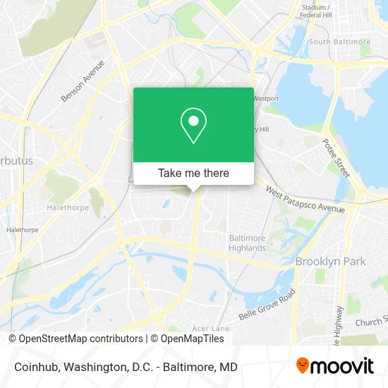
Coinhub Address: 3905 Hollins Ferry Rd, Halethorpe, Maryland 21227, US street in Baltimore County
- Save Mart,
- Water's Edge Townhomes,
- Lansdowne High School,
- Amazon Flex Warehouse,
- John D. Remick Sr. School of Isshin-Ryu,
- La Ecuatoriana,
- Lansdowne MD USA,
- La Esperanza Cafe,
- Martin G Mendez,
- T-Mobile,
- El Pueblito Restaurant & Bar,
- Patapsco Flea Market,
- Baltimore Link Bus 75 - Arundel Mills,
- Patapsco Light Rail Station,
- Patapsco,
- Walmart Supercenter,
- I-695 @ Exit 9 (Hollins Ferry Rd),
- Walmart,
- West Baltimore, Maryland,
- Commerce Dr (washington blvd and commerce)
Places Near Coinhub (Baltimore County)
- Rock Creek Tennis Center, Washington,
- National Zoo, Washington,
- PG Mall, Prince George's County,
- Amazon Hq2, Arlington County,
- Museum Of The Bible, Washington,
- The Anthem, Washington,
- Sibley Memorial Hospital, Washington,
- M&T Bank Stadium, Baltimore,
- National Museum of African American History and Culture, Washington,
- Capital One Arena, Washington,
- Georgetown, Washington,
- National Theatre, Washington,
- Warner Theatre, Washington,
- Westfield Montgomery Mall, Montgomery County,
- Washington National Cathedral, Washington,
- Basilica of the National Shrine, Washington,
- Marriott Marquis Washington, DC, Washington,
- Washington DC VA Medical Center, Washington,
- Pennsylvania Ave NW (3rd st and pennsylvania), Washington,
- Camden Yards, Baltimore
How to get to popular places in Washington, D.C. - Baltimore, MD with public transit
Get around Baltimore County by public transit!
Traveling around Baltimore County has never been so easy. See step by step directions as you travel to any attraction, street or major public transit station. View bus and train schedules, arrival times, service alerts and detailed routes on a map, so you know exactly how to get to anywhere in Baltimore County.
When traveling to any destination around Baltimore County use Moovit's Live Directions with Get Off Notifications to know exactly where and how far to walk, how long to wait for your line, and how many stops are left. Moovit will alert you when it's time to get off — no need to constantly re-check whether yours is the next stop.
Wondering how to use public transit in Baltimore County or how to pay for public transit in Baltimore County? Moovit public transit app can help you navigate your way with public transit easily, and at minimum cost. It includes public transit fees, ticket prices, and costs. Looking for a map of Baltimore County public transit lines? Moovit public transit app shows all public transit maps in Baltimore County with all Bus, Train, Metro, Light Rail and Ferry routes and stops on an interactive map.
Washington, D.C. - Baltimore, MD has 5 transit type(s), including: Bus, Train, Metro, Light Rail and Ferry, operated by several transit agencies, including WMATA, Montgomery County Ride On, Fairfax Connector, TheBus, PRTC, DASH - Alexandria, Arlington Transit (ART), RTA of Central Maryland, MDOT MTA, MDOT MTA Light RailLink, MDOT MTA Commuter Bus, MDOT MTA Local Bus, FXBGO!, Virginia Railway Express (VRE) and MARC