Directions to College of Alameda station with public transit
The following transit lines have routes that pass near College of Alameda
How to get to College of Alameda station by bus?
Click on the bus route to see step by step directions with maps, line arrival times and updated time schedules.
How to get to College of Alameda station by train?
Click on the train route to see step by step directions with maps, line arrival times and updated time schedules.
How to get to College of Alameda station by BART?
Click on the BART route to see step by step directions with maps, line arrival times and updated time schedules.
Bus stops near College of Alameda
- Webster St & Willie Stargell Av, 5 min walk,
- Mariner Sq Loop & Willie Stargell Av, 7 min walk,
- Lincoln Av & 6th St, 14 min walk,
Ferry stations near College of Alameda
- Main Street Alameda Ferry Terminal, 14 min walk,
- Alameda Bohol Circle Immigrant Park Dock, 21 min walk,
Train station near College of Alameda
- Oakland Jack London Square, 31 min walk,
Bus lines to College of Alameda station
- O, Santa Clara - Encinal Transbay,
- W, High - South Shore Transbay,
- 20, Dimond - Fruitvale - South Shore,
- 51A, Broadway - Santa Clara,
- 96, Alameda Pt. - 14th Ave. - Dimond,
- 851, College - Broadway All Nighter,
- 19, Seminary Ave. & San Leandro St.,
- 631, Encinal - Alameda - Bay Farm,
- 663, Encinal - South Shore - High St.,
What are the closest stations to College of Alameda?
The closest stations to College of Alameda are:
- Webster St & Willie Stargell Av is 343 yards away, 5 min walk.
- Mariner Sq Loop & Willie Stargell Av is 502 yards away, 7 min walk.
- Lincoln Av & 6th St is 1087 yards away, 14 min walk.
- Main Street Alameda Ferry Terminal is 1204 yards away, 14 min walk.
- Alameda Bohol Circle Immigrant Park Dock is 1709 yards away, 21 min walk.
- Oakland Jack London Square is 2566 yards away, 31 min walk.
Which bus lines stop near College of Alameda?
These bus lines stop near College of Alameda: 20, 51A, 96, O.
Which train line stops near College of Alameda?
CC (Sacramento)
Which BART lines stop near College of Alameda?
These BART lines stop near College of Alameda: GREEN, ORANGE, RED.
What’s the nearest bus stop to College of Alameda?
The nearest bus stop to College of Alameda is Webster St & Willie Stargell Av. It’s a 5 min walk away.
What’s the nearest ferry station to College of Alameda?
The nearest ferry station to College of Alameda is Main Street Alameda Ferry Terminal. It’s a 14 min walk away.
What time is the first train to College of Alameda?
The CC is the first train that goes to College of Alameda. It stops nearby at 5:42 AM.
What time is the last train to College of Alameda?
The COAST STARLIGHT is the last train that goes to College of Alameda. It stops nearby at 9:09 AM.
What time is the first bus to College of Alameda?
The 851 is the first bus that goes to College of Alameda. It stops nearby at 3:27 AM.
What time is the last bus to College of Alameda?
The 851 is the last bus that goes to College of Alameda. It stops nearby at 2:47 AM.
What time is the first ferry to College of Alameda?
The OAKLAND & ALAMEDA is the first ferry that goes to College of Alameda. It stops nearby at 8:30 AM.
What time is the last ferry to College of Alameda?
The OAKLAND & ALAMEDA is the last ferry that goes to College of Alameda. It stops nearby at 10:15 PM.
See College of Alameda on the map
Public Transportation to College of Alameda
Wondering how to get to College of Alameda, United States? Moovit helps you find the best way to get to College of Alameda with step-by-step directions from the nearest public transit station.
Moovit provides free maps and live directions to help you navigate through your city. View schedules, routes, timetables, and find out how long does it take to get to College of Alameda in real time.
Looking for the nearest stop or station to College of Alameda? Check out this list of stops closest to your destination: Webster St & Willie Stargell Av; Mariner Sq Loop & Willie Stargell Av; Lincoln Av & 6th St; Main Street Alameda Ferry Terminal; Alameda Bohol Circle Immigrant Park Dock; Oakland Jack London Square.
Bus: 20, 51A, 96, O, W, 19, 631, 663.Train: CC, COAST STARLIGHT.BART: GREEN, ORANGE, RED.Ferry: OAKLAND & ALAMEDA, SOUTH SAN FRANCISCO, OAKLAND ALAMEDA WATER SHUTTLE.
Want to see if there’s another route that gets you there at an earlier time? Moovit helps you find alternative routes or times. Get directions from and directions to College of Alameda easily from the Moovit App or Website.
We make riding to College of Alameda easy, which is why over 1.5 million users, including users in Alameda, trust Moovit as the best app for public transit. You don’t need to download an individual bus app or train app, Moovit is your all-in-one transit app that helps you find the best bus time or train time available.
For information on prices of bus, BART, train and light rail, costs and ride fares to College of Alameda, please check the Moovit app.
Get to College of Alameda with public transit and pay for the ride in the Moovit app. In addition to all info you may need for your trip to College of Alameda, including live directions, real-time arrivals and fare prices, you can also buy public transit passes for your rides. No need for cash or paper tickets to get to College of Alameda - everything you need is accessible in the app with a click of the button.
Use the app to navigate to popular places including to the airport, hospital, stadium, grocery store, mall, coffee shop, school, college, and university.
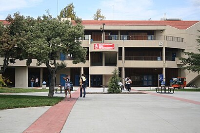
College of Alameda Address: 555 Ralph Appezzato Memorial Pkwy street in Alameda
Directions to College of Alameda station with public transit
How to get to popular places in San Francisco - San Jose, CA with public transit
Get around Alameda by public transit!
Traveling around Alameda has never been so easy. See step by step directions as you travel to any attraction, street or major public transit station. View bus and train schedules, arrival times, service alerts and detailed routes on a map, so you know exactly how to get to anywhere in Alameda.
When traveling to any destination around Alameda use Moovit's Live Directions with Get Off Notifications to know exactly where and how far to walk, how long to wait for your line, and how many stops are left. Moovit will alert you when it's time to get off — no need to constantly re-check whether yours is the next stop.
Wondering how to use public transit in Alameda or how to pay for public transit in Alameda? Moovit public transit app can help you navigate your way with public transit easily, and at minimum cost. It includes public transit fees, ticket prices, and costs. Looking for a map of Alameda public transit lines? Moovit public transit app shows all public transit maps in Alameda with all Bus, Train, BART, Light Rail, Ferry and Cable Car routes and stops on an interactive map.
San Francisco - San Jose, CA has 6 transit type(s), including: Bus, Train, BART, Light Rail, Ferry and Cable Car, operated by several transit agencies, including MUNI, BART, VTA, Muni Metro, SF Cable Car, AC Transit, Golden Gate Transit, County Connection, Marin Transit, Capitol Corridor, SamTrans, Sonoma County Transit, Stanford Marguerite Shuttle, Caltrain and SANTAROSA