Directions to College of the Holy Spirit Manila with public transportation
The following transit lines have routes that pass near College of the Holy Spirit Manila
How to get to College of the Holy Spirit Manila by bus?
Click on the bus route to see step by step directions with maps, line arrival times and updated time schedules.
How to get to College of the Holy Spirit Manila by train?
Click on the train route to see step by step directions with maps, line arrival times and updated time schedules.
Bus stops near College of the Holy Spirit Manila
- San Sebastian Church, 3 min walk,
- Manuel Quezon University, R Hidalgo, Manila, 4 min walk,
- R Hidalgo, Manila, 4 min walk,
- Aguado, Manila, 5 min walk,
- Farnecio / Arlegui, Manila, 5 min walk,
- Jose P Laurel Sr, Manila, 8 min walk,
- Tuberias, Manila, 10 min walk,
- M. Arenas, Manila, 13 min walk,
- Legarda, Manila, 14 min walk,
- Mendiola / Legarda Intersection, Manila, 14 min walk,
- Ramon Magsaysay Blvd, Manila, 17 min walk,
Train stations near College of the Holy Spirit Manila
- Legarda Lrt, 7 min walk,
- Central Terminal Lrt, 28 min walk,
Bus lines to College of the Holy Spirit Manila
- JEEP, R Hidalgo, Manila,
- JEEP, Unang Hakbang / Luzon Ave,
- JEEP, Matimyas, Manila City,
- JEEP, Mayor Antonio J. Villegas Rd, Manilla,
- JEEP, QUIAPO - BACOOD,
- JEEP, Punta - Quiapo (Barbosa) via Sta. Mesa,
- JEEP, Quiapo (Barbosa) - San Juan via Legarda,
- JEEP, Quiapo (Barbosa) San Juan via Legarda,
- JEEP, Quiapo (Barbosa) - Santol via Sta. Mesa,
- JEEP, Arlegui, Manila,
- BUS, Manila Road East, Taytay, Manila,
- JEEP, Carlos Palanca Sr, Manila,
- JEEP, Balderama / Caruncho Ave, Pasig City, Manila,
- JEEP, Dimasalang / Aurora Boulevard Intersection, Quezon City,
- JEEP, Mendiola / Legarda Intersection, Manila,
- JEEP, Jollibee Figueras Legarda / Bustillos Intersection, Manila,
- BUS, Cainta - Quiapo via Ortigas Ave, Magsaysay Blvd,
- JEEP, Bacood Quiapo (Barbosa) via R Magsaysay,
- JEEP, Pasig-Quiapo via Sta Mesa,
- JEEP, EDSA Shaw Quiapo via Sta Mesa,
What are the closest stations to College of the Holy Spirit Manila?
The closest stations to College of the Holy Spirit Manila are:
- San Sebastian Church is 162 meters away, 3 min walk.
- Manuel Quezon University, R Hidalgo, Manila is 257 meters away, 4 min walk.
- R Hidalgo, Manila is 268 meters away, 4 min walk.
- Aguado, Manila is 332 meters away, 5 min walk.
- Farnecio / Arlegui, Manila is 351 meters away, 5 min walk.
- Legarda Lrt is 534 meters away, 7 min walk.
- Jose P Laurel Sr, Manila is 597 meters away, 8 min walk.
- Tuberias, Manila is 745 meters away, 10 min walk.
- M. Arenas, Manila is 992 meters away, 13 min walk.
- Legarda, Manila is 1040 meters away, 14 min walk.
- Mendiola / Legarda Intersection, Manila is 1051 meters away, 14 min walk.
- Ramon Magsaysay Blvd, Manila is 1272 meters away, 17 min walk.
- Central Terminal Lrt is 2184 meters away, 28 min walk.
Which bus lines stop near College of the Holy Spirit Manila?
These bus lines stop near College of the Holy Spirit Manila: BUS, JEEP.
Which train line stops near College of the Holy Spirit Manila?
LRT 2 (Recto)
What’s the nearest train station to College of the Holy Spirit Manila?
The nearest train station to College of the Holy Spirit Manila is Legarda Lrt. It’s a 7 min walk away.
What’s the nearest bus station to College of the Holy Spirit Manila?
The nearest bus station to College of the Holy Spirit Manila is San Sebastian Church. It’s a 3 min walk away.
What time is the first train to College of the Holy Spirit Manila?
The LRT 2 is the first train that goes to College of the Holy Spirit Manila. It stops nearby at 5:00 AM.
What time is the last train to College of the Holy Spirit Manila?
The LRT 1 is the last train that goes to College of the Holy Spirit Manila. It stops nearby at 10:01 PM.
What time is the first bus to College of the Holy Spirit Manila?
The JEEP is the first bus that goes to College of the Holy Spirit Manila. It stops nearby at 7:00 AM.
What time is the last bus to College of the Holy Spirit Manila?
The BUS is the last bus that goes to College of the Holy Spirit Manila. It stops nearby at 1:46 AM.
See College of the Holy Spirit Manila on the map
Public Transportation to College of the Holy Spirit Manila
Wondering how to get to College of the Holy Spirit Manila, Philippines? Moovit helps you find the best way to get to College of the Holy Spirit Manila with step-by-step directions from the nearest public transit station.
Moovit provides free maps and live directions to help you navigate through your city. View schedules, routes, timetables, and find out how long does it take to get to College of the Holy Spirit Manila in real time.
Looking for the nearest stop or station to College of the Holy Spirit Manila? Check out this list of stops closest to your destination: San Sebastian Church; Manuel Quezon University; R Hidalgo; Aguado; Farnecio / Arlegui; Legarda Lrt; Jose P Laurel Sr; Tuberias; M. Arenas; Legarda; Mendiola / Legarda Intersection; Ramon Magsaysay Blvd; Central Terminal Lrt.
Bus: BUS, JEEP.Train: LRT 2, LRT 1.
Want to see if there’s another route that gets you there at an earlier time? Moovit helps you find alternative routes or times. Get directions from and directions to College of the Holy Spirit Manila easily from the Moovit App or Website.
We make riding to College of the Holy Spirit Manila easy, which is why over 1.5 million users, including users in Manila, trust Moovit as the best app for public transit. You don’t need to download an individual bus app or train app, Moovit is your all-in-one transit app that helps you find the best bus time or train time available.
For information on prices of bus and train, costs and ride fares to College of the Holy Spirit Manila, please check the Moovit app.
Use the app to navigate to popular places including to the airport, hospital, stadium, grocery store, mall, coffee shop, school, college, and university.
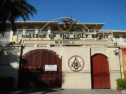
College of the Holy Spirit Manila Address: Barangay 638, Manila street in Manila
Places Near College of the Holy Spirit Manila
How to get to popular places in Manila with public transit
Get around Manila by public transit!
Traveling around Manila has never been so easy. See step by step directions as you travel to any attraction, street or major public transit station. View bus and train schedules, arrival times, service alerts and detailed routes on a map, so you know exactly how to get to anywhere in Manila.
When traveling to any destination around Manila use Moovit's Live Directions with Get Off Notifications to know exactly where and how far to walk, how long to wait for your line, and how many stops are left. Moovit will alert you when it's time to get off — no need to constantly re-check whether yours is the next stop.
Wondering how to use public transit in Manila or how to pay for public transit in Manila? Moovit public transit app can help you navigate your way with public transit easily, and at minimum cost. It includes public transit fees, ticket prices, and costs. Looking for a map of Manila public transit lines? Moovit public transit app shows all public transit maps in Manila with all Bus and Train routes and stops on an interactive map.
Manila has 2 transit type(s), including: Bus and Train, operated by several transit agencies, including MRTC, LRTA, PNR, LTFRB, BGC Bus, P2P and UV Express