See Comerica Park, Detroit, on the map
Directions to Comerica Park (Detroit) with public transportation
The following transit lines have routes that pass near Comerica Park
 Bus:
Bus: - Light Rail:
How to get to Comerica Park by bus?
Click on the bus route to see step by step directions with maps, line arrival times and updated time schedules.
Light Rail stations near Comerica Park in Detroit
- Montcalm St - Northbound,4 min walk,
- Grand Circus Park,8 min walk,
Bus stations near Comerica Park in Detroit
- Grand Circus Park,4 min walk,
- Clifford & Elizabeth,4 min walk,
- Woodward & I-75 Service Dr,5 min walk,
- Gratiot & Brush,5 min walk,
- Woodward + Clifford,5 min walk,
- Gratiot + Beaubien,6 min walk,
- Clifford & Washington,6 min walk,
- Gratiot + Madison,7 min walk,
Bus lines to Comerica Park in Detroit
- 4,Jason Hargrove Transit Center - Bay 4,
- 461,Troy Civic Ctr P&R Lot,
- 462,Auburn Hills Meijer,
- 23,Meijer Gateway - Eb,
- 6,8 Mile & Hayes,
- 40,Rosa Parks Transit Center - Deboarding,
- 261,Metro Airport North Terminal,
- 530,Bagley + Third,
- 18,Fenkell & Dale,
- 31,Moross & Mack,
- D2A2,Grand Circus Park,
- 563,Jefferson + Griswold,
What are the closest stations to Comerica Park?
The closest stations to Comerica Park are:
- Montcalm St - Northbound is 254 yards away, 4 min walk.
- Woodward & I-75 Service Dr is 316 yards away, 5 min walk.
- Grand Circus Park is 322 yards away, 4 min walk.
- Clifford & Elizabeth is 323 yards away, 4 min walk.
- Gratiot & Brush is 365 yards away, 5 min walk.
- Woodward + Clifford is 374 yards away, 5 min walk.
- Gratiot + Beaubien is 431 yards away, 6 min walk.
- Clifford & Washington is 437 yards away, 6 min walk.
- Gratiot + Madison is 519 yards away, 7 min walk.
Which bus lines stop near Comerica Park?
These bus lines stop near Comerica Park: 1, 16, 18, 261, 4, 52.
Which light rail line stops near Comerica Park?
QLINE
What’s the nearest light rail station to Comerica Park in Detroit?
The nearest light rail station to Comerica Park in Detroit is Montcalm St - Northbound. It’s a 4 min walk away.
What’s the nearest bus stop to Comerica Park in Detroit?
The nearest bus stops to Comerica Park in Detroit are Woodward & I-75 Service Dr, Gratiot & Brush and Woodward + Clifford. The closest one is a 5 min walk away.
What time is the first light rail to Comerica Park in Detroit?
The DPM is the first light rail that goes to Comerica Park in Detroit. It stops nearby at 7:13 AM.
What time is the last light rail to Comerica Park in Detroit?
The QLINE is the last light rail that goes to Comerica Park in Detroit. It stops nearby at 12:08 AM.
What time is the first bus to Comerica Park in Detroit?
The 6 is the first bus that goes to Comerica Park in Detroit. It stops nearby at 3:10 AM.
What time is the last bus to Comerica Park in Detroit?
The 4 is the last bus that goes to Comerica Park in Detroit. It stops nearby at 3:33 AM.
How much is the bus fare to Comerica Park?
The bus fare to Comerica Park costs about $2.00.
How much is the light rail fare to Comerica Park?
The light rail fare to Comerica Park costs about $2.00.
See Comerica Park, Detroit, on the map
Public Transit to Comerica Park in Detroit
Wondering how to get to Comerica Park in Detroit, United States? Moovit helps you find the best way to get to Comerica Park with step-by-step directions from the nearest public transit station.
Moovit provides free maps and live directions to help you navigate through your city. View schedules, routes, timetables, and find out how long does it take to get to Comerica Park in real time.
Looking for the nearest stop or station to Comerica Park? Check out this list of stops closest to your destination: Montcalm St - Northbound; Woodward & I-75 Service Dr; Grand Circus Park; Clifford & Elizabeth; Gratiot & Brush; Woodward + Clifford; Gratiot + Beaubien; Clifford & Washington; Gratiot + Madison.
Bus:Light Rail:
Want to see if there’s another route that gets you there at an earlier time? Moovit helps you find alternative routes or times. Get directions from and directions to Comerica Park easily from the Moovit App or Website.
We make riding to Comerica Park easy, which is why over 1.5 million users, including users in Detroit, trust Moovit as the best app for public transit. You don’t need to download an individual bus app or train app, Moovit is your all-in-one transit app that helps you find the best bus time or train time available.
For information on prices of bus and light rail, costs and ride fares to Comerica Park, please check the Moovit app.
Use the app to navigate to popular places including to the airport, hospital, stadium, grocery store, mall, coffee shop, school, college, and university.
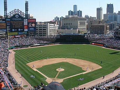
Comerica Park Address: 2100 Woodward Ave street in Detroit
Comerica Park is a baseball stadium located in Downtown Detroit. It has been the ballpark of Major League Baseball's Detroit Tigers since 2000, when the team left Tiger Stadium.Wiki
Attractions near Comerica Park
Comerica Park,ATM,Little Caesars Pizza,Lexus Cigar Lounge - Comerica Park,Comerica Park (Tiger Club),Comerica Park-Gate D,Coppercraft Distillery,850 Witherell Lot,Grand Valley State University Detroit Center,Brown Bean Cafe,24 Hour Locksmith Detroit Mi,Beer Hall,Delaware North,Miller Lite Lounge,Detroit Tigers Press Lounge,Hardluck Lounge,Gold Robert S,Barden Companies,GDD Adams Street,Art & Soul DetroitHow to get to popular attractions in Detroit with public transit
Martin Luther King High School, Detroit,Interstate I-94 (The Ford Freeway), Detroit,Rosa Parks Transit Center, Detroit,Aisha Shule / W.E.B. DuBois Preparatory Academy, Detroit,Detroit Police Department- 6th Precinct, Detroit,Dearborn Sausage, Dearborn,Downtown Detroit, Detroit,Lodge Freeway, Detroit,Wolverine Packing Co, Detroit,Motown Museum, Detroit,Evergreen & Grand River Avenues, Detroit,Christine's Beauty Room & Boutique, Detroit,Davison Street & Mound Road, Detroit,Fox Theatre Detroit, Detroit,8 Mile & Mound Roads, Warren,I-94 Exit 222B, Harper Avenue, Detroit,Bad Luck Bar, Detroit,SB M 39 / 96, Detroit,9 Mile Road & Southfield Fwy, Southfield,Brightmoor, DetroitGet around Detroit by public transit!
Traveling around Detroit has never been so easy. See step by step directions as you travel to any attraction, street or major public transit station. View bus and train schedules, arrival times, service alerts and detailed routes on a map, so you know exactly how to get to anywhere in Detroit.
When traveling to any destination around Detroit use Moovit's Live Directions with Get Off Notifications to know exactly where and how far to walk, how long to wait for your line, and how many stops are left. Moovit will alert you when it's time to get off — no need to constantly re-check whether yours is the next stop.
Wondering how to use public transit in Detroit or how to pay for public transit in Detroit? Moovit public transit app can help you navigate your way with public transit easily, and at minimum cost. It includes public transit fees, ticket prices, and costs. Looking for a map of Detroit public transit lines? Moovit public transit app shows all public transit maps in Detroit with all bus or light rail routes and stops on an interactive map.
Detroit has 2 transit type(s), including: bus or light rail, operated by several transit agencies, including SMART, Qline Detroit, DDOT, DETROIT PEOPLE MOVER, The Ride, Michigan Flyer, Detroit Ann Arbor Express, University of Michigan Transportation Services, Amtrak, FlixBus-us and Greyhound-us