See Commander's Palace, New Orleans, on the map
Directions to Commander's Palace (New Orleans) with public transportation
The following transit lines have routes that pass near Commander's Palace
 Bus:
Bus:
How to get to Commander's Palace by bus?
Click on the bus route to see step by step directions with maps, line arrival times and updated time schedules.
Bus stations near Commander's Palace in New Orleans
- Magazine at Harmony,2 min walk,
- Jackson at Coliseum,9 min walk,
- Louisiana at Prytania,10 min walk,
Streetcar stations near Commander's Palace in New Orleans
- St Charles at Washington,4 min walk,
Bus lines to Commander's Palace in New Orleans
- 11,Canal at Magazine >> Children's Hospital,
- 91,Tchoup. Wal-Mart,
- 27,Delgado Cc Via Xavier,
What are the closest stations to Commander's Palace?
The closest stations to Commander's Palace are:
- Magazine at Harmony is 124 yards away, 2 min walk.
- St Charles at Washington is 319 yards away, 4 min walk.
- Jackson at Coliseum is 676 yards away, 9 min walk.
- Louisiana at Prytania is 814 yards away, 10 min walk.
Which bus lines stop near Commander's Palace?
These bus lines stop near Commander's Palace: 57, 91.
What’s the nearest Streetcar station to Commander's Palace in New Orleans?
The nearest Streetcar station to Commander's Palace in New Orleans is St Charles at Washington. It’s a 4 min walk away.
What’s the nearest bus stop to Commander's Palace in New Orleans?
The nearest bus stop to Commander's Palace in New Orleans is Magazine at Harmony. It’s a 2 min walk away.
What time is the first Streetcar to Commander's Palace in New Orleans?
The 12 is the first Streetcar that goes to Commander's Palace in New Orleans. It stops nearby at 3:00 AM.
What time is the last Streetcar to Commander's Palace in New Orleans?
The 12 is the last Streetcar that goes to Commander's Palace in New Orleans. It stops nearby at 3:00 AM.
What time is the first bus to Commander's Palace in New Orleans?
The 91 is the first bus that goes to Commander's Palace in New Orleans. It stops nearby at 3:11 AM.
What time is the last bus to Commander's Palace in New Orleans?
The 91 is the last bus that goes to Commander's Palace in New Orleans. It stops nearby at 2:52 AM.
See Commander's Palace, New Orleans, on the map
Public Transit to Commander's Palace in New Orleans
Wondering how to get to Commander's Palace in New Orleans, United States? Moovit helps you find the best way to get to Commander's Palace with step-by-step directions from the nearest public transit station.
Moovit provides free maps and live directions to help you navigate through your city. View schedules, routes, timetables, and find out how long does it take to get to Commander's Palace in real time.
Looking for the nearest stop or station to Commander's Palace? Check out this list of stops closest to your destination: Magazine at Harmony; St Charles at Washington; Jackson at Coliseum; Louisiana at Prytania.
Bus:
Want to see if there’s another route that gets you there at an earlier time? Moovit helps you find alternative routes or times. Get directions from and directions to Commander's Palace easily from the Moovit App or Website.
We make riding to Commander's Palace easy, which is why over 1.5 million users, including users in New Orleans, trust Moovit as the best app for public transit. You don’t need to download an individual bus app or train app, Moovit is your all-in-one transit app that helps you find the best bus time or train time available.
For information on prices of bus, costs and ride fares to Commander's Palace, please check the Moovit app.
Use the app to navigate to popular places including to the airport, hospital, stadium, grocery store, mall, coffee shop, school, college, and university.
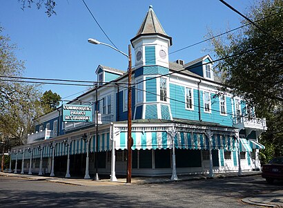
Commander's Palace Address: Washington Avenue street in New Orleans
Commander's Palace is a Louisiana Creole restaurant in New Orleans, Louisiana.Wiki
Attractions near Commander's Palace
Famous New Orleans Restaurant,American Express,Commander s Palace,Garden District, Louisiana,Le Petit Bleu,Lafayette Cemetery No. 1,Garden District,Lafayette Cemetery Number 1,Caroline Mang - Latter & Blum,Prytania St / Washington Ave,Pamela Dennis Flowers,Maisonette,Chicory House,Krewe of Proteus,New Orleans Opera Association,Fay Nelson Fay,Belfort Mansion,St Elizabeths-Anne Rice House,Clean Juice,SwootHow to get to popular attractions in New Orleans with public transit
Professional Construction Services, New Orleans,St Bernard Parish, New Orleans,The Tickle Room, New Orleans,Westwego, Westwego,Empress Hotel, New Orleans,Pat O'Briens, New Orleans,Ursuline Academy, New Orleans,New Orleans Pelicans Team Store, New Orleans,Dropping The Net Ministries, New Orleans,RTA Bus Line 94, New Orleans,Chalmette, Chalmette,Canal Street Ferry Terminal, New Orleans,krewe of bacchus Den, New Orleans,RTA 91 stop ID N8398, New Orleans,Metairie, Metairie,Sazerac Bar, New Orleans,little swamp shack on the bayou AirBnB, New Orleans,NORTA Bus Stop #1603, New Orleans,RTA Bus Line 28, New Orleans,Trumpet Of Truth Ministries, New OrleansGet around New Orleans by public transit!
Traveling around New Orleans has never been so easy. See step by step directions as you travel to any attraction, street or major public transit station. View bus and train schedules, arrival times, service alerts and detailed routes on a map, so you know exactly how to get to anywhere in New Orleans.
When traveling to any destination around New Orleans use Moovit's Live Directions with Get Off Notifications to know exactly where and how far to walk, how long to wait for your line, and how many stops are left. Moovit will alert you when it's time to get off — no need to constantly re-check whether yours is the next stop.
Wondering how to use public transit in New Orleans or how to pay for public transit in New Orleans? Moovit public transit app can help you navigate your way with public transit easily, and at minimum cost. It includes public transit fees, ticket prices, and costs. Looking for a map of New Orleans public transit lines? Moovit public transit app shows all public transit maps in New Orleans with all bus routes and stops on an interactive map.
New Orleans has 1 transit type(s), including: bus, operated by several transit agencies, including New Orleans RTA , New Orleans RTA , New Orleans RTA , JP Transit , Megabus, FlixBus-us and Greyhound-us