How to get to Community Autism Services by bus?
Click on the bus route to see step by step directions with maps, line arrival times and updated time schedules.
From Best Buy, Boston
65 minFrom Franklin Park, Boston
47 minFrom Childrens Museum, Boston
66 minFrom Carson Beach, Boston
67 minFrom Samuel Adams Brewery, Boston
49 minFrom Haymarket, Boston, Boston
57 minFrom South Boston, Boston
61 minFrom Sam Adams Boston Brewery Tour, Boston
49 minFrom Arnold Arboretum, Boston
48 minFrom Andrew Station - MBTA - Red Line, Boston
50 min
How to get to Community Autism Services by train?
Click on the train route to see step by step directions with maps, line arrival times and updated time schedules.
From Best Buy, Boston
96 minFrom Franklin Park, Boston
96 minFrom Childrens Museum, Boston
94 minFrom Carson Beach, Boston
86 minFrom Samuel Adams Brewery, Boston
98 minFrom Haymarket, Boston, Boston
103 minFrom South Boston, Boston
95 minFrom Sam Adams Boston Brewery Tour, Boston
98 minFrom Arnold Arboretum, Boston
83 minFrom Andrew Station - MBTA - Red Line, Boston
103 min
How to get to Community Autism Services by subway?
Click on the subway route to see step by step directions with maps, line arrival times and updated time schedules.
From Best Buy, Boston
59 minFrom Franklin Park, Boston
83 minFrom Childrens Museum, Boston
68 minFrom Carson Beach, Boston
58 minFrom Samuel Adams Brewery, Boston
75 minFrom Haymarket, Boston, Boston
54 minFrom South Boston, Boston
58 minFrom Sam Adams Boston Brewery Tour, Boston
75 minFrom Arnold Arboretum, Boston
83 minFrom Andrew Station - MBTA - Red Line, Boston
48 min
Bus stops near Community Autism Services in Quincy
Subway station near Community Autism Services in Quincy
- Wollaston, 35 min walk,VIEW
What are the closest stations to Community Autism Services?
The closest stations to Community Autism Services are:
- Copeland St @ Cross St is 240 yards away, 3 min walk.
- West St @ Ida St is 629 yards away, 8 min walk.
- Wollaston is 2945 yards away, 35 min walk.
Which bus line stops near Community Autism Services?
215 (Ashmont)
Which train line stops near Community Autism Services?
GREENBUSH (#1061 | Greenbush)
Which subway line stops near Community Autism Services?
RED LINE (Ashmont/Braintree)
What’s the nearest bus station to Community Autism Services in Quincy?
The nearest bus station to Community Autism Services in Quincy is Copeland St @ Cross St. It’s a 3 min walk away.
What time is the first subway to Community Autism Services in Quincy?
The RED LINE is the first subway that goes to Community Autism Services in Quincy. It stops nearby at 5:18 AM.
What time is the last subway to Community Autism Services in Quincy?
The RED LINE is the last subway that goes to Community Autism Services in Quincy. It stops nearby at 1:49 AM.
What time is the first bus to Community Autism Services in Quincy?
The 215 is the first bus that goes to Community Autism Services in Quincy. It stops nearby at 5:11 AM.
What time is the last bus to Community Autism Services in Quincy?
The 215 is the last bus that goes to Community Autism Services in Quincy. It stops nearby at 1:12 AM.
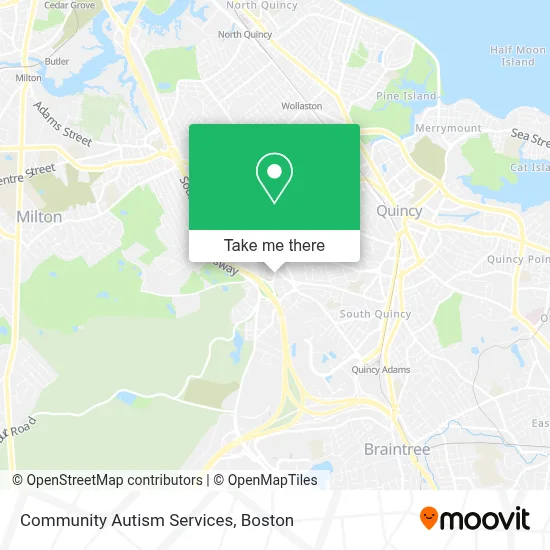
See Community Autism Services, Quincy, on the map
Public Transit to Community Autism Services in Quincy
Wondering how to get to Community Autism Services in Quincy? Moovit helps you find the best way to get to Community Autism Services with step-by-step directions from the nearest public transit station.
Moovit provides free maps and live directions to help you navigate through your city. View schedules, routes, timetables, and find out how long does it take to get to Community Autism Services in real time.
Looking for the nearest stop or station to Community Autism Services? Check out this list of stops closest to your destination: Copeland St @ Cross St; West St @ Ida St; Wollaston.
Bus: 215, 238.Train: GREENBUSH.Subway: RED LINE.
Want to see if there’s another route that gets you there at an earlier time? Moovit helps you find alternative routes or times. Get directions from and directions to Community Autism Services easily from the Moovit App or Website.
We make riding to Community Autism Services easy, which is why over 1.7 million users, including users in Quincy, trust Moovit as the best app for public transit. You don’t need to download an individual bus app or train app, Moovit is your all-in-one transit app that helps you find the best bus time or train time available.
For information on prices of bus, subway and train, costs and ride fares to Community Autism Services, please check the Moovit app.
Use the app to navigate to popular places including to the airport, hospital, stadium, grocery store, mall, coffee shop, school, college, and university.
Community Autism Services Address: 1266 Furnace Brook Pkwy Ste 410 street in Quincy
- Sharpturn Mortgage,
- Peacefield Financial,
- Perruzzi Law Offices,
- Ready Kiernan & McNally,
- Beaton Donna Licsw,
- Stepping Stones Group,
- Stronghand Massage Therapy,
- Foot Specialists of New England,
- D-Target,
- District Court,
- Prime Behavioral Health,
- Laila Maalouf Law Offices,
- Peter Dewire MD,
- Quincy Fire Department Engine 5 West Quincy,
- Trust 1 Services,
- Boston Marine in S,
- ATM,
- One Two Locksmith,
- Charbel Automotive,
- Hall Place Cemetery
Places Near Community Autism Services (Quincy)
- Boston Children's Hospital, Boston,
- Boston Common, Boston,
- Leader Bank Pavilion (Leader Bank Pavillion), Boston,
- Wilbur Theatre, Boston,
- Boston Medical Center, Boston,
- House Of Blues, Boston,
- Wang Theater, Boston,
- Prudential Center, Boston,
- Massachusetts General Hospital, Boston,
- Museum Of Science, Boston,
- Boston Convention & Exhibition Center, Boston,
- Mgm Music Hall, Boston,
- North End, Boston,
- Quincy Market, Boston,
- Isabella Stewart Gardner Museum, Boston,
- Faneuil Hall, Boston,
- Cheers, Boston,
- Seaport District, Boston,
- Td Garden, Boston,
- Castle Island, Boston
How to get to popular places in Boston with public transit
Get around Quincy by public transit!
Traveling around Quincy has never been so easy. See step by step directions as you travel to any attraction, street or major public transit station. View bus and train schedules, arrival times, service alerts and detailed routes on a map, so you know exactly how to get to anywhere in Quincy.
When traveling to any destination around Quincy use Moovit's Live Directions with Get Off Notifications to know exactly where and how far to walk, how long to wait for your line, and how many stops are left. Moovit will alert you when it's time to get off — no need to constantly re-check whether yours is the next stop.
Wondering how to use public transit in Quincy or how to pay for public transit in Quincy? Moovit public transit app can help you navigate your way with public transit easily, and at minimum cost. It includes public transit fees, ticket prices, and costs. Looking for a map of Quincy public transit lines? Moovit public transit app shows all public transit maps in Quincy with all Bus, Train, Subway and Ferry routes and stops on an interactive map.
Boston has 4 transit type(s), including: Bus, Train, Subway and Ferry, operated by several transit agencies, including MBTA, Southeastern Regional Transit Authority, MetroWest Regional Transit Authority, Rhode Island Public Transit Authority, WRTA, Lowell Regional Transit Authority, Merrimack Valley Transit, Montachusett Regional Transit Authority, Cape Cod Regional Transit Authority, Brockton Area Transit Authority, Martha's Vineyard Transit Authority, the WAVE - Nantucket Regional Transit Authority, GATRA, Cape Ann Transportation Authority and Massport