Directions to Congregation Shivtei Yeshuron-Ezras Israel (Philadelphia) with public transportation
The following transit lines have routes that pass near Congregation Shivtei Yeshuron-Ezras Israel
How to get to Congregation Shivtei Yeshuron-Ezras Israel by bus?
Click on the bus route to see step by step directions with maps, line arrival times and updated time schedules.
How to get to Congregation Shivtei Yeshuron-Ezras Israel by train?
Click on the train route to see step by step directions with maps, line arrival times and updated time schedules.
How to get to Congregation Shivtei Yeshuron-Ezras Israel by subway?
Click on the subway route to see step by step directions with maps, line arrival times and updated time schedules.
Bus stations near Congregation Shivtei Yeshuron-Ezras Israel in Philadelphia
- 4th St & Wolf St, 5 min walk,
- 7th St & Tasker St , 13 min walk,
- Tasker St & Columbus Blvd, 15 min walk,
Subway stations near Congregation Shivtei Yeshuron-Ezras Israel in Philadelphia
- Snyder, 20 min walk,
Bus lines to Congregation Shivtei Yeshuron-Ezras Israel in Philadelphia
- 57, Packer Marine Terminal,
- 47, 5th-Godrey,
- 7, 33rd-Dauphin,
- 25, Frankford Transportation Center,
- 29, 33rd-Dickinson,
- 64, 49th-Woodland,
What are the closest stations to Congregation Shivtei Yeshuron-Ezras Israel?
The closest stations to Congregation Shivtei Yeshuron-Ezras Israel are:
- 4th St & Wolf St is 369 yards away, 5 min walk.
- 7th St & Tasker St is 998 yards away, 13 min walk.
- Tasker St & Columbus Blvd is 1213 yards away, 15 min walk.
- Snyder is 1636 yards away, 20 min walk.
Which bus line stops near Congregation Shivtei Yeshuron-Ezras Israel?
57
Which train lines stop near Congregation Shivtei Yeshuron-Ezras Israel?
These train lines stop near Congregation Shivtei Yeshuron-Ezras Israel: EASTBOUND, MEDIA/ELWYN LINE, PAOLI/THORNDALE LINE.
Which subway line stops near Congregation Shivtei Yeshuron-Ezras Israel?
BSL
What’s the nearest subway station to Congregation Shivtei Yeshuron-Ezras Israel in Philadelphia?
The nearest subway station to Congregation Shivtei Yeshuron-Ezras Israel in Philadelphia is Snyder. It’s a 20 min walk away.
What’s the nearest bus stop to Congregation Shivtei Yeshuron-Ezras Israel in Philadelphia?
The nearest bus stop to Congregation Shivtei Yeshuron-Ezras Israel in Philadelphia is 4th St & Wolf St. It’s a 5 min walk away.
See Congregation Shivtei Yeshuron-Ezras Israel, Philadelphia, on the map
Public Transit to Congregation Shivtei Yeshuron-Ezras Israel in Philadelphia
Wondering how to get to Congregation Shivtei Yeshuron-Ezras Israel in Philadelphia, United States? Moovit helps you find the best way to get to Congregation Shivtei Yeshuron-Ezras Israel with step-by-step directions from the nearest public transit station.
Moovit provides free maps and live directions to help you navigate through your city. View schedules, routes, timetables, and find out how long does it take to get to Congregation Shivtei Yeshuron-Ezras Israel in real time.
Looking for the nearest stop or station to Congregation Shivtei Yeshuron-Ezras Israel? Check out this list of stops closest to your destination: 4th St & Wolf St; 7th St & Tasker St ; Tasker St & Columbus Blvd; Snyder.
Bus: 57, 47, 7, 25, 29, 64.Train: EASTBOUND, MEDIA/ELWYN LINE, PAOLI/THORNDALE LINE.Subway: BSL.
Want to see if there’s another route that gets you there at an earlier time? Moovit helps you find alternative routes or times. Get directions from and directions to Congregation Shivtei Yeshuron-Ezras Israel easily from the Moovit App or Website.
We make riding to Congregation Shivtei Yeshuron-Ezras Israel easy, which is why over 1.5 million users, including users in Philadelphia, trust Moovit as the best app for public transit. You don’t need to download an individual bus app or train app, Moovit is your all-in-one transit app that helps you find the best bus time or train time available.
For information on prices of bus, subway and train, costs and ride fares to Congregation Shivtei Yeshuron-Ezras Israel, please check the Moovit app.
Use the app to navigate to popular places including to the airport, hospital, stadium, grocery store, mall, coffee shop, school, college, and university.
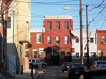
Congregation Shivtei Yeshuron-Ezras Israel Address: 2015 S 4th St Philadelphia, PA 19148 street in Philadelphia
Attractions near Congregation Shivtei Yeshuron-Ezras Israel
E Moyamensing Ave / Mifflin St,307 Mifflin St,5th and Snyder Route 79,Lil Poconos!,Delete Page,Fifth Locksmith & Car Key,Quinn's Flower Shop,416 Little Sigel St,Jo Jo's Deli,S 3rd St / Emily St,Tree St / S 4th St,2135 S 5th St,3rd and Jackson Grocery,Iron Security,308 Tree St,Furness High School,Horace Howard Furness High School,El Primo Car Wash,Beautique Lash & Nails,S 3rd St / Mifflin StHow to get to popular attractions in Philadelphia with public transit
Jalena's Dominican Hair Salon, Linwood,Market-Frankford El Girard Station, Philadelphia,Market Frankford Line Nite Owl Bus, Philadelphia,septa 10 trolley 52nd Lancaster Ave, Philadelphia,1021 S. 4th St, Philadelphia,Broad Street & Packer Avenue, Philadelphia,Valvoline Instant Oil Change, Willow Grove,Thornton Road and Comly Road, Philadelphia,Krewstown Shopping Center, Philadelphia,NJ Transit Train 3848 To NY, Princeton Junction,Philadelphia's Magic Gardens, Philadelphia,Cambria County Prison North Philly, Philadelphia,Robbinsville,FedEx Cargo City, Tinicum,River Line Camden To Trenton, Bordentown,39th & Powelton, Philadelphia,Ghost Bus Parking Lot, Philadelphia,Septa elmwood depot, Philadelphia,SEPTA 17 At 19th And JFK, Philadelphia,SEPTA EL to 69th street terminal, PhiladelphiaGet around Philadelphia by public transit!
Traveling around Philadelphia has never been so easy. See step by step directions as you travel to any attraction, street or major public transit station. View bus and train schedules, arrival times, service alerts and detailed routes on a map, so you know exactly how to get to anywhere in Philadelphia.
When traveling to any destination around Philadelphia use Moovit's Live Directions with Get Off Notifications to know exactly where and how far to walk, how long to wait for your line, and how many stops are left. Moovit will alert you when it's time to get off — no need to constantly re-check whether yours is the next stop.
Wondering how to use public transit in Philadelphia or how to pay for public transit in Philadelphia? Moovit public transit app can help you navigate your way with public transit easily, and at minimum cost. It includes public transit fees, ticket prices, and costs. Looking for a map of Philadelphia public transit lines? Moovit public transit app shows all public transit maps in Philadelphia with all Bus, Train, Subway, Light Rail and Cable Car routes and stops on an interactive map.
Philadelphia has 5 transit type(s), including: Bus, Train, Subway, Light Rail and Cable Car, operated by several transit agencies, including SEPTA Subway, SEPTA Trolley, SEPTA Rail, SEPTA, NJ TRANSIT RAIL-Rail, NJ TRANSIT RAIL-Tram, NJ TRANSIT BUS, Port Authority Transit Corporation, Navy Yard, Penn Transit, Drexel University, Pottstown Area Rapid Transit (PART), Fullington Tours, Chescobus, Amtrak