Directions to Conservation Commission (Boston) with public transportation
The following transit lines have routes that pass near Conservation Commission
 Bus: 10X.
How to get to Conservation Commission by bus?
Click on the bus route to see step by step directions with maps, line arrival times and updated time schedules.
Bus stop near Conservation Commission in Boston
- Foster (Foster Center Baptist Church), 3 min walk,VIEW
Bus lines to Conservation Commission in Boston
- 10X, Providence,VIEW
What are the closest stations to Conservation Commission?
The closest stations to Conservation Commission are:
- Foster (Foster Center Baptist Church) is 179 yards away, 3 min walk.
Which bus line stops near Conservation Commission?
10X (Foster)
What’s the nearest bus station to Conservation Commission in Boston?
The nearest bus station to Conservation Commission in Boston is Foster (Foster Center Baptist Church). It’s a 3 min walk away.
What time is the first bus to Conservation Commission in Boston?
The 10X is the first bus that goes to Conservation Commission in Boston. It stops nearby at 7:00 AM.
What time is the last bus to Conservation Commission in Boston?
The 10X is the last bus that goes to Conservation Commission in Boston. It stops nearby at 5:59 PM.
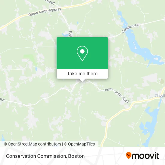
See Conservation Commission, Boston, on the map
Public Transit to Conservation Commission in Boston
Wondering how to get to Conservation Commission in Boston? Moovit helps you find the best way to get to Conservation Commission with step-by-step directions from the nearest public transit station.
Moovit provides free maps and live directions to help you navigate through your city. View schedules, routes, timetables, and find out how long does it take to get to Conservation Commission in real time.
Looking for the nearest stop or station to Conservation Commission? Check out this list of stops closest to your destination: Foster (Foster Center Baptist Church).
Bus: 10X.
Want to see if there’s another route that gets you there at an earlier time? Moovit helps you find alternative routes or times. Get directions from and directions to Conservation Commission easily from the Moovit App or Website.
We make riding to Conservation Commission easy, which is why over 1.7 million users, including users in Boston, trust Moovit as the best app for public transit. You don’t need to download an individual bus app or train app, Moovit is your all-in-one transit app that helps you find the best bus time or train time available.
For information on prices of bus and train, costs and ride fares to Conservation Commission, please check the Moovit app.
Use the app to navigate to popular places including to the airport, hospital, stadium, grocery store, mall, coffee shop, school, college, and university.
Conservation Commission Address: 181 Howard Hill Rd Foster, RI 02825 street in Boston
- Ccap Foster Outreach Office,
- Foster Town Hall,
- A D T Security Services,
- Hopkins Mill Historic District,
- Foster Town Hall,
- J Ace Painting,
- Sandy Brook Cemetery,
- Phillips Memorial Cemetery,
- Grade 8 Motorsports,
- Xtra Mart,
- Detailed Image Auto Detailing,
- Rambone and Sprague Oil SVC.,
- Xen's Critters,
- Frank Tree Services and Landscaping,
- Rhode Island Alpaca Farm,
- Fraser Communications Group,
- Rinsepure Technologies,
- Shaklee Distributors,
- Scituate Power Equipment,
- Rockwell Amusements
Places Near Conservation Commission (Boston)
- Isabella Stewart Gardner Museum, Boston,
- Mgm Music Hall, Boston,
- Wilbur Theatre, Boston,
- Boston Medical Center, Boston,
- Quincy Market, Boston,
- Leader Bank Pavilion (Leader Bank Pavillion), Boston,
- Cheers, Boston,
- Castle Island, Boston,
- House Of Blues, Boston,
- Wang Theater, Boston,
- Boston Children's Hospital, Boston,
- Seaport District, Boston,
- Faneuil Hall, Boston,
- Boston Convention & Exhibition Center, Boston,
- Massachusetts General Hospital, Boston,
- Prudential Center, Boston,
- North End, Boston,
- Td Garden, Boston,
- Museum Of Science, Boston,
- Boston Common, Boston
How to get to popular places in Boston with public transit
Get around Boston by public transit!
Traveling around Boston has never been so easy. See step by step directions as you travel to any attraction, street or major public transit station. View bus and train schedules, arrival times, service alerts and detailed routes on a map, so you know exactly how to get to anywhere in Boston.
When traveling to any destination around Boston use Moovit's Live Directions with Get Off Notifications to know exactly where and how far to walk, how long to wait for your line, and how many stops are left. Moovit will alert you when it's time to get off — no need to constantly re-check whether yours is the next stop.
Wondering how to use public transit in Boston or how to pay for public transit in Boston? Moovit public transit app can help you navigate your way with public transit easily, and at minimum cost. It includes public transit fees, ticket prices, and costs. Looking for a map of Boston public transit lines? Moovit public transit app shows all public transit maps in Boston with all Bus, Train, Subway and Ferry routes and stops on an interactive map.
Boston has 4 transit type(s), including: Bus, Train, Subway and Ferry, operated by several transit agencies, including MBTA, Southeastern Regional Transit Authority, MetroWest Regional Transit Authority, Rhode Island Public Transit Authority, WRTA, Lowell Regional Transit Authority, Merrimack Valley Transit, Montachusett Regional Transit Authority, Cape Cod Regional Transit Authority, Brockton Area Transit Authority, Martha's Vineyard Transit Authority, the WAVE - Nantucket Regional Transit Authority, GATRA, Cape Ann Transportation Authority and Massport