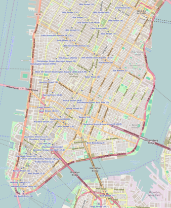
See Corbin Building, Manhattan, on the map
Directions to Corbin Building (Manhattan) with public transportation
The following transit lines have routes that pass near Corbin Building
 Bus:
Bus: - Train:
- Subway:
How to get to Corbin Building by bus?
Click on the bus route to see step by step directions with maps, line arrival times and updated time schedules.
How to get to Corbin Building by train?
Click on the train route to see step by step directions with maps, line arrival times and updated time schedules.
How to get to Corbin Building by subway?
Click on the subway route to see step by step directions with maps, line arrival times and updated time schedules.
Bus stations near Corbin Building in Manhattan
- Broadway/Cortlandt St,2 min walk,
Bus lines to Corbin Building in Manhattan
- BXM18,Downtown Wall St Via 5 Av Via Broadway,
- SIM4,Annadale Via Richmond Av,
- SIM4C,Huguenot Via Richmond Av Via Arthur Kill,
- SIM4X,Park and Ride Si Mall,
- M55,South Ferry,
What are the closest stations to Corbin Building?
The closest stations to Corbin Building are:
- Broadway/Cortlandt St is 103 yards away, 2 min walk.
Which bus lines stop near Corbin Building?
These bus lines stop near Corbin Building: BM3, BXM18, QM11.
Which train line stops near Corbin Building?
PATH
Which subway lines stop near Corbin Building?
These subway lines stop near Corbin Building: 3, 5, C, E.
What’s the nearest bus stop to Corbin Building in Manhattan?
The nearest bus stop to Corbin Building in Manhattan is Broadway/Cortlandt St. It’s a 2 min walk away.
See Corbin Building, Manhattan, on the map
Public Transit to Corbin Building in Manhattan
Wondering how to get to Corbin Building in Manhattan, United States? Moovit helps you find the best way to get to Corbin Building with step-by-step directions from the nearest public transit station.
Moovit provides free maps and live directions to help you navigate through your city. View schedules, routes, timetables, and find out how long does it take to get to Corbin Building in real time.
Looking for the nearest stop or station to Corbin Building? Check out this list of stops closest to your destination: Broadway/Cortlandt St.
Bus:Train:Subway:
Want to see if there’s another route that gets you there at an earlier time? Moovit helps you find alternative routes or times. Get directions from and directions to Corbin Building easily from the Moovit App or Website.
We make riding to Corbin Building easy, which is why over 1.5 million users, including users in Manhattan, trust Moovit as the best app for public transit. You don’t need to download an individual bus app or train app, Moovit is your all-in-one transit app that helps you find the best bus time or train time available.
For information on prices of subway, train and bus, costs and ride fares to Corbin Building, please check the Moovit app.
Use the app to navigate to popular places including to the airport, hospital, stadium, grocery store, mall, coffee shop, school, college, and university.
Corbin Building Address: 13 John St street in Manhattan
Attractions near Corbin Building
Nys Collection Eyewear,Underground Potato,Great American Bagel,Cracked.Pro,Gong Cha,Island of Treats,Dapper Doughnut,MRS. Bloom's @ Fulton Center,Wework,Womens March Alliance,Motto,Abels Coffee Service,Levy Group Cpas,Free Great Tours - NYC Day Tours,Pretty Sweeties,Irving Farm's Fulton Center,Zaro's Family Bakery,Neuhaus Belgian Chocolate,Moleskine,The Dating AcademyHow to get to popular attractions in Manhattan with public transit
SoHo, Manhattan,Stout, Manhattan,Central Park SummerStage, Manhattan,J.G. Melon, Manhattan,Jackson Heights, NY, Queens,Newark Liberty International Airport (EWR), Newark, Nj,Burger Joint, Manhattan,MTA Subway - 42nd St / Bryant Park (B / D/F / M/7), Manhattan,New Jersey, Nutley, Nj,Hair of the Dog, Manhattan,Atlantic City, NJ, Atlantic City, Nj,I-80 (Interstate 80), Paterson, Nj,Hill Country Chicken, Manhattan,The Kunjip, Manhattan,MTA Subway - Fulton St (A / C/J / Z/2 / 3/4 / 5), Manhattan,The Grey Dog, Manhattan,NJT - New Brunswick Station (NEC), New Brunswick, Nj,MTA Subway - Broadway (N/W), Queens,LIRR - Babylon Station, Babylon, Ny,5 Napkin Burger, ManhattanGet around Manhattan by public transit!
Traveling around Manhattan has never been so easy. See step by step directions as you travel to any attraction, street or major public transit station. View bus and train schedules, arrival times, service alerts and detailed routes on a map, so you know exactly how to get to anywhere in Manhattan.
When traveling to any destination around Manhattan use Moovit's Live Directions with Get Off Notifications to know exactly where and how far to walk, how long to wait for your line, and how many stops are left. Moovit will alert you when it's time to get off — no need to constantly re-check whether yours is the next stop.
Wondering how to use public transit in Manhattan or how to pay for public transit in Manhattan? Moovit public transit app can help you navigate your way with public transit easily, and at minimum cost. It includes public transit fees, ticket prices, and costs. Looking for a map of Manhattan public transit lines? Moovit public transit app shows all public transit maps in Manhattan with all subway, train or bus routes and stops on an interactive map.
Manhattan has 3 transit type(s), including: subway, train or bus, operated by several transit agencies, including MTA Subway, Metro-North Railroad, LIRR, PATH, Shore Line East, MTA Bus Company, MTA New York City Transit - Express routes, MTA Bus, NJ Transit, NYC Ferry, NICE bus, Bee-Line Bus, NJ Transit Rail, NJ Transit Rail and Norwalk Transit District