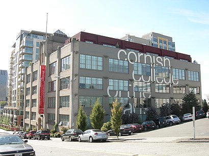
See Cornish College Of The Arts, Seattle, on the map
Directions to Cornish College Of The Arts (Seattle) with public transportation
The following transit lines have routes that pass near Cornish College Of The Arts
 Bus:
Bus:
How to get to Cornish College Of The Arts by bus?
Click on the bus route to see step by step directions with maps, line arrival times and updated time schedules.
Bus stations near Cornish College Of The Arts in Seattle
- Denny Way & Fairview Ave,2 min walk,
- Fairview Ave & Denny Way,3 min walk,
Bus lines to Cornish College Of The Arts in Seattle
- 8,Mount Baker Transit Center,
- 70,U-District Station Eastlake,
What are the closest stations to Cornish College Of The Arts?
The closest stations to Cornish College Of The Arts are:
- Denny Way & Fairview Ave is 129 yards away, 2 min walk.
- Fairview Ave & Denny Way is 211 yards away, 3 min walk.
Which bus lines stop near Cornish College Of The Arts?
These bus lines stop near Cornish College Of The Arts: 40, 545, 70, 8.
What’s the nearest bus stop to Cornish College Of The Arts in Seattle?
The nearest bus stop to Cornish College Of The Arts in Seattle is Denny Way & Fairview Ave. It’s a 2 min walk away.
See Cornish College Of The Arts, Seattle, on the map
Public Transit to Cornish College Of The Arts in Seattle
Wondering how to get to Cornish College Of The Arts in Seattle, United States? Moovit helps you find the best way to get to Cornish College Of The Arts with step-by-step directions from the nearest public transit station.
Moovit provides free maps and live directions to help you navigate through your city. View schedules, routes, timetables, and find out how long does it take to get to Cornish College Of The Arts in real time.
Looking for the nearest stop or station to Cornish College Of The Arts? Check out this list of stops closest to your destination: Denny Way & Fairview Ave; Fairview Ave & Denny Way.
Bus:
Want to see if there’s another route that gets you there at an earlier time? Moovit helps you find alternative routes or times. Get directions from and directions to Cornish College Of The Arts easily from the Moovit App or Website.
We make riding to Cornish College Of The Arts easy, which is why over 1.5 million users, including users in Seattle, trust Moovit as the best app for public transit. You don’t need to download an individual bus app or train app, Moovit is your all-in-one transit app that helps you find the best bus time or train time available.
For information on prices of bus, costs and ride fares to Cornish College Of The Arts, please check the Moovit app.
Use the app to navigate to popular places including to the airport, hospital, stadium, grocery store, mall, coffee shop, school, college, and university.
Location: Seattle, Seattle - Tacoma, WA
Attractions near Cornish College Of The Arts
Cornish Cafe,Norton Building,Cornish College Library,Cornish Commons,Graham Terry Apartments,Fedex Office,Arte Tower,Carbon56,Cornish College of the Arts,Nw Pain Relief Center,F. K. Kirsten,Seattle Times,Vera Whole Health,Lake Union Vision Clinic,Social Security Office,Raisbeck Performance Hall,Starbucks,2121,Centennial Lab,Westlake CleanersHow to get to popular attractions in Seattle with public transit
City of University Place, University Place,Everett, WA, Everett,Tacoma Dome - Transit Center, Tacoma,Regal Cinemas Lakewood 15 & RPX, Lakewood,Salty's on Alki, Seattle,Alaska Airlines, System Operations Control (SOC), Seatac,Safeway, South Hill,City of Olympia, Olympia,Sea Airport, Seatac,Walmart Supercenter, Lakewood,Walmart Supercenter, Puyallup,Woodland Park Zoo, Seattle,The Outlet Collection - Seattle, Auburn,Hotel Murano, Tacoma,QFC, Seattle,Costco Wholesale, Everett,Tacoma Community College, Tacoma,Uw Medical Center, Seattle,Ringers Pub & Grill, Mountlake Terrace,Woodinville Park and Ride, WoodinvilleGet around Seattle by public transit!
Traveling around Seattle has never been so easy. See step by step directions as you travel to any attraction, street or major public transit station. View bus and train schedules, arrival times, service alerts and detailed routes on a map, so you know exactly how to get to anywhere in Seattle.
When traveling to any destination around Seattle use Moovit's Live Directions with Get Off Notifications to know exactly where and how far to walk, how long to wait for your line, and how many stops are left. Moovit will alert you when it's time to get off — no need to constantly re-check whether yours is the next stop.
Wondering how to use public transit in Seattle or how to pay for public transit in Seattle? Moovit public transit app can help you navigate your way with public transit easily, and at minimum cost. It includes public transit fees, ticket prices, and costs. Looking for a map of Seattle public transit lines? Moovit public transit app shows all public transit maps in Seattle with all bus routes and stops on an interactive map.
Seattle has 1 transit type(s), including: bus, operated by several transit agencies, including Sound Transit, Seattle Streetcar, Sound Transit, Metro Transit, Metro Transit, Sound Transit, Whatcom Transportation Authority, Mason Transit Authority, Snoqualmie Valley Transportation (SVT), Snoqualmie Valley Transportation, Amtrak, Island Transit, Kitsap Transit, Intercity Transit and Everett Transit