Directions to Cortez, Florida with public transportation
The following transit lines have routes that pass near Cortez, Florida
How to get to Cortez, Florida by bus?
Click on the bus route to see step by step directions with maps, line arrival times and updated time schedules.
Bus stations near Cortez, Florida
- Gulf Dr N/9th St N, 2 min walk,
- Cortez Rd W/127th St W, 5 min walk,
- Bridge Street Water Taxi, 15 min walk,
Bus lines to Cortez, Florida
- 5, Pine Ave/N Bay Blvd (Ami Pier),
- 6, Coquina Beach,
- 33, Pine Ave/N Bay Blvd (Ami Pier),
What are the closest stations to Cortez, Florida?
The closest stations to Cortez, Florida are:
- Gulf Dr N/9th St N is 102 yards away, 2 min walk.
- Cortez Rd W/127th St W is 359 yards away, 5 min walk.
- Bridge Street Water Taxi is 991 yards away, 15 min walk.
Which bus line stops near Cortez, Florida?
6
What’s the nearest bus stop to Cortez, Florida?
The nearest bus stop to Cortez, Florida is Gulf Dr N/9th St N. It’s a 2 min walk away.
What time is the first bus to Cortez, Florida?
The 6 is the first bus that goes to Cortez, Florida. It stops nearby at 5:56 AM.
What time is the last bus to Cortez, Florida?
The 5 is the last bus that goes to Cortez, Florida. It stops nearby at 10:21 PM.
How much is the bus fare to Cortez, Florida?
The bus fare to Cortez, Florida costs about $1.50.
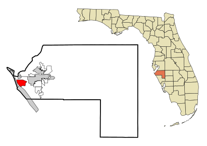
See Cortez, Florida on the map
Public Transportation to Cortez, Florida
Wondering how to get to Cortez, Florida, United States? Moovit helps you find the best way to get to Cortez, Florida with step-by-step directions from the nearest public transit station.
Moovit provides free maps and live directions to help you navigate through your city. View schedules, routes, timetables, and find out how long does it take to get to Cortez, Florida in real time.
Looking for the nearest stop or station to Cortez, Florida? Check out this list of stops closest to your destination: Gulf Dr N/9th St N; Cortez Rd W/127th St W; Bridge Street Water Taxi.
Bus: 6, 5, 33.
Want to see if there’s another route that gets you there at an earlier time? Moovit helps you find alternative routes or times. Get directions from and directions to Cortez, Florida easily from the Moovit App or Website.
We make riding to Cortez, Florida easy, which is why over 1.5 million users, including users in Cortez, trust Moovit as the best app for public transit. You don’t need to download an individual bus app or train app, Moovit is your all-in-one transit app that helps you find the best bus time or train time available.
For information on prices of bus, costs and ride fares to Cortez, Florida, please check the Moovit app.
Get to Cortez, Florida with public transit and pay for the ride in the Moovit app. In addition to all info you may need for your trip to Cortez, Florida, including live directions, real-time arrivals and fare prices, you can also buy public transit passes for your rides. No need for cash or paper tickets to get to Cortez, Florida - everything you need is accessible in the app with a click of the button.
Use the app to navigate to popular places including to the airport, hospital, stadium, grocery store, mall, coffee shop, school, college, and university.
Cortez, Florida Address: Manatee, FL street in Cortez
Attractions near Cortez, Florida
Island Pearl Excursions,Cortez Watersports (Cortez Water Sports),Cortez Park,Cortez Fishing Center,Hunters Point Fl,Home Care Group,125th St W,125th St W & Avenue D,USCG Sta. Cortez,Gulfside Ultralight Tours,Ap Bell Fish,Cortez Post Office,Post Office-Cortez,Runaway Bay Vacations,Star Fish Company (Star Fish Co Seafood Market and Restaurant),Sally's Salon,Bradenton Beach Marina,Island Pearl Excursions,One Love Grill,Cortez Church of ChristHow to get to popular attractions in Cortez with public transit
Siesta Beach, Siesta Key,Pine Park, North Port,Bradenton Quick Mart, South Bradenton,Pier 22 Restaurant, Patio, Ballroom & Catering, Bradenton,The Hood, Sarasota,75 Soyth,I75 Exit 207, Bee Ridge,Sea Palm Cottages on Siesta Key, Siesta Key,Sarasota Opera Administration, Sarasota,The Book Nook, Sarasota Springs,Publix Liquors at Centergate Village, Bee Ridge,Us 41 & Ortiz, Warm Mineral Springs,LA Fitness, Vamo,Ringling College of Art and Design Family Housing, Sarasota,Sarasota Zombie Pubcrawl, Gulf Gate Estates,Bradenton, FL, Bradenton,Tom And jerry's Too Auto Body, Sarasota,One-Eyed Jacks Poker Room, Sarasota,Island Walk At The West Village, North Port,North Siesta Key Bridge, SarasotaGet around Sarasota by public transit!
Traveling around Sarasota has never been so easy. See step by step directions as you travel to any attraction, street or major public transit station. View bus and train schedules, arrival times, service alerts and detailed routes on a map, so you know exactly how to get to anywhere in Sarasota.
When traveling to any destination around Sarasota use Moovit's Live Directions with Get Off Notifications to know exactly where and how far to walk, how long to wait for your line, and how many stops are left. Moovit will alert you when it's time to get off — no need to constantly re-check whether yours is the next stop.
Wondering how to use public transit in Sarasota or how to pay for public transit in Sarasota? Moovit public transit app can help you navigate your way with public transit easily, and at minimum cost. It includes public transit fees, ticket prices, and costs. Looking for a map of Sarasota public transit lines? Moovit public transit app shows all public transit maps in Sarasota with all bus routes and stops on an interactive map.
Sarasota has 1 transit type(s), including: bus, operated by several transit agencies, including Sarasota County Area Transit, Manatee County Area Transit, Greyhound-us, Amtrak Chartered Vehicle, FlixBus-us