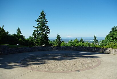
See Council Crest Park, Portland, on the map
Directions to Council Crest Park (Portland) with public transportation
The following transit lines have routes that pass near Council Crest Park
 Bus:
Bus: - Light Rail:
- Gondola:
How to get to Council Crest Park by bus?
Click on the bus route to see step by step directions with maps, line arrival times and updated time schedules.
Light Rail stations near Council Crest Park in Portland
- PSU South/SW 5th & Jackson,3 min walk,
- Washington Park,46 min walk,
Bus stations near Council Crest Park in Portland
- SW Talbot & Talbot Terrace (South),7 min walk,
Gondola stations near Council Crest Park in Portland
- Marquam Hill Upper Tram Terminal (East),21 min walk,
Bus lines to Council Crest Park in Portland
- 51,SW Columbia & 18th (East),
What are the closest stations to Council Crest Park?
The closest stations to Council Crest Park are:
- PSU South/SW 5th & Jackson is 197 yards away, 3 min walk.
- SW Talbot & Talbot Terrace (South) is 565 yards away, 7 min walk.
- Marquam Hill Upper Tram Terminal (East) is 1584 yards away, 21 min walk.
- Washington Park is 3883 yards away, 46 min walk.
Which bus lines stop near Council Crest Park?
These bus lines stop near Council Crest Park: 19, 54, 8.
Which light rail lines stop near Council Crest Park?
These light rail lines stop near Council Crest Park: BLUE, RED.
What’s the nearest light rail station to Council Crest Park in Portland?
The nearest light rail station to Council Crest Park in Portland is PSU South/SW 5th & Jackson. It’s a 3 min walk away.
What’s the nearest bus stop to Council Crest Park in Portland?
The nearest bus stop to Council Crest Park in Portland is SW Talbot & Talbot Terrace (South). It’s a 7 min walk away.
What’s the nearest gondola station to Council Crest Park in Portland?
The nearest gondola station to Council Crest Park in Portland is Marquam Hill Upper Tram Terminal (East). It’s a 21 min walk away.
What time is the first light rail to Council Crest Park in Portland?
The RED is the first light rail that goes to Council Crest Park in Portland. It stops nearby at 3:47 AM.
What time is the last light rail to Council Crest Park in Portland?
The BLUE is the last light rail that goes to Council Crest Park in Portland. It stops nearby at 1:38 AM.
What time is the first bus to Council Crest Park in Portland?
The 51 is the first bus that goes to Council Crest Park in Portland. It stops nearby at 6:12 AM.
What time is the last bus to Council Crest Park in Portland?
The 51 is the last bus that goes to Council Crest Park in Portland. It stops nearby at 6:29 PM.
What time is the first gondola to Council Crest Park in Portland?
The PORTLAND AERIAL TRAM is the first gondola that goes to Council Crest Park in Portland. It stops nearby at 5:30 AM.
What time is the last gondola to Council Crest Park in Portland?
The PORTLAND AERIAL TRAM is the last gondola that goes to Council Crest Park in Portland. It stops nearby at 9:29 PM.
See Council Crest Park, Portland, on the map
Public Transit to Council Crest Park in Portland
Wondering how to get to Council Crest Park in Portland, United States? Moovit helps you find the best way to get to Council Crest Park with step-by-step directions from the nearest public transit station.
Moovit provides free maps and live directions to help you navigate through your city. View schedules, routes, timetables, and find out how long does it take to get to Council Crest Park in real time.
Looking for the nearest stop or station to Council Crest Park? Check out this list of stops closest to your destination: PSU South/SW 5th & Jackson; SW Talbot & Talbot Terrace (South); Marquam Hill Upper Tram Terminal (East); Washington Park.
Bus:Light Rail:Gondola:
Want to see if there’s another route that gets you there at an earlier time? Moovit helps you find alternative routes or times. Get directions from and directions to Council Crest Park easily from the Moovit App or Website.
We make riding to Council Crest Park easy, which is why over 1.5 million users, including users in Portland, trust Moovit as the best app for public transit. You don’t need to download an individual bus app or train app, Moovit is your all-in-one transit app that helps you find the best bus time or train time available.
For information on prices of bus and light rail, costs and ride fares to Council Crest Park, please check the Moovit app.
Use the app to navigate to popular places including to the airport, hospital, stadium, grocery store, mall, coffee shop, school, college, and university.
Council Crest Park Address: Council Crest Park street in Portland
Attractions near Council Crest Park
Council Crest,Council Crest Capital,3640 SW Dosch Rd,Fairmount Boulevard Loop,Leashalong Headquarters,Portland Banner Bags,Kenneth Asburry Sr. Memorial Tree Farm,Opal Blooms,Oregon Liquor Store,Demoude die Casting,Lorraine Guthrie Architect,Southwest Hills, Oregon,Eigenenergy,Residences at Butler Creek Apartments,Wrecker Services,Soma Agency,Montmore Homeowners Assoc,Documax Enterprises,The Sunny June Farm,Montgomery Klash Interior DesignHow to get to popular attractions in Portland with public transit
Pok Pok Noi, Portland,Kohl's Portland Gateway, Portland,Oregon, Milwaukie,Walmart Supercenter, Portland,Nike - Michael Jordan Building,Fred Meyer Gas Station - Cornelius, Cornelius,Café Yumm!, Beaverton,Nike - Dan Fouts Building,Fred Meyer, Raleigh Hills,Sunset Highway US 26W, Portland,Tienda La Tapatia, Gresham,The Alibi Restaurant & Lounge, Portland,5 Corners, Five Corners,Asian Food Center 百佳超市, Beaverton,TriMet SE Powell Blvd MAX Station, Portland,Cedar Mill, Beaverton,TriMet SE Holgate Blvd MAX Station, Portland,Downtown Lake Oswego, Lake Oswego,Johns Landing Water Tower, Portland,Clackamas County Jail, Oregon CityGet around Portland by public transit!
Traveling around Portland has never been so easy. See step by step directions as you travel to any attraction, street or major public transit station. View bus and train schedules, arrival times, service alerts and detailed routes on a map, so you know exactly how to get to anywhere in Portland.
When traveling to any destination around Portland use Moovit's Live Directions with Get Off Notifications to know exactly where and how far to walk, how long to wait for your line, and how many stops are left. Moovit will alert you when it's time to get off — no need to constantly re-check whether yours is the next stop.
Wondering how to use public transit in Portland or how to pay for public transit in Portland? Moovit public transit app can help you navigate your way with public transit easily, and at minimum cost. It includes public transit fees, ticket prices, and costs. Looking for a map of Portland public transit lines? Moovit public transit app shows all public transit maps in Portland with all bus or light rail routes and stops on an interactive map.
Portland has 2 transit type(s), including: bus or light rail, operated by several transit agencies, including Mount Adams Transportation Service, RiverCities Transit, TriMet , TriMet , TriMet, Portland Streetcar, Portland Aerial Tram, C-TRAN, Multnomah County Job Connector Shuttles, Washington Park Shuttle, SMART, Canby Area Transit, South Clackamas Transportation District, The Wave and Lincoln County Transit