Directions to Creation (Queens) with public transportation
The following transit lines have routes that pass near Creation
 Bus: Q111, Q114, Q51, Q115, Q113.
- Train: BABYLON BRANCH, LONG BEACH BRANCH, FAR ROCKAWAY BRANCH, WEST HEMPSTEAD BRANCH, HEMPSTEAD BRANCH.
- Subway: E, J, Z.
How to get to Creation by bus?
Click on the bus route to see step by step directions with maps, line arrival times and updated time schedules.
From Bullpen Entrance Citi Field, Queens
60 minFrom 30-56 Whitestone Expwy, Queens
63 minFrom Elmhurst, NY, Queens
61 minFrom Ridgewood, Queens
66 minFrom Mall del Sol Guayaquil,Ecuador, Queens
70 minFrom Resorts World Shuttle Bus, Queens
62 minFrom Nostrand Ave, Brooklyn, Queens
69 minFrom Northwell - Long Island Jewish Medical Center, Queens
67 minFrom Ridgewood, NY, Queens
70 minFrom Plattduetsche Park, Franklin Square
58 min
How to get to Creation by train?
Click on the train route to see step by step directions with maps, line arrival times and updated time schedules.
How to get to Creation by subway?
Click on the subway route to see step by step directions with maps, line arrival times and updated time schedules.
From Bullpen Entrance Citi Field, Queens
71 minFrom 30-56 Whitestone Expwy, Queens
94 minFrom Elmhurst, NY, Queens
61 minFrom Ridgewood, Queens
88 minFrom Mall del Sol Guayaquil,Ecuador, Queens
67 minFrom Resorts World Shuttle Bus, Queens
59 minFrom Nostrand Ave, Brooklyn, Queens
102 minFrom Ridgewood, NY, Queens
79 min
Bus stops near Creation in Queens
- Guy R Brewer Blvd/116 Av, 1 min walk,VIEW
- Guy R Brewer Blvd/Linden Blvd, 3 min walk,VIEW
- Linden Blvd/Guy R Brewer Bl, 4 min walk,VIEW
- Linden Blvd/Guy R Brewer Blvd, 4 min walk,VIEW
- Guy R Brewer Blvd/Foch Blvd, 5 min walk,VIEW
- Merrick Blvd/Linden Blvd, 12 min walk,VIEW
- Linden Bl / Merrick, 12 min walk,VIEW
Train stations near Creation in Queens
Subway station near Creation in Queens
- Jamaica Center-Parsons/Archer, 25 min walk,VIEW
Bus lines to Creation in Queens
- Q115, Springfield Gardens Via Brewer Bl,VIEW
- Q111, Rush Cedarhurst Peninsula Bl Via Brewer Bl Via 147 Av,VIEW
- Q113, Limited Jamaica Parsons-Hillside Via Nassau Exy Via Brewer Bl,VIEW
- Q114, Rush Far Rockaway Seagirt Bl Via Brewer Bl,VIEW
- QM63, Rosedale,VIEW
- Q51, Limited Cambria Heights,VIEW
- QM21, Midtown 57 St Via Madison Av,VIEW
- QM65, Laurelton,VIEW
- Q5, Green Acres Via Merrick Bl,VIEW
- Q84, Rush Laurelton 238 St,VIEW
- Q85, Rush Rosedale 147 Av,VIEW
- Q86, Rush Rosedale 149 Av Via Merrick Bl,VIEW
- Q87, Rush Green Acres Via Merrick Bl,VIEW
- Q89, Rush Green Acres Via Rochdale,VIEW
- N4, Freeport,VIEW
What are the closest stations to Creation?
The closest stations to Creation are:
- Guy R Brewer Blvd/116 Av is 52 yards away, 1 min walk.
- Guy R Brewer Blvd/Linden Blvd is 233 yards away, 3 min walk.
- Linden Blvd/Guy R Brewer Bl is 257 yards away, 4 min walk.
- Linden Blvd/Guy R Brewer Blvd is 261 yards away, 4 min walk.
- Guy R Brewer Blvd/Foch Blvd is 354 yards away, 5 min walk.
- Merrick Blvd/Linden Blvd is 955 yards away, 12 min walk.
- Linden Bl / Merrick is 963 yards away, 12 min walk.
- Locust Manor is 1526 yards away, 19 min walk.
- Jamaica Center-Parsons/Archer is 2073 yards away, 25 min walk.
- St.Albans is 2283 yards away, 28 min walk.
- Hillside Facility is 3062 yards away, 37 min walk.
Which bus lines stop near Creation?
These bus lines stop near Creation: Q111, Q114, Q51.
Which train lines stop near Creation?
These train lines stop near Creation: BABYLON BRANCH, LONG BEACH BRANCH.
Which subway lines stop near Creation?
These subway lines stop near Creation: E, J.
What’s the nearest subway station to Creation in Queens?
The nearest subway station to Creation in Queens is Jamaica Center-Parsons/Archer. It’s a 25 min walk away.
What’s the nearest train station to Creation in Queens?
The nearest train station to Creation in Queens is Locust Manor. It’s a 19 min walk away.
What’s the nearest bus station to Creation in Queens?
The nearest bus station to Creation in Queens is Guy R Brewer Blvd/116 Av. It’s a 1 min walk away.
What time is the first subway to Creation in Queens?
The E is the first subway that goes to Creation in Queens. It stops nearby at 3:06 AM.
What time is the last subway to Creation in Queens?
The J is the last subway that goes to Creation in Queens. It stops nearby at 3:49 AM.
What time is the first train to Creation in Queens?
The FAR ROCKAWAY BRANCH is the first train that goes to Creation in Queens. It stops nearby at 3:30 AM.
What time is the last train to Creation in Queens?
The FAR ROCKAWAY BRANCH is the last train that goes to Creation in Queens. It stops nearby at 2:50 AM.
What time is the first bus to Creation in Queens?
The Q5 is the first bus that goes to Creation in Queens. It stops nearby at 3:04 AM.
What time is the last bus to Creation in Queens?
The Q114 is the last bus that goes to Creation in Queens. It stops nearby at 3:06 AM.
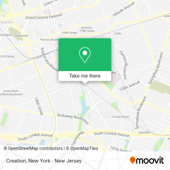
See Creation, Queens, on the map
Public Transit to Creation in Queens
Wondering how to get to Creation in Queens? Moovit helps you find the best way to get to Creation with step-by-step directions from the nearest public transit station.
Moovit provides free maps and live directions to help you navigate through your city. View schedules, routes, timetables, and find out how long does it take to get to Creation in real time.
Looking for the nearest stop or station to Creation? Check out this list of stops closest to your destination: Guy R Brewer Blvd/116 Av; Guy R Brewer Blvd/Linden Blvd; Linden Blvd/Guy R Brewer Bl; Linden Blvd/Guy R Brewer Blvd; Guy R Brewer Blvd/Foch Blvd; Merrick Blvd/Linden Blvd; Linden Bl / Merrick; Locust Manor; Jamaica Center-Parsons/Archer; St.Albans; Hillside Facility.
Bus: Q111, Q114, Q51, Q115, Q113.Train: BABYLON BRANCH, LONG BEACH BRANCH, FAR ROCKAWAY BRANCH, WEST HEMPSTEAD BRANCH, HEMPSTEAD BRANCH, MONTAUK BRANCH, PORT JEFFERSON BRANCH, RONKONKOMA BRANCH.Subway: E, J, Z.
Want to see if there’s another route that gets you there at an earlier time? Moovit helps you find alternative routes or times. Get directions from and directions to Creation easily from the Moovit App or Website.
We make riding to Creation easy, which is why over 1.5 million users, including users in Queens, trust Moovit as the best app for public transit. You don’t need to download an individual bus app or train app, Moovit is your all-in-one transit app that helps you find the best bus time or train time available.
For information on prices of bus, subway and train, costs and ride fares to Creation, please check the Moovit app.
Use the app to navigate to popular places including to the airport, hospital, stadium, grocery store, mall, coffee shop, school, college, and university.
Creation Address: 115-16 Guy R Brewer Blvd street in Queens
- J. Styles NY,
- Guy R Brewer Blvd,
- Pawar Bldg,
- Quality Inn,
- Life Line Prayer Center Inc.,
- MTA Regional Bus Depot - Baisley Park,
- Big Apple Circus Returns To Lincoln Center Live,
- Elite Bill Services,
- Amazon Locker - Ruthie,
- 116-25 Guy R Brewer Boulevard,
- MTA Q113/Q111 Bus Stop,
- Police Athletic League Edward Byrne Center,
- Amazon Locker - Forebear,
- South Jamaica Multi Service Center,
- Mta Bus Baisley Park Depot,
- Head Start,
- 213,
- Nyc Health + Hospitals / Gotham Health, South Queens,
- Bricks 4 Kidz Jamaica,
- A Tribe Called Thrift
Places Near Creation (Queens)
- 376 Hudson Street, Manhattan,
- SoHo, Manhattan,
- Chinatown, Manhattan,
- 66 John Street, Manhattan,
- 1 Police Plaza, Manhattan,
- Wall Street, Manhattan,
- Queens Center Mall, Queens,
- qqqq, Manhattan,
- Pier 83, Manhattan,
- San Gennaro Feast, Manhattan,
- Times Square, Manhattan,
- 3 Stone St, Manhattan,
- Rockefeller Center, Manhattan,
- Bellevue Hospital, Manhattan,
- Katz's Deli, Manhattan,
- Mountainside Hospital, Glen Ridge,
- 911 Memorial, Manhattan,
- 26 Federal Plaza, Manhattan,
- Hudson Yards, Manhattan,
- 111 Centre New York City Supreme Court, Manhattan
How to get to popular places in New York - New Jersey with public transit
Get around Queens by public transit!
Traveling around Queens has never been so easy. See step by step directions as you travel to any attraction, street or major public transit station. View bus and train schedules, arrival times, service alerts and detailed routes on a map, so you know exactly how to get to anywhere in Queens.
When traveling to any destination around Queens use Moovit's Live Directions with Get Off Notifications to know exactly where and how far to walk, how long to wait for your line, and how many stops are left. Moovit will alert you when it's time to get off — no need to constantly re-check whether yours is the next stop.
Wondering how to use public transit in Queens or how to pay for public transit in Queens? Moovit public transit app can help you navigate your way with public transit easily, and at minimum cost. It includes public transit fees, ticket prices, and costs. Looking for a map of Queens public transit lines? Moovit public transit app shows all public transit maps in Queens with all Bus, Train, Subway, Light Rail, Ferry and Cable Car routes and stops on an interactive map.
New York - New Jersey has 6 transit type(s), including: Bus, Train, Subway, Light Rail, Ferry and Cable Car, operated by several transit agencies, including MTA Subway, Metro-North Railroad, LIRR, PATH, MTA New York City Transit - Express routes, MTA Bus, NJ Transit, NYC Ferry, NICE bus, Bee-Line Bus, NJ Transit Rail, Norwalk Transit District, Hartford Line, River Valley Transit and HART