Directions to Credit Union 1 (Quincy) with public transportation
The following transit lines have routes that pass near Credit Union 1
 Bus: 210, 217.
- Train: FALL RIVER/NEW BEDFORD, GREENBUSH.
- Subway: RED LINE, MATTAPAN LINE.
- Ferry: QUINCY FERRY, WINTHROP/QUINCY FERRY.
How to get to Credit Union 1 by bus?
Click on the bus route to see step by step directions with maps, line arrival times and updated time schedules.
From Envoy Hotel, Boston
94 minFrom Roslindale, Boston
72 minFrom Boston City Hall, Boston
63 minFrom Vertex Pharmaceuticals (Fan Pier), Boston
96 minFrom Fidelity Investments, Boston
86 minFrom Doubletree by Hilton Hotel Boston - Downtown, Boston
73 minFrom Target, Boston
55 minFrom Doubletree-Boston Bayside, Boston
57 minFrom Amazon Boston, Boston
99 minFrom 1010 MASS AVE, Boston
67 min
How to get to Credit Union 1 by train?
Click on the train route to see step by step directions with maps, line arrival times and updated time schedules.
From Envoy Hotel, Boston
55 minFrom Roslindale, Boston
81 minFrom Boston City Hall, Boston
75 minFrom Vertex Pharmaceuticals (Fan Pier), Boston
57 minFrom Fidelity Investments, Boston
47 minFrom Doubletree by Hilton Hotel Boston - Downtown, Boston
58 minFrom Target, Boston
88 minFrom Doubletree-Boston Bayside, Boston
74 minFrom Amazon Boston, Boston
59 minFrom 1010 MASS AVE, Boston
84 min
How to get to Credit Union 1 by subway?
Click on the subway route to see step by step directions with maps, line arrival times and updated time schedules.
From Envoy Hotel, Boston
36 minFrom Roslindale, Boston
68 minFrom Boston City Hall, Boston
43 minFrom Vertex Pharmaceuticals (Fan Pier), Boston
39 minFrom Fidelity Investments, Boston
29 minFrom Doubletree by Hilton Hotel Boston - Downtown, Boston
34 minFrom Target, Boston
31 minFrom Doubletree-Boston Bayside, Boston
26 minFrom Amazon Boston, Boston
40 minFrom 1010 MASS AVE, Boston
39 min
Bus stops near Credit Union 1 in Quincy
Subway stations near Credit Union 1 in Quincy
Ferry station near Credit Union 1 in Quincy
- Quincy, 62 min walk,VIEW
What are the closest stations to Credit Union 1?
The closest stations to Credit Union 1 are:
- Hancock St @ Beale St is 231 yards away, 3 min walk.
- Hancock St @ Clay St is 327 yards away, 5 min walk.
- Wollaston is 2057 yards away, 25 min walk.
- Quincy is 5243 yards away, 62 min walk.
- Cedar Grove is 5417 yards away, 64 min walk.
Which bus line stops near Credit Union 1?
210 (Fields Corner)
Which train lines stop near Credit Union 1?
These train lines stop near Credit Union 1: FALL RIVER/NEW BEDFORD, GREENBUSH.
Which subway line stops near Credit Union 1?
RED LINE (Ashmont/Braintree)
What’s the nearest subway station to Credit Union 1 in Quincy?
The nearest subway station to Credit Union 1 in Quincy is Wollaston. It’s a 25 min walk away.
What’s the nearest bus station to Credit Union 1 in Quincy?
The nearest bus station to Credit Union 1 in Quincy is Hancock St @ Beale St. It’s a 3 min walk away.
What time is the first subway to Credit Union 1 in Quincy?
The MATTAPAN LINE is the first subway that goes to Credit Union 1 in Quincy. It stops nearby at 5:10 AM.
What time is the last subway to Credit Union 1 in Quincy?
The MATTAPAN LINE is the last subway that goes to Credit Union 1 in Quincy. It stops nearby at 2:31 AM.
What time is the first bus to Credit Union 1 in Quincy?
The 210 is the first bus that goes to Credit Union 1 in Quincy. It stops nearby at 5:02 AM.
What time is the last bus to Credit Union 1 in Quincy?
The 210 is the last bus that goes to Credit Union 1 in Quincy. It stops nearby at 1:13 AM.
What time is the first ferry to Credit Union 1 in Quincy?
The QUINCY FERRY is the first ferry that goes to Credit Union 1 in Quincy. It stops nearby at 6:15 AM.
What time is the last ferry to Credit Union 1 in Quincy?
The QUINCY FERRY is the last ferry that goes to Credit Union 1 in Quincy. It stops nearby at 8:55 PM.
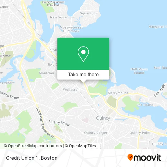
See Credit Union 1, Quincy, on the map
Public Transit to Credit Union 1 in Quincy
Wondering how to get to Credit Union 1 in Quincy? Moovit helps you find the best way to get to Credit Union 1 with step-by-step directions from the nearest public transit station.
Moovit provides free maps and live directions to help you navigate through your city. View schedules, routes, timetables, and find out how long does it take to get to Credit Union 1 in real time.
Looking for the nearest stop or station to Credit Union 1? Check out this list of stops closest to your destination: Hancock St @ Beale St; Hancock St @ Clay St; Wollaston; Quincy; Cedar Grove.
Bus: 210, 217.Train: FALL RIVER/NEW BEDFORD, GREENBUSH.Subway: RED LINE, MATTAPAN LINE.Ferry: QUINCY FERRY, WINTHROP/QUINCY FERRY.
Want to see if there’s another route that gets you there at an earlier time? Moovit helps you find alternative routes or times. Get directions from and directions to Credit Union 1 easily from the Moovit App or Website.
We make riding to Credit Union 1 easy, which is why over 1.7 million users, including users in Quincy, trust Moovit as the best app for public transit. You don’t need to download an individual bus app or train app, Moovit is your all-in-one transit app that helps you find the best bus time or train time available.
For information on prices of bus, subway and train, costs and ride fares to Credit Union 1, please check the Moovit app.
Use the app to navigate to popular places including to the airport, hospital, stadium, grocery store, mall, coffee shop, school, college, and university.
Credit Union 1 Address: 721 Hancock St Quincy, MA 02170 street in Quincy
- WESTERN UNION,
- Rapid Carpet Cleaning,
- TACO BELL,
- Howard Johnson's,
- World Class Carpet Cleaning,
- L Y Massage Therapy and Hair Salon,
- Horizon Acupuncture,
- Keller Williams Realty,
- Dunkin',
- City of Quincy Commission on the Family,
- Efficiency Moving,
- Just Right Demolition,
- Rose's Cleaning,
- Britos Cleaning Services,
- Odyssey Universal,
- Soft Touch Masonry and Construction,
- Grumpy Cleaner,
- High Quality Contractors,
- Handyman Pro Repair,
- Premier Plastering
Places Near Credit Union 1 (Quincy)
- House Of Blues, Boston,
- Seaport District, Boston,
- Leader Bank Pavilion (Leader Bank Pavillion), Boston,
- Td Garden, Boston,
- North End, Boston,
- Castle Island, Boston,
- Boston Common, Boston,
- Boston Medical Center, Boston,
- Museum Of Science, Boston,
- Massachusetts General Hospital, Boston,
- Isabella Stewart Gardner Museum, Boston,
- Prudential Center, Boston,
- Wang Theater, Boston,
- Wilbur Theatre, Boston,
- Boston Convention & Exhibition Center, Boston,
- Faneuil Hall, Boston,
- Boston Children's Hospital, Boston,
- Mgm Music Hall, Boston,
- Quincy Market, Boston,
- Cheers, Boston
How to get to popular places in Boston with public transit
Get around Quincy by public transit!
Traveling around Quincy has never been so easy. See step by step directions as you travel to any attraction, street or major public transit station. View bus and train schedules, arrival times, service alerts and detailed routes on a map, so you know exactly how to get to anywhere in Quincy.
When traveling to any destination around Quincy use Moovit's Live Directions with Get Off Notifications to know exactly where and how far to walk, how long to wait for your line, and how many stops are left. Moovit will alert you when it's time to get off — no need to constantly re-check whether yours is the next stop.
Wondering how to use public transit in Quincy or how to pay for public transit in Quincy? Moovit public transit app can help you navigate your way with public transit easily, and at minimum cost. It includes public transit fees, ticket prices, and costs. Looking for a map of Quincy public transit lines? Moovit public transit app shows all public transit maps in Quincy with all Bus, Train, Subway and Ferry routes and stops on an interactive map.
Boston has 4 transit type(s), including: Bus, Train, Subway and Ferry, operated by several transit agencies, including MBTA, Southeastern Regional Transit Authority, MetroWest Regional Transit Authority, Rhode Island Public Transit Authority, WRTA, Lowell Regional Transit Authority, Merrimack Valley Transit, Montachusett Regional Transit Authority, Cape Cod Regional Transit Authority, Brockton Area Transit Authority, Martha's Vineyard Transit Authority, the WAVE - Nantucket Regional Transit Authority, GATRA, Cape Ann Transportation Authority and Massport