How to get to CSI Integrated Services Center: CAF by bus?
Click on the bus route to see step by step directions with maps, line arrival times and updated time schedules.
From Coppedè Quarter, Roma
84 minFrom San Lorenzo, Roma
73 minFrom Prati Fiscali Street / Cave Fiscali Street, Roma
96 minFrom Seven Churches Street, Roma
94 minFrom Palatino TV Production Center - Mediaset, Roma
86 minFrom Basilica of San Pietro in Vincoli, Roma
68 minFrom Sapienza University - Marco Polo Campus, Roma
64 minFrom Colle Degli Abeti, Roma
40 minFrom Policlinico Avenue 155, Roma
90 minFrom Rieti Street, Roma
74 min
How to get to CSI Integrated Services Center: CAF by train?
Click on the train route to see step by step directions with maps, line arrival times and updated time schedules.
How to get to CSI Integrated Services Center: CAF by metro?
Click on the metro route to see step by step directions with maps, line arrival times and updated time schedules.
From Coppedè Quarter, Roma
97 minFrom San Lorenzo, Roma
84 minFrom Prati Fiscali Street / Cave Fiscali Street, Roma
95 minFrom Seven Churches Street, Roma
103 minFrom Palatino TV Production Center - Mediaset, Roma
78 minFrom Basilica of San Pietro in Vincoli, Roma
80 minFrom Sapienza University - Marco Polo Campus, Roma
77 minFrom Policlinico Avenue 155, Roma
86 minFrom Rieti Street, Roma
87 min
Bus stops near CSI Integrated Services Center: CAF in Roma
Metro station near CSI Integrated Services Center: CAF in Roma
- Maura Tower, 17 min walk,VIEW
Bus lines to CSI Integrated Services Center: CAF in Roma
What are the closest stations to CSI Integrated Services Center: CAF?
The closest stations to CSI Integrated Services Center: CAF are:
- Squinzano/Torchiarolo is 165 meters away, 3 min walk.
- Trinitapoli/Alberobello is 311 meters away, 5 min walk.
- Variola is 388 meters away, 6 min walk.
- Torrenova/Squinzano is 551 meters away, 8 min walk.
- Torrenova/Maglie is 552 meters away, 8 min walk.
- Maura Tower is 1260 meters away, 17 min walk.
Which bus lines stop near CSI Integrated Services Center: CAF?
These bus lines stop near CSI Integrated Services Center: CAF: 053, 056.
Which train line stops near CSI Integrated Services Center: CAF?
FL2 (Tivoli)
Which metro line stops near CSI Integrated Services Center: CAF?
C (Monte Compatri-Pantano)
What’s the nearest metro station to CSI Integrated Services Center: CAF in Roma?
The nearest metro station to CSI Integrated Services Center: CAF in Roma is Maura Tower. It’s a 17 min walk away.
What’s the nearest bus station to CSI Integrated Services Center: CAF in Roma?
The nearest bus station to CSI Integrated Services Center: CAF in Roma is Squinzano/Torchiarolo. It’s a 3 min walk away.
What time is the first metro to CSI Integrated Services Center: CAF in Roma?
The C is the first metro that goes to CSI Integrated Services Center: CAF in Roma. It stops nearby at 5:43 AM.
What time is the last metro to CSI Integrated Services Center: CAF in Roma?
The C is the last metro that goes to CSI Integrated Services Center: CAF in Roma. It stops nearby at 9:19 PM.
What time is the first bus to CSI Integrated Services Center: CAF in Roma?
The N11 is the first bus that goes to CSI Integrated Services Center: CAF in Roma. It stops nearby at 3:07 AM.
What time is the last bus to CSI Integrated Services Center: CAF in Roma?
The N11 is the last bus that goes to CSI Integrated Services Center: CAF in Roma. It stops nearby at 3:37 AM.
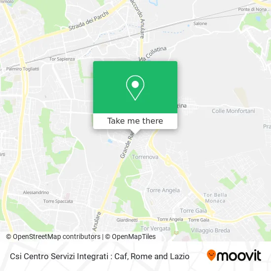
See CSI Integrated Services Center: CAF, Roma, on the map
Public Transit to CSI Integrated Services Center: CAF in Roma
Wondering how to get to CSI Integrated Services Center: CAF in Roma? Moovit helps you find the best way to get to CSI Integrated Services Center: CAF with step-by-step directions from the nearest public transit station.
Moovit provides free maps and live directions to help you navigate through your city. View schedules, routes, timetables, and find out how long does it take to get to CSI Integrated Services Center: CAF in real time.
Looking for the nearest stop or station to CSI Integrated Services Center: CAF? Check out this list of stops closest to your destination: Squinzano/Torchiarolo; Trinitapoli/Alberobello; Variola; Torrenova/Squinzano; Torrenova/Maglie; Maura Tower.
Bus: 053, 056, N11, 113, A05, A50, 058, 058F.Train: FL2.Metro: C.
Want to see if there’s another route that gets you there at an earlier time? Moovit helps you find alternative routes or times. Get directions from and directions to CSI Integrated Services Center: CAF easily from the Moovit App or Website.
We make riding to CSI Integrated Services Center: CAF easy, which is why over 1.5 million users, including users in Roma, trust Moovit as the best app for public transit. You don’t need to download an individual bus app or train app, Moovit is your all-in-one transit app that helps you find the best bus time or train time available.
For information on prices of bus, metro, light rail and train, costs and ride fares to CSI Integrated Services Center: CAF, please check the Moovit app.
Use the app to navigate to popular places including to the airport, hospital, stadium, grocery store, mall, coffee shop, school, college, and university.
CSI Integrated Services Center: CAF Address: Via Serracapriola, 26 00133 Roma street in Roma
- CCR,
- Rome Bearing Center,
- Cisternino Street, 69,
- The Children's Paradise - Inflatable Park,
- Tittarelli Luxury Custom Srl Simplified in Brief Tittarelli Luxury Custom,
- Torchiarolo Street / Squinzano Street,
- Eastern Ring Road 4051,
- Serracapriola Street 48,
- Lucio Lombardo Radice Secondary School,
- Via Girolamo Variola 14-16,
- Pratiko,
- Danilo Attorresi,
- Alcinoo Street 35,
- Santercole Daniele,
- Guantini Angelo,
- Tommaso Comanducci,
- Arpen Society,
- Bricoman Rome,
- Al.Fa.Srl,
- La Luce Toys
Places Near CSI Integrated Services Center: CAF (Roma)
- Paths, Roma,
- Gemelli Polyclinic, Roma,
- Scuderie Del Quirinale, Roma,
- Tiber Island, Roma,
- Sandro Pertini Hospital, Roma,
- Trastevere Quarter, Roma,
- Gravity, Roma,
- Tor Vergata, Roma,
- Cristo Re Hospital, Roma,
- Casilino Polyclinic, Roma,
- Roma Est Shopping Center, Roma,
- Coppedè Quarter, Roma,
- IDI (Dermopatico Dell'Immacolata Institute), Roma,
- Olympic Stadium, Rome, Roma,
- The Wow Side, Fiumicino,
- Villa Borghese, Roma,
- Termini Station, Roma,
- Santa Maria Maggiore, Roma,
- Auditorium Music Park, Roma,
- The Sail, Roma
How to get to popular places in Rome and Lazio with public transit
Get around Roma by public transit!
Traveling around Roma has never been so easy. See step by step directions as you travel to any attraction, street or major public transit station. View bus and train schedules, arrival times, service alerts and detailed routes on a map, so you know exactly how to get to anywhere in Roma.
When traveling to any destination around Roma use Moovit's Live Directions with Get Off Notifications to know exactly where and how far to walk, how long to wait for your line, and how many stops are left. Moovit will alert you when it's time to get off — no need to constantly re-check whether yours is the next stop.
Wondering how to use public transit in Roma or how to pay for public transit in Roma? Moovit public transit app can help you navigate your way with public transit easily, and at minimum cost. It includes public transit fees, ticket prices, and costs. Looking for a map of Roma public transit lines? Moovit public transit app shows all public transit maps in Roma with all Bus, Train, Metro, Light Rail, Ferry, Funicular and Gondola routes and stops on an interactive map.
Rome and Lazio has 7 transit type(s), including: Bus, Train, Metro, Light Rail, Ferry, Funicular and Gondola, operated by several transit agencies, including ATAC, Cotral, Trenitalia, Troiani Transportation Services, BIS, ATR Mobility, Tuscia, Shuttle, Seatour, Troiani Bus Lines, CSC Mobility, Terravision, ATRAL, Tambus and Sitbus