See Curtner Av, San Francisco - San Jose, CA, on the map
Directions to Curtner Av (San Francisco - San Jose, CA) with public transportation
The following transit lines have routes that pass near Curtner Av
 Bus:
Bus: - Train:
How to get to Curtner Av by bus?
Click on the bus route to see step by step directions with maps, line arrival times and updated time schedules.
How to get to Curtner Av by train?
Click on the train route to see step by step directions with maps, line arrival times and updated time schedules.
Bus stations near Curtner Av in San Francisco - San Jose, CA
- Monterey & Old Tully,13 min walk,
- Curtner @ The Plant (Op),16 min walk,
Bus lines to Curtner Av in San Francisco - San Jose, CA
- 66,Santa Teresa Station,
- 68,San Jose Diridon,
- 26,Eastridge,
What are the closest stations to Curtner Av?
The closest stations to Curtner Av are:
- Monterey & Old Tully is 1091 yards away, 13 min walk.
- Curtner @ The Plant (Op) is 1305 yards away, 16 min walk.
Which bus lines stop near Curtner Av?
These bus lines stop near Curtner Av: 26, 66, 68.
Which train line stops near Curtner Av?
BABY BULLET
What’s the nearest bus stop to Curtner Av in San Francisco - San Jose, CA?
The nearest bus stop to Curtner Av in San Francisco - San Jose, CA is Monterey & Old Tully. It’s a 13 min walk away.
See Curtner Av, San Francisco - San Jose, CA, on the map
Public Transit to Curtner Av in San Francisco - San Jose, CA
Wondering how to get to Curtner Av in San Francisco - San Jose, CA, United States? Moovit helps you find the best way to get to Curtner Av with step-by-step directions from the nearest public transit station.
Moovit provides free maps and live directions to help you navigate through your city. View schedules, routes, timetables, and find out how long does it take to get to Curtner Av in real time.
Looking for the nearest stop or station to Curtner Av? Check out this list of stops closest to your destination: Monterey & Old Tully; Curtner @ The Plant (Op).
Bus:Train:
Want to see if there’s another route that gets you there at an earlier time? Moovit helps you find alternative routes or times. Get directions from and directions to Curtner Av easily from the Moovit App or Website.
We make riding to Curtner Av easy, which is why over 1.5 million users, including users in San Francisco - San Jose, CA, trust Moovit as the best app for public transit. You don’t need to download an individual bus app or train app, Moovit is your all-in-one transit app that helps you find the best bus time or train time available.
For information on prices of bus, light rail and train, costs and ride fares to Curtner Av, please check the Moovit app.
Use the app to navigate to popular places including to the airport, hospital, stadium, grocery store, mall, coffee shop, school, college, and university.
Location: San Francisco - San Jose, CA
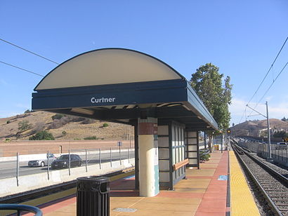
Curtner is a light rail station operated by Santa Clara Valley Transportation Authority (VTA). This station is served by VTA's Alum Rock–Santa Teresa line.Wiki
Attractions near Curtner Av
Oak Hill Memorial Park Mausoleum,Classic Cab,Grandmas Resting Place...,276 Chateau La Salle Dr,Chateau La Salle,Atlas Painting,The Pool,Chateau La Salle Mobile Home Park,Chateau La Salle Drive,The Sin Caravan,Oak Hill Memorial Park,Oak Hill Funeral Home & Memorial Park,Beth David Memorial Garden,313 Esfahan Ct,Schuster Shuttle,408MX,Chateau la salle,Nor Cal Laser Tag,Mini Whale-Slayers Anonymous,408mxHow to get to popular attractions in San Francisco - San Jose, CA with public transit
Renaissance ClubSport Walnut Creek Hotel, Contra Costa Centre,City of Pleasanton, Pleasanton,Milpitas Library, Milpitas,Walmart Supercenter, Antioch,Japantown (日本町), San Jose,Nordstrom Valley Fair, San Jose,The Castro, Castro/Upper Market,Lake Elizabeth, Fremont,Genentech Inc, South San Francisco,Best Western Plus Grosvenor Airport Hotel, South San Francisco,Sonoma State University,440 Castro, Castro/Upper Market,Town & Country Village, Palo Alto,Mountain View VTA Light Rail Station,BJ's Restaurant and Brewhouse, Cupertino,I-680 / US-101 / I-280 Interchange, San Jose,Mountain View Caltrain Station,City of San José, San Jose,San Antonio Caltrain Station,City of Fremont, FremontGet around San Francisco - San Jose, CA by public transit!
Traveling around San Francisco - San Jose, CA has never been so easy. See step by step directions as you travel to any attraction, street or major public transit station. View bus and train schedules, arrival times, service alerts and detailed routes on a map, so you know exactly how to get to anywhere in San Francisco - San Jose, CA.
When traveling to any destination around San Francisco - San Jose, CA use Moovit's Live Directions with Get Off Notifications to know exactly where and how far to walk, how long to wait for your line, and how many stops are left. Moovit will alert you when it's time to get off — no need to constantly re-check whether yours is the next stop.
Wondering how to use public transit in San Francisco - San Jose, CA or how to pay for public transit in San Francisco - San Jose, CA? Moovit public transit app can help you navigate your way with public transit easily, and at minimum cost. It includes public transit fees, ticket prices, and costs. Looking for a map of San Francisco - San Jose, CA public transit lines? Moovit public transit app shows all public transit maps in San Francisco - San Jose, CA with all bus, light rail or train routes and stops on an interactive map.
San Francisco - San Jose, CA has 3 transit type(s), including: bus, light rail or train, operated by several transit agencies, including BART, Bay Area Rapid Transit, Muni Metro, Caltrain, VTA, Capitol Corridor, Sonoma Marin Area Rail Transit, MUNI, VTA, SF Cable Car, AC Transit, Dumbarton Express, Golden Gate Transit, County Connection and SamTrans