Directions to Cvs Pharmacy (Quincy) with public transportation
The following transit lines have routes that pass near Cvs Pharmacy
 Bus: 201, 210, 211, 217.
- Subway: RED LINE, MATTAPAN LINE.
- Ferry: QUINCY FERRY, WINTHROP/QUINCY FERRY.
How to get to Cvs Pharmacy by bus?
Click on the bus route to see step by step directions with maps, line arrival times and updated time schedules.
From Sudbury, Boston
101 minFrom Hewlett Room 32-G882 (MIT Stata Center), Cambridge
119 minFrom MGH, Boston
101 minFrom World Trade Center, Boston
120 minFrom SoWa Winter Market, Boston
79 minFrom Brookline High School (Brookline Town High School), Brookline
112 minFrom Cambridgeside, Cambridge
137 minFrom Atlantic Fish Co, Boston
98 minFrom CambridgeSide (Cambridgeside Galleria), Cambridge
137 min
How to get to Cvs Pharmacy by subway?
Click on the subway route to see step by step directions with maps, line arrival times and updated time schedules.
From Sudbury, Boston
48 minFrom Hewlett Room 32-G882 (MIT Stata Center), Cambridge
50 minFrom MGH, Boston
51 minFrom World Trade Center, Boston
59 minFrom SoWa Winter Market, Boston
59 minFrom Brookline High School (Brookline Town High School), Brookline
70 minFrom Cambridgeside, Cambridge
62 minFrom Atlantic Fish Co, Boston
55 minFrom Boston Navy Yard, Boston
70 minFrom CambridgeSide (Cambridgeside Galleria), Cambridge
62 min
Bus stops near Cvs Pharmacy in Quincy
Ferry station near Cvs Pharmacy in Quincy
- Quincy, 29 min walk,VIEW
What are the closest stations to Cvs Pharmacy?
The closest stations to Cvs Pharmacy are:
- E Squantum St Opp Hummock Rd is 507 yards away, 6 min walk.
- E Squantum St @ Faxon Rd. is 1473 yards away, 18 min walk.
- Quincy is 2466 yards away, 29 min walk.
- Wollaston is 3091 yards away, 37 min walk.
- Cedar Grove is 4231 yards away, 50 min walk.
Which bus lines stop near Cvs Pharmacy?
These bus lines stop near Cvs Pharmacy: 201, 210, 211.
Which subway line stops near Cvs Pharmacy?
RED LINE (Ashmont/Braintree)
What’s the nearest bus station to Cvs Pharmacy in Quincy?
The nearest bus station to Cvs Pharmacy in Quincy is E Squantum St Opp Hummock Rd. It’s a 6 min walk away.
What’s the nearest ferry station to Cvs Pharmacy in Quincy?
The nearest ferry station to Cvs Pharmacy in Quincy is Quincy. It’s a 29 min walk away.
What time is the first subway to Cvs Pharmacy in Quincy?
The MATTAPAN LINE is the first subway that goes to Cvs Pharmacy in Quincy. It stops nearby at 5:10 AM.
What time is the last subway to Cvs Pharmacy in Quincy?
The MATTAPAN LINE is the last subway that goes to Cvs Pharmacy in Quincy. It stops nearby at 2:31 AM.
What time is the first bus to Cvs Pharmacy in Quincy?
The 211 is the first bus that goes to Cvs Pharmacy in Quincy. It stops nearby at 5:49 AM.
What time is the last bus to Cvs Pharmacy in Quincy?
The 211 is the last bus that goes to Cvs Pharmacy in Quincy. It stops nearby at 8:20 PM.
What time is the first ferry to Cvs Pharmacy in Quincy?
The QUINCY FERRY is the first ferry that goes to Cvs Pharmacy in Quincy. It stops nearby at 6:15 AM.
What time is the last ferry to Cvs Pharmacy in Quincy?
The QUINCY FERRY is the last ferry that goes to Cvs Pharmacy in Quincy. It stops nearby at 8:55 PM.
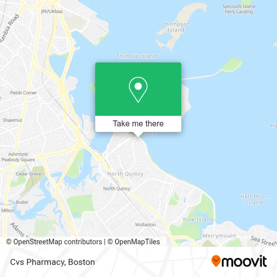
See Cvs Pharmacy, Quincy, on the map
Public Transit to Cvs Pharmacy in Quincy
Wondering how to get to Cvs Pharmacy in Quincy? Moovit helps you find the best way to get to Cvs Pharmacy with step-by-step directions from the nearest public transit station.
Moovit provides free maps and live directions to help you navigate through your city. View schedules, routes, timetables, and find out how long does it take to get to Cvs Pharmacy in real time.
Looking for the nearest stop or station to Cvs Pharmacy? Check out this list of stops closest to your destination: E Squantum St Opp Hummock Rd; E Squantum St @ Faxon Rd.; Quincy; Wollaston; Cedar Grove.
Bus: 201, 210, 211, 217.Subway: RED LINE, MATTAPAN LINE.Ferry: QUINCY FERRY, WINTHROP/QUINCY FERRY.
Want to see if there’s another route that gets you there at an earlier time? Moovit helps you find alternative routes or times. Get directions from and directions to Cvs Pharmacy easily from the Moovit App or Website.
We make riding to Cvs Pharmacy easy, which is why over 1.7 million users, including users in Quincy, trust Moovit as the best app for public transit. You don’t need to download an individual bus app or train app, Moovit is your all-in-one transit app that helps you find the best bus time or train time available.
For information on prices of bus and subway, costs and ride fares to Cvs Pharmacy, please check the Moovit app.
Use the app to navigate to popular places including to the airport, hospital, stadium, grocery store, mall, coffee shop, school, college, and university.
Cvs Pharmacy Address: 321 Quincy Shore Dr street in Quincy
- Cvs Quincy Shore Drive,
- Quincy Animal Shelter,
- Wollaston Beach,
- Wollaston Beach-West,
- Paul's Rubbish Removal And Demolition,
- Bay State Ledger-Certified Public Bookkeeper,
- Boston Stone Works, Llc,
- Turn It Up Dance Challenge,
- Lee Kennedy Co.,
- Neponset Bridge,
- Marina Bay Nursing And Rehab,
- Olympia Sports,
- Marina Bay,
- The Atlantic at Marina Bay,
- Seoulã© Korean-French Cuisine,
- Marvin Photo & Video,
- QC gym,
- 5 Corners Food Mart,
- Flat Rate Locksmith of Quincy,
- Creedon Field North Quincy High School
Places Near Cvs Pharmacy (Quincy)
- Quincy Market, Boston,
- Museum Of Science, Boston,
- Cheers, Boston,
- North End, Boston,
- Castle Island, Boston,
- Seaport District, Boston,
- Wilbur Theatre, Boston,
- Td Garden, Boston,
- Mgm Music Hall, Boston,
- Isabella Stewart Gardner Museum, Boston,
- Boston Children's Hospital, Boston,
- Boston Medical Center, Boston,
- Wang Theater, Boston,
- House Of Blues, Boston,
- Prudential Center, Boston,
- Faneuil Hall, Boston,
- Leader Bank Pavilion (Leader Bank Pavillion), Boston,
- Boston Common, Boston,
- Massachusetts General Hospital, Boston,
- Boston Convention & Exhibition Center, Boston
How to get to popular places in Boston with public transit
Get around Quincy by public transit!
Traveling around Quincy has never been so easy. See step by step directions as you travel to any attraction, street or major public transit station. View bus and train schedules, arrival times, service alerts and detailed routes on a map, so you know exactly how to get to anywhere in Quincy.
When traveling to any destination around Quincy use Moovit's Live Directions with Get Off Notifications to know exactly where and how far to walk, how long to wait for your line, and how many stops are left. Moovit will alert you when it's time to get off — no need to constantly re-check whether yours is the next stop.
Wondering how to use public transit in Quincy or how to pay for public transit in Quincy? Moovit public transit app can help you navigate your way with public transit easily, and at minimum cost. It includes public transit fees, ticket prices, and costs. Looking for a map of Quincy public transit lines? Moovit public transit app shows all public transit maps in Quincy with all Bus, Train, Subway and Ferry routes and stops on an interactive map.
Boston has 4 transit type(s), including: Bus, Train, Subway and Ferry, operated by several transit agencies, including MBTA, Southeastern Regional Transit Authority, MetroWest Regional Transit Authority, Rhode Island Public Transit Authority, WRTA, Lowell Regional Transit Authority, Merrimack Valley Transit, Montachusett Regional Transit Authority, Cape Cod Regional Transit Authority, Brockton Area Transit Authority, Martha's Vineyard Transit Authority, the WAVE - Nantucket Regional Transit Authority, GATRA, Cape Ann Transportation Authority and Massport