How to get to DLT Solutions by bus?
Click on the bus route to see step by step directions with maps, line arrival times and updated time schedules.
From Glover Park, Washington
111 minFrom 14th St & U St, Washington
124 minFrom Audi Field, Washington
144 minFrom Shaw-Howard University Metro Station, Washington
134 minFrom Kramerbooks, Washington
93 minFrom U St NW (14th & u street nw), Washington
124 minFrom Walmart, Washington
129 minFrom National Law Enforcement Officers Memorial, Washington
131 minFrom George Washington Lisner Auditorium, Washington
86 minFrom Department of Justice (DOJ), Washington
147 min
How to get to DLT Solutions by train?
Click on the train route to see step by step directions with maps, line arrival times and updated time schedules.
How to get to DLT Solutions by metro?
Click on the metro route to see step by step directions with maps, line arrival times and updated time schedules.
From Department of Justice (DOJ), Washington
61 minFrom 14th St & U St, Washington
58 minFrom Audi Field, Washington
73 minFrom Shaw-Howard University Metro Station, Washington
55 minFrom Kramerbooks, Washington
59 minFrom U St NW (14th & u street nw), Washington
58 minFrom Walmart, Washington
63 minFrom National Law Enforcement Officers Memorial, Washington
56 minFrom George Washington Lisner Auditorium, Washington
55 min
Bus stops near DLT Solutions in Alexandria
Metro stations near DLT Solutions in Alexandria
Train station near DLT Solutions in Alexandria
- Alexandria, 50 min walk,VIEW
Bus lines to DLT Solutions in Alexandria
What are the closest stations to DLT Solutions?
The closest stations to DLT Solutions are:
- Russell Rd + Mansion Dr is 148 yards away, 2 min walk.
- Mount Vernon Ave & Raymond Ave is 1020 yards away, 13 min walk.
- Mt Vernon Av + Raymond Av is 1033 yards away, 13 min walk.
- Potomac Yard is 2321 yards away, 28 min walk.
- Alexandria is 4228 yards away, 50 min walk.
- Ronald Reagan Washington National Airport Metrorail Station is 5160 yards away, 61 min walk.
Which bus lines stop near DLT Solutions?
These bus lines stop near DLT Solutions: 103, 33, A11, A12.
Which train line stops near DLT Solutions?
PALMETTO (Savannah)
Which metro lines stop near DLT Solutions?
These metro lines stop near DLT Solutions: BLUE, YELLOW.
What’s the nearest metro station to DLT Solutions in Alexandria?
The nearest metro station to DLT Solutions in Alexandria is Potomac Yard. It’s a 28 min walk away.
What’s the nearest bus station to DLT Solutions in Alexandria?
The nearest bus station to DLT Solutions in Alexandria is Russell Rd + Mansion Dr. It’s a 2 min walk away.
What time is the first metro to DLT Solutions in Alexandria?
The YELLOW is the first metro that goes to DLT Solutions in Alexandria. It stops nearby at 5:04 AM.
What time is the last metro to DLT Solutions in Alexandria?
The YELLOW is the last metro that goes to DLT Solutions in Alexandria. It stops nearby at 12:35 AM.
What time is the first train to DLT Solutions in Alexandria?
The SILVER METEOR is the first train that goes to DLT Solutions in Alexandria. It stops nearby at 5:54 AM.
What time is the last train to DLT Solutions in Alexandria?
The SILVER METEOR is the last train that goes to DLT Solutions in Alexandria. It stops nearby at 5:54 AM.
What time is the first bus to DLT Solutions in Alexandria?
The 33 is the first bus that goes to DLT Solutions in Alexandria. It stops nearby at 5:14 AM.
What time is the last bus to DLT Solutions in Alexandria?
The A11 is the last bus that goes to DLT Solutions in Alexandria. It stops nearby at 1:49 AM.
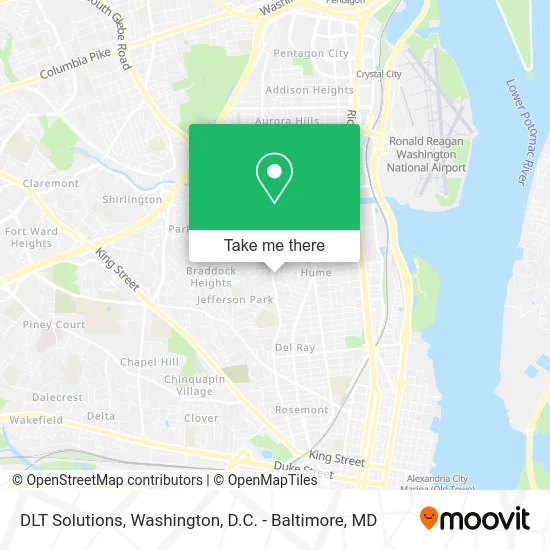
See DLT Solutions, Alexandria, on the map
Public Transit to DLT Solutions in Alexandria
Wondering how to get to DLT Solutions in Alexandria? Moovit helps you find the best way to get to DLT Solutions with step-by-step directions from the nearest public transit station.
Moovit provides free maps and live directions to help you navigate through your city. View schedules, routes, timetables, and find out how long does it take to get to DLT Solutions in real time.
Looking for the nearest stop or station to DLT Solutions? Check out this list of stops closest to your destination: Russell Rd + Mansion Dr; Mount Vernon Ave & Raymond Ave; Mt Vernon Av + Raymond Av; Potomac Yard; Alexandria; Ronald Reagan Washington National Airport Metrorail Station.
Bus: 103, 33, A11, A12.Train: PALMETTO, CARDINAL, CAROLINIAN, CRESCENT, FLORIDIAN, NORTHEAST REGIONAL.Metro: BLUE, YELLOW, METRO STATION CLOSURE SHUTTLE.
Want to see if there’s another route that gets you there at an earlier time? Moovit helps you find alternative routes or times. Get directions from and directions to DLT Solutions easily from the Moovit App or Website.
We make riding to DLT Solutions easy, which is why over 1.5 million users, including users in Alexandria, trust Moovit as the best app for public transit. You don’t need to download an individual bus app or train app, Moovit is your all-in-one transit app that helps you find the best bus time or train time available.
For information on prices of bus, metro and train, costs and ride fares to DLT Solutions, please check the Moovit app.
Use the app to navigate to popular places including to the airport, hospital, stadium, grocery store, mall, coffee shop, school, college, and university.
DLT Solutions Address: 204 Pine St Alexandria, VA 22305 street in Alexandria
- ACDS,
- Schuler Solutions,
- Reimers Design Studio,
- Dr. Jake Newsome,
- The Deevy Group L Compass,
- Hobbitronics,
- Delray Tower,
- Alexandria Library - James M. Duncan Branch,
- The Calvert,
- Delray Tower by Udr,
- Different Stages LLC Home Staging,
- Mount Vernon Community School ,
- Streets Market & Cafe,
- Lou Lou Boutique,
- Tax Max, LLC,
- Peerless Patents,
- FedEx,
- Ethiopian Airlines,
- Ahope for Children,
- Mast Holding I
Places Near DLT Solutions (Alexandria)
- Washington DC VA Medical Center, Washington,
- Basilica of the National Shrine, Washington,
- M&T Bank Stadium, Baltimore,
- Marriott Marquis Washington, DC, Washington,
- Sibley Memorial Hospital, Washington,
- National Zoo, Washington,
- The Anthem, Washington,
- National Theatre, Washington,
- Rock Creek Tennis Center, Washington,
- PG Mall, Prince George's County,
- Pennsylvania Ave NW (3rd st and pennsylvania), Washington,
- Warner Theatre, Washington,
- Capital One Arena, Washington,
- Museum Of The Bible, Washington,
- Amazon Hq2, Arlington County,
- Camden Yards, Baltimore,
- Westfield Montgomery Mall, Montgomery County,
- Washington National Cathedral, Washington,
- Georgetown, Washington,
- National Museum of African American History and Culture, Washington
How to get to popular places in Washington, D.C. - Baltimore, MD with public transit
Get around Alexandria by public transit!
Traveling around Alexandria has never been so easy. See step by step directions as you travel to any attraction, street or major public transit station. View bus and train schedules, arrival times, service alerts and detailed routes on a map, so you know exactly how to get to anywhere in Alexandria.
When traveling to any destination around Alexandria use Moovit's Live Directions with Get Off Notifications to know exactly where and how far to walk, how long to wait for your line, and how many stops are left. Moovit will alert you when it's time to get off — no need to constantly re-check whether yours is the next stop.
Wondering how to use public transit in Alexandria or how to pay for public transit in Alexandria? Moovit public transit app can help you navigate your way with public transit easily, and at minimum cost. It includes public transit fees, ticket prices, and costs. Looking for a map of Alexandria public transit lines? Moovit public transit app shows all public transit maps in Alexandria with all Bus, Train, Metro, Light Rail and Ferry routes and stops on an interactive map.
Washington, D.C. - Baltimore, MD has 5 transit type(s), including: Bus, Train, Metro, Light Rail and Ferry, operated by several transit agencies, including WMATA, Montgomery County Ride On, Fairfax Connector, TheBus, PRTC, DASH - Alexandria, Arlington Transit (ART), RTA of Central Maryland, MDOT MTA, MDOT MTA Light RailLink, MDOT MTA Commuter Bus, MDOT MTA Local Bus, FXBGO!, Virginia Railway Express (VRE) and MARC