How to get to DMZ by bus?
Click on the bus route to see step by step directions with maps, line arrival times and updated time schedules.
From Dunbar High School, Washington
85 minFrom Nova- Alexandria Campus, Alexandria
85 minFrom The Queen Vic, Washington
61 minFrom Ford House Office Building, Washington
59 minFrom ARC HOTEL Washington DC Georgetown, Washington
78 minFrom NASA HQ, Washington
57 minFrom The Mayflower Hotel, Autograph Collection, Washington
83 minFrom Vietnam Veterans Memorial, Washington
95 minFrom The Mayflower Hotel Autograph Collection Washington, Washington
82 minFrom National Museum of Women in the Arts, Washington
66 min
How to get to DMZ by metro?
Click on the metro route to see step by step directions with maps, line arrival times and updated time schedules.
From Dunbar High School, Washington
77 minFrom The Queen Vic, Washington
87 minFrom Ford House Office Building, Washington
64 minFrom ARC HOTEL Washington DC Georgetown, Washington
76 minFrom NASA HQ, Washington
66 minFrom The Mayflower Hotel, Autograph Collection, Washington
72 minFrom Vietnam Veterans Memorial, Washington
90 minFrom The Mayflower Hotel Autograph Collection Washington, Washington
71 minFrom National Museum of Women in the Arts, Washington
71 min
Bus stops near DMZ in Prince George's County
Metro station near DMZ in Prince George's County
- Southern Ave Metro Station, 26 min walk,VIEW
Bus lines to DMZ in Prince George's County
What are the closest stations to DMZ?
The closest stations to DMZ are:
- Eastover Ctr+#5101 is 9 yards away, 1 min walk.
- Indian Head Highway at Southern Avenue is 284 yards away, 4 min walk.
- Indian Head Hwy + Southern Ave is 284 yards away, 4 min walk.
- Southern Av Se+S Capitol St SW is 406 yards away, 6 min walk.
- Southern Av+S Capitol St is 444 yards away, 6 min walk.
- Southern Ave Metro Station is 2205 yards away, 26 min walk.
Which bus lines stop near DMZ?
These bus lines stop near DMZ: C11, C13, P93, P94, P95.
Which metro line stops near DMZ?
GREEN (Branch Av)
What’s the nearest metro station to DMZ in Prince George's County?
The nearest metro station to DMZ in Prince George's County is Southern Ave Metro Station. It’s a 26 min walk away.
What’s the nearest bus station to DMZ in Prince George's County?
The nearest bus station to DMZ in Prince George's County is Eastover Ctr+#5101. It’s a 1 min walk away.
What time is the first metro to DMZ in Prince George's County?
The GREEN is the first metro that goes to DMZ in Prince George's County. It stops nearby at 5:08 AM.
What time is the last metro to DMZ in Prince George's County?
The GREEN is the last metro that goes to DMZ in Prince George's County. It stops nearby at 12:25 AM.
What time is the first bus to DMZ in Prince George's County?
The C11 is the first bus that goes to DMZ in Prince George's County. It stops nearby at 3:00 AM.
What time is the last bus to DMZ in Prince George's County?
The C11 is the last bus that goes to DMZ in Prince George's County. It stops nearby at 3:12 AM.
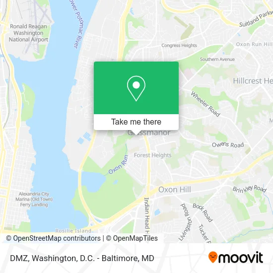
See DMZ, Prince George's County, on the map
Public Transit to DMZ in Prince George's County
Wondering how to get to DMZ in Prince George's County? Moovit helps you find the best way to get to DMZ with step-by-step directions from the nearest public transit station.
Moovit provides free maps and live directions to help you navigate through your city. View schedules, routes, timetables, and find out how long does it take to get to DMZ in real time.
Looking for the nearest stop or station to DMZ? Check out this list of stops closest to your destination: Eastover Ctr+#5101; Indian Head Highway at Southern Avenue; Indian Head Hwy + Southern Ave; Southern Av Se+S Capitol St SW; Southern Av+S Capitol St; Southern Ave Metro Station.
Bus: C11, C13, P93, P94, P95, C17, P97, C27, C15.Metro: GREEN.
Want to see if there’s another route that gets you there at an earlier time? Moovit helps you find alternative routes or times. Get directions from and directions to DMZ easily from the Moovit App or Website.
We make riding to DMZ easy, which is why over 1.5 million users, including users in Prince George's County, trust Moovit as the best app for public transit. You don’t need to download an individual bus app or train app, Moovit is your all-in-one transit app that helps you find the best bus time or train time available.
For information on prices of bus and metro, costs and ride fares to DMZ, please check the Moovit app.
Use the app to navigate to popular places including to the airport, hospital, stadium, grocery store, mall, coffee shop, school, college, and university.
DMZ Address: 5037 Indian Head Hwy Oxon Hill, MD 20745 street in Prince George's County
- Americas Best (America's Best Contacts & Eyeglasses),
- Libertyx Bitcoin ATM,
- Eastover Shopping Center,
- Esco,
- Amazon Locker-Santi,
- Eastover Laundromat,
- Hill Oxon Chiropractor,
- Rainbow Kids,
- Strike,
- Lady Foot Locker,
- Same Day Hardwood Flooring,
- Discount Sounds & Security,
- DC Boundary Stone Se7,
- Mobile Depot,
- Start Upholstery Cleaning Business,
- Ucomm Maryland,
- Amazon Locker-Backup,
- T-Mobile,
- Shalom Behavioral Health,
- Eastover Shopping Center (Eastover Center)
Places Near DMZ (Prince George's County)
- Warner Theatre, Washington,
- Westfield Montgomery Mall, Montgomery County,
- Sibley Memorial Hospital, Washington,
- Marriott Marquis Washington, DC, Washington,
- Rock Creek Tennis Center, Washington,
- National Theatre, Washington,
- PG Mall, Prince George's County,
- Georgetown, Washington,
- Camden Yards, Baltimore,
- National Museum of African American History and Culture, Washington,
- The Anthem, Washington,
- National Zoo, Washington,
- Museum Of The Bible, Washington,
- Capital One Arena, Washington,
- Amazon Hq2, Arlington County,
- Basilica of the National Shrine, Washington,
- M&T Bank Stadium, Baltimore,
- Pennsylvania Ave NW (3rd st and pennsylvania), Washington,
- Washington DC VA Medical Center, Washington,
- Washington National Cathedral, Washington
How to get to popular places in Washington, D.C. - Baltimore, MD with public transit
Get around Prince George's County by public transit!
Traveling around Prince George's County has never been so easy. See step by step directions as you travel to any attraction, street or major public transit station. View bus and train schedules, arrival times, service alerts and detailed routes on a map, so you know exactly how to get to anywhere in Prince George's County.
When traveling to any destination around Prince George's County use Moovit's Live Directions with Get Off Notifications to know exactly where and how far to walk, how long to wait for your line, and how many stops are left. Moovit will alert you when it's time to get off — no need to constantly re-check whether yours is the next stop.
Wondering how to use public transit in Prince George's County or how to pay for public transit in Prince George's County? Moovit public transit app can help you navigate your way with public transit easily, and at minimum cost. It includes public transit fees, ticket prices, and costs. Looking for a map of Prince George's County public transit lines? Moovit public transit app shows all public transit maps in Prince George's County with all Bus, Train, Metro, Light Rail and Ferry routes and stops on an interactive map.
Washington, D.C. - Baltimore, MD has 5 transit type(s), including: Bus, Train, Metro, Light Rail and Ferry, operated by several transit agencies, including WMATA, Montgomery County Ride On, Fairfax Connector, TheBus, PRTC, DASH - Alexandria, Arlington Transit (ART), RTA of Central Maryland, MDOT MTA, MDOT MTA Light RailLink, MDOT MTA Commuter Bus, MDOT MTA Local Bus, FXBGO!, Virginia Railway Express (VRE) and MARC