How to get to DQ Grill & Chill Restaurant by bus?
Click on the bus route to see step by step directions with maps, line arrival times and updated time schedules.
From YEG Tex, Edmonton
54 minFrom Tamarack, Edmonton
59 minFrom W P Wagner Senior High School, Edmonton
83 minFrom Walmart, Edmonton
55 minFrom Albian Central Receiving CNRL, Edmonton
45 minFrom Terwillegar Park, Edmonton
75 minFrom Weinlos Park, Edmonton
43 minFrom Union Hall Events Centre, Edmonton
73 minFrom Avanica Furniture, Edmonton
72 minFrom SSS Motorsports, Edmonton
75 min
Bus stops near DQ Grill & Chill Restaurant in Edmonton
Bus lines to DQ Grill & Chill Restaurant in Edmonton
What are the closest stations to DQ Grill & Chill Restaurant?
The closest stations to DQ Grill & Chill Restaurant are:
- 66 Street & 25 Avenue SW is 353 meters away, 5 min walk.
- 66 Street & Winspear Common SW is 801 meters away, 11 min walk.
Which bus lines stop near DQ Grill & Chill Restaurant?
These bus lines stop near DQ Grill & Chill Restaurant: 518, 519.
What’s the nearest bus station to DQ Grill & Chill Restaurant in Edmonton?
The nearest bus station to DQ Grill & Chill Restaurant in Edmonton is 66 Street & 25 Avenue SW. It’s a 5 min walk away.
What time is the first bus to DQ Grill & Chill Restaurant in Edmonton?
The 519 is the first bus that goes to DQ Grill & Chill Restaurant in Edmonton. It stops nearby at 5:59 AM.
What time is the last bus to DQ Grill & Chill Restaurant in Edmonton?
The 519 is the last bus that goes to DQ Grill & Chill Restaurant in Edmonton. It stops nearby at 12:06 AM.
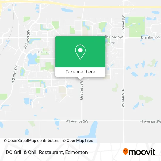
See DQ Grill & Chill Restaurant, Edmonton, on the map
Public Transit to DQ Grill & Chill Restaurant in Edmonton
Wondering how to get to DQ Grill & Chill Restaurant in Edmonton? Moovit helps you find the best way to get to DQ Grill & Chill Restaurant with step-by-step directions from the nearest public transit station.
Moovit provides free maps and live directions to help you navigate through your city. View schedules, routes, timetables, and find out how long does it take to get to DQ Grill & Chill Restaurant in real time.
Looking for the nearest stop or station to DQ Grill & Chill Restaurant? Check out this list of stops closest to your destination: 66 Street & 25 Avenue SW; 66 Street & Winspear Common SW.
Bus: 518, 519, 521, 638, 664.
Want to see if there’s another route that gets you there at an earlier time? Moovit helps you find alternative routes or times. Get directions from and directions to DQ Grill & Chill Restaurant easily from the Moovit App or Website.
We make riding to DQ Grill & Chill Restaurant easy, which is why over 1.5 million users, including users in Edmonton, trust Moovit as the best app for public transit. You don’t need to download an individual bus app or train app, Moovit is your all-in-one transit app that helps you find the best bus time or train time available.
For information on prices of bus and light rail, costs and ride fares to DQ Grill & Chill Restaurant, please check the Moovit app.
Use the app to navigate to popular places including to the airport, hospital, stadium, grocery store, mall, coffee shop, school, college, and university.
DQ Grill & Chill Restaurant Address: 2510 66 St SW Edmonton, AB T6X 2Z3 street in Edmonton
- Dairy Queen,
- Canadian Tire,
- Plantlife (Orchards),
- Orchard Smiles Dental,
- Starbucks,
- Canopus Home Inspections,
- Soapybear Clothing,
- Everglow Medi Spa,
- Shaktiflow Studios,
- Fair Trading Canada,
- Cuddle Bugs Dayhome,
- Pretty Plum Boutiq,
- Alpha Tools,
- A1 Air & Safety,
- 1480 Watt Drive Southwest,
- Brookfield Residential in the Orchards,
- Alberta Crane Service LTD,
- Amba Custom,
- Sanpreet,
- K B Fence
Places Near DQ Grill & Chill Restaurant (Edmonton)
- Londonderry Mall, Edmonton,
- Kingsway Mall, Edmonton,
- Edmonton EXPO Centre, Edmonton,
- Cross Cancer Institute, Edmonton,
- Edmonton Commonwealth Stadium, Edmonton,
- MacEwan University, Edmonton,
- Whyte Avenue, Edmonton,
- Kaye Edmonton Clinic, Edmonton,
- Borden Park, Edmonton,
- Northgate Centre, Edmonton,
- West Edmonton Mall, Edmonton,
- Royal Alexandra Hospital, Edmonton,
- Canada Place Service Canada Centre, Edmonton,
- Edmonton Valley Zoo, Edmonton,
- Rogers Place, Edmonton,
- Edmonton VIA Rail Station, Edmonton,
- University of Alberta, Edmonton,
- Alberta Legislature Building, Edmonton,
- Fort Edmonton Park, Edmonton,
- Grey Nuns Community Hospital, Edmonton
How to get to popular places in Edmonton with public transit
Get around Edmonton by public transit!
Traveling around Edmonton has never been so easy. See step by step directions as you travel to any attraction, street or major public transit station. View bus and train schedules, arrival times, service alerts and detailed routes on a map, so you know exactly how to get to anywhere in Edmonton.
When traveling to any destination around Edmonton use Moovit's Live Directions with Get Off Notifications to know exactly where and how far to walk, how long to wait for your line, and how many stops are left. Moovit will alert you when it's time to get off — no need to constantly re-check whether yours is the next stop.
Wondering how to use public transit in Edmonton or how to pay for public transit in Edmonton? Moovit public transit app can help you navigate your way with public transit easily, and at minimum cost. It includes public transit fees, ticket prices, and costs. Looking for a map of Edmonton public transit lines? Moovit public transit app shows all public transit maps in Edmonton with all Bus and Light Rail routes and stops on an interactive map.
Edmonton has 2 transit type(s), including: Bus and Light Rail, operated by several transit agencies, including ETS LRT, ETS, Strathcona County Transit, St. Albert Transit, Spruce Grove Transit, Fort Saskatchewan Transit, Beaumont Transit and Leduc Transit