Directions to D. Reed Electric, Inc. (Boston) with public transportation
The following transit lines have routes that pass near D. Reed Electric, Inc.
 Bus: 220.
- Train: GREENBUSH.
- Ferry: HEWITT'S COVE FERRY, BUMPKIN ISLAND FERRY, GEORGES ISLAND FERRY, PEDDOCKS ISLAND FERRY, HINGHAM FERRY.
How to get to D. Reed Electric, Inc. by bus?
Click on the bus route to see step by step directions with maps, line arrival times and updated time schedules.
From Walmart, Quincy
43 minFrom Best Western Adams Inn Quincy - Boston, Quincy
74 minFrom Nantasket Beach, Hull
29 minFrom Boston Scientific, Quincy
85 minFrom Archbishop Williams High School, Braintree Town
43 minFrom rmv Braintree, Braintree Town
81 minFrom Marina Bay, Quincy
84 minFrom Encompass Health Rehabilitation Hospital of Braintree, Braintree Town
80 minFrom Ramada by Wyndham Boston, Boston
79 minFrom Granite Links Golf Club at Quarry Hills, Quincy
81 min
How to get to D. Reed Electric, Inc. by train?
Click on the train route to see step by step directions with maps, line arrival times and updated time schedules.
Bus stop near D. Reed Electric, Inc. in Boston
- Hingham Shipyard @ Ferry Terminal, 4 min walk,VIEW
Train station near D. Reed Electric, Inc. in Boston
- East Weymouth, 25 min walk,VIEW
Ferry stations near D. Reed Electric, Inc. in Boston
Bus lines to D. Reed Electric, Inc. in Boston
- 220, Quincy Center Via Shipyard,VIEW
What are the closest stations to D. Reed Electric, Inc.?
The closest stations to D. Reed Electric, Inc. are:
- Hingham Shipyard @ Ferry Terminal is 301 yards away, 4 min walk.
- East Weymouth is 2137 yards away, 25 min walk.
- Grape Island is 3948 yards away, 53 min walk.
- Hewitt's Cove is 4810 yards away, 57 min walk.
- Hingham is 4821 yards away, 57 min walk.
Which bus line stops near D. Reed Electric, Inc.?
220 (Hingham Depot Via Shipyard)
Which train line stops near D. Reed Electric, Inc.?
GREENBUSH (#1061 | Greenbush)
What’s the nearest train station to D. Reed Electric, Inc. in Boston?
The nearest train station to D. Reed Electric, Inc. in Boston is East Weymouth. It’s a 25 min walk away.
What’s the nearest bus station to D. Reed Electric, Inc. in Boston?
The nearest bus station to D. Reed Electric, Inc. in Boston is Hingham Shipyard @ Ferry Terminal. It’s a 4 min walk away.
What time is the first train to D. Reed Electric, Inc. in Boston?
The GREENBUSH is the first train that goes to D. Reed Electric, Inc. in Boston. It stops nearby at 5:37 AM.
What time is the last train to D. Reed Electric, Inc. in Boston?
The GREENBUSH is the last train that goes to D. Reed Electric, Inc. in Boston. It stops nearby at 12:22 AM.
What time is the first bus to D. Reed Electric, Inc. in Boston?
The 220 is the first bus that goes to D. Reed Electric, Inc. in Boston. It stops nearby at 5:25 AM.
What time is the last bus to D. Reed Electric, Inc. in Boston?
The 220 is the last bus that goes to D. Reed Electric, Inc. in Boston. It stops nearby at 1:40 AM.
What time is the first ferry to D. Reed Electric, Inc. in Boston?
The HINGHAM/HULL FERRY is the first ferry that goes to D. Reed Electric, Inc. in Boston. It stops nearby at 5:40 AM.
What time is the last ferry to D. Reed Electric, Inc. in Boston?
The HINGHAM/HULL FERRY is the last ferry that goes to D. Reed Electric, Inc. in Boston. It stops nearby at 10:50 PM.
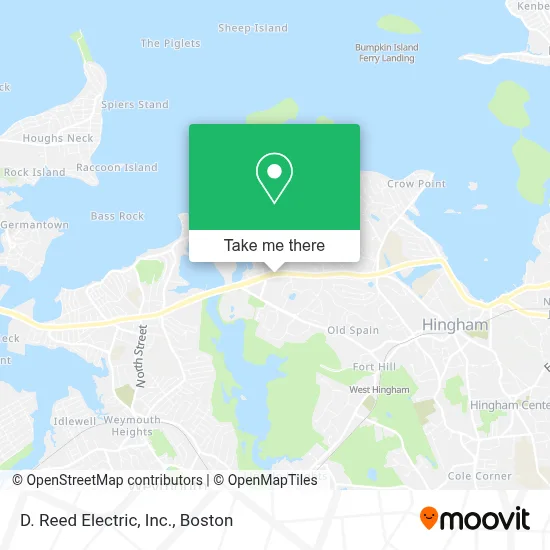
See D. Reed Electric, Inc., Boston, on the map
Public Transit to D. Reed Electric, Inc. in Boston
Wondering how to get to D. Reed Electric, Inc. in Boston? Moovit helps you find the best way to get to D. Reed Electric, Inc. with step-by-step directions from the nearest public transit station.
Moovit provides free maps and live directions to help you navigate through your city. View schedules, routes, timetables, and find out how long does it take to get to D. Reed Electric, Inc. in real time.
Looking for the nearest stop or station to D. Reed Electric, Inc.? Check out this list of stops closest to your destination: Hingham Shipyard @ Ferry Terminal; East Weymouth; Grape Island; Hewitt's Cove; Hingham.
Bus: 220.Train: GREENBUSH.Ferry: HEWITT'S COVE FERRY, BUMPKIN ISLAND FERRY, GEORGES ISLAND FERRY, PEDDOCKS ISLAND FERRY, HINGHAM FERRY, HINGHAM/HULL FERRY.
Want to see if there’s another route that gets you there at an earlier time? Moovit helps you find alternative routes or times. Get directions from and directions to D. Reed Electric, Inc. easily from the Moovit App or Website.
We make riding to D. Reed Electric, Inc. easy, which is why over 1.7 million users, including users in Boston, trust Moovit as the best app for public transit. You don’t need to download an individual bus app or train app, Moovit is your all-in-one transit app that helps you find the best bus time or train time available.
For information on prices of bus, subway and train, costs and ride fares to D. Reed Electric, Inc., please check the Moovit app.
Use the app to navigate to popular places including to the airport, hospital, stadium, grocery store, mall, coffee shop, school, college, and university.
D. Reed Electric, Inc. Address: 350 Lincoln St Ste 2400 street in Boston
- Apelon,
- Sela the International Private School,
- The Launch at Hingham Shipyard,
- Hewitts Cove Pay Parking,
- Coinstar,
- Coinstar - Bitcoin ATM,
- Alma Nove,
- Lynch Athletic Fields,
- Shipyard Dog Co.,
- Copia Real Estate Design & Build,
- Talbots Corporate Headquarters,
- Backriver Townhomes,
- RN Body Transformations,
- Hingham Ferry,
- Hewitts Cove Ferry Terminal,
- Stepping Stone Learning Center,
- Chabad of South Shore Boston,
- Arkham Asylum,
- Weymouth Back River Reservation,
- A Emergency Locksmith
Places Near D. Reed Electric, Inc. (Boston)
- House Of Blues, Boston,
- Isabella Stewart Gardner Museum, Boston,
- Seaport District, Boston,
- Mgm Music Hall, Boston,
- Boston Children's Hospital, Boston,
- Museum Of Science, Boston,
- Quincy Market, Boston,
- Faneuil Hall, Boston,
- Boston Medical Center, Boston,
- North End, Boston,
- Castle Island, Boston,
- Prudential Center, Boston,
- Td Garden, Boston,
- Massachusetts General Hospital, Boston,
- Leader Bank Pavilion (Leader Bank Pavillion), Boston,
- Wang Theater, Boston,
- Wilbur Theatre, Boston,
- Cheers, Boston,
- Boston Common, Boston,
- Boston Convention & Exhibition Center, Boston
How to get to popular places in Boston with public transit
Get around Boston by public transit!
Traveling around Boston has never been so easy. See step by step directions as you travel to any attraction, street or major public transit station. View bus and train schedules, arrival times, service alerts and detailed routes on a map, so you know exactly how to get to anywhere in Boston.
When traveling to any destination around Boston use Moovit's Live Directions with Get Off Notifications to know exactly where and how far to walk, how long to wait for your line, and how many stops are left. Moovit will alert you when it's time to get off — no need to constantly re-check whether yours is the next stop.
Wondering how to use public transit in Boston or how to pay for public transit in Boston? Moovit public transit app can help you navigate your way with public transit easily, and at minimum cost. It includes public transit fees, ticket prices, and costs. Looking for a map of Boston public transit lines? Moovit public transit app shows all public transit maps in Boston with all Bus, Train, Subway and Ferry routes and stops on an interactive map.
Boston has 4 transit type(s), including: Bus, Train, Subway and Ferry, operated by several transit agencies, including MBTA, Southeastern Regional Transit Authority, MetroWest Regional Transit Authority, Rhode Island Public Transit Authority, WRTA, Lowell Regional Transit Authority, Merrimack Valley Transit, Montachusett Regional Transit Authority, Cape Cod Regional Transit Authority, Brockton Area Transit Authority, Martha's Vineyard Transit Authority, the WAVE - Nantucket Regional Transit Authority, GATRA, Cape Ann Transportation Authority and Massport