How to get to Dapper Dog by bus?
Click on the bus route to see step by step directions with maps, line arrival times and updated time schedules.
From Lawrence, Massachusetts, Lawrence
75 minFrom Rockingham Mall Salem New Hampshire, Lawrence
73 minFrom Phillips Academy Andover, Andover
99 minFrom Lawrence, MA, Lawrence
56 minFrom Parque de las ardillas, Lawrence
75 minFrom Andover, MA, Andover
93 minFrom Methuen, Methuen Town
69 minFrom QRD, Methuen Town
64 min
Bus stop near Dapper Dog in Boston
- River Rd & Burnham Rd, 10 min walk,VIEW
Bus lines to Dapper Dog in Boston
- 2, White Dove Plaza,VIEW
What are the closest stations to Dapper Dog?
The closest stations to Dapper Dog are:
- River Rd & Burnham Rd is 822 yards away, 10 min walk.
Which bus lines stop near Dapper Dog?
These bus lines stop near Dapper Dog: 12, 24.
What’s the nearest bus station to Dapper Dog in Boston?
The nearest bus station to Dapper Dog in Boston is River Rd & Burnham Rd. It’s a 10 min walk away.
What time is the first bus to Dapper Dog in Boston?
The 2 is the first bus that goes to Dapper Dog in Boston. It stops nearby at 6:43 AM.
What time is the last bus to Dapper Dog in Boston?
The 2 is the last bus that goes to Dapper Dog in Boston. It stops nearby at 7:19 PM.
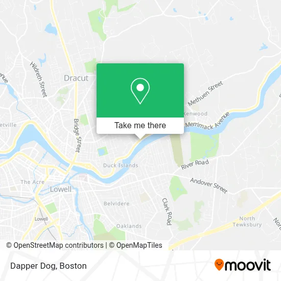
See Dapper Dog, Boston, on the map
Public Transit to Dapper Dog in Boston
Wondering how to get to Dapper Dog in Boston? Moovit helps you find the best way to get to Dapper Dog with step-by-step directions from the nearest public transit station.
Moovit provides free maps and live directions to help you navigate through your city. View schedules, routes, timetables, and find out how long does it take to get to Dapper Dog in real time.
Looking for the nearest stop or station to Dapper Dog? Check out this list of stops closest to your destination: River Rd & Burnham Rd.
Bus: 12, 24, 2.
Want to see if there’s another route that gets you there at an earlier time? Moovit helps you find alternative routes or times. Get directions from and directions to Dapper Dog easily from the Moovit App or Website.
We make riding to Dapper Dog easy, which is why over 1.7 million users, including users in Boston, trust Moovit as the best app for public transit. You don’t need to download an individual bus app or train app, Moovit is your all-in-one transit app that helps you find the best bus time or train time available.
For information on prices of bus, costs and ride fares to Dapper Dog, please check the Moovit app.
Use the app to navigate to popular places including to the airport, hospital, stadium, grocery store, mall, coffee shop, school, college, and university.
Dapper Dog Address: 189 Merrimack Ave street in Boston
- Currier Construction,
- Ri Associates,
- Pool 5,
- Accurate Painting & General Contractor,
- Rourke's Cabana,
- Napa Auto Parts,
- J & M Renovation,
- Darren Laquidara,
- George McDermott Reservoir,
- Hart Norman E,
- National Life Insurance,
- The Living Room,
- Ben Hall Masterson Memorial Fund,
- St Johns Rectory,
- Ralph Acbrecht,
- Baobab Construction & Carpentry,
- Omega Power Washing Pros,
- WM Fountain,
- Tiny Hearts Family Daycare,
- Not Your Average Telegram
Places Near Dapper Dog (Boston)
- Faneuil Hall, Boston,
- Boston Medical Center, Boston,
- Museum Of Science, Boston,
- Td Garden, Boston,
- Castle Island, Boston,
- Mgm Music Hall, Boston,
- Prudential Center, Boston,
- Leader Bank Pavilion (Leader Bank Pavillion), Boston,
- Boston Children's Hospital, Boston,
- North End, Boston,
- Seaport District, Boston,
- Quincy Market, Boston,
- Cheers, Boston,
- Wang Theater, Boston,
- Isabella Stewart Gardner Museum, Boston,
- Wilbur Theatre, Boston,
- Massachusetts General Hospital, Boston,
- House Of Blues, Boston,
- Boston Common, Boston,
- Boston Convention & Exhibition Center, Boston
How to get to popular places in Boston with public transit
Get around Boston by public transit!
Traveling around Boston has never been so easy. See step by step directions as you travel to any attraction, street or major public transit station. View bus and train schedules, arrival times, service alerts and detailed routes on a map, so you know exactly how to get to anywhere in Boston.
When traveling to any destination around Boston use Moovit's Live Directions with Get Off Notifications to know exactly where and how far to walk, how long to wait for your line, and how many stops are left. Moovit will alert you when it's time to get off — no need to constantly re-check whether yours is the next stop.
Wondering how to use public transit in Boston or how to pay for public transit in Boston? Moovit public transit app can help you navigate your way with public transit easily, and at minimum cost. It includes public transit fees, ticket prices, and costs. Looking for a map of Boston public transit lines? Moovit public transit app shows all public transit maps in Boston with all Bus, Train, Subway and Ferry routes and stops on an interactive map.
Boston has 4 transit type(s), including: Bus, Train, Subway and Ferry, operated by several transit agencies, including MBTA, Southeastern Regional Transit Authority, MetroWest Regional Transit Authority, Rhode Island Public Transit Authority, WRTA, Lowell Regional Transit Authority, Merrimack Valley Transit, Montachusett Regional Transit Authority, Cape Cod Regional Transit Authority, Brockton Area Transit Authority, Martha's Vineyard Transit Authority, the WAVE - Nantucket Regional Transit Authority, GATRA, Cape Ann Transportation Authority and Massport