Directions to Datos (San Andrés Cholula) with public transportation
The following transit lines have routes that pass near Datos
 Bus: A3 - A, A6 - A, A9, RUTA 5, RUTA 53 SUR.
How to get to Datos by bus?
Click on the bus route to see step by step directions with maps, line arrival times and updated time schedules.
From Texcoco, Puebla
48 minFrom LIBERTAD, Puebla
29 minFrom PARQUE DEL CENTENARIO LAGUNA DE CHAPULCO, Ocoyucan
45 minFrom Torre Chiapas, San Gregorio Atzompa
30 minFrom Santa Clara, Puebla
49 minFrom Fraccionamiento Bosques del Pilar, Puebla
49 minFrom Academia de Seguridad Pública Municipal, Puebla
49 minFrom Conjunto Habitacional La Guadalupana, Puebla
58 minFrom Instituto Nacional De Astrofísica, Óptica Y Electrónica (Inaoe), San Jerónimo Tecuanipan
45 minFrom San Cosme Mazatecoxco, San Pedro Cholula
40 min
Bus stops near Datos in San Andrés Cholula
Bus lines to Datos in San Andrés Cholula
- A3 - A, Tonanzintla,VIEW
- RUTA 53 SUR, Ramal 1, Tepeyac - Barrio Del Alto,VIEW
- RUTA 61, Ramal 1, Galaxia Bosques De Manzanilla - La Noria,VIEW
- RUTA MALACATEPEC A, Ramal 2, Fco. Sarabia - Centro,VIEW
- RUTA MALACATEPEC B, Ramal 1, Santiago Coltzingo - Puebla,VIEW
- A2 - A, Centro - T. Tlaxcalancingo - Santa Clara Ocoyucan,VIEW
- TRANSPORTE NOCTURNO, Paseo Bravo - La María,VIEW
- RUTA 53N, Ramal 1, Malintzi - La Providencia,VIEW
- RUTA 5, Ramal La Joya - Ex Rancho Colorado (Ida),VIEW
- TRANSPORTE NOCTURNO, Paseo Bravo - Central De Abasto,VIEW
- RUTA MALACATEPEC, Ramal Malacatepec - Puebla (Circuito),VIEW
- RUTA PORTES GIL, Ruta Portes Gil - Ocoyucan - Puebla (Circuito),VIEW
- RUTA PUEBLA, Ramal Puebla - Izucar De Matamoros,VIEW
- A6, Estadios,VIEW
- A6 - A, Ciudad Judicial - Estadios,VIEW
What are the closest stations to Datos?
The closest stations to Datos are:
- Avenida 9 Poniente, 2901 is 20 meters away, 1 min walk.
- Calle 29 Sur, 724 is 35 meters away, 1 min walk.
- Juarez-29 Sur is 173 meters away, 3 min walk.
- Chipilo, Lb is 305 meters away, 4 min walk.
- Avenida Juarez-Blvrd. Atlixco is 330 meters away, 5 min walk.
- Boulevard Atlixco, 42 is 337 meters away, 5 min walk.
Which bus lines stop near Datos?
These bus lines stop near Datos: A3 - A, A6 - A, A9, RUTA 5, RUTA 53 SUR, RUTA 53N, RUTA 61.
What’s the nearest bus station to Datos in San Andrés Cholula?
The nearest bus stations to Datos in San Andrés Cholula are Avenida 9 Poniente, 2901 and Calle 29 Sur, 724. The closest one is a 1 min walk away.
What time is the first bus to Datos in San Andrés Cholula?
The TRANSPORTE NOCTURNO is the first bus that goes to Datos in San Andrés Cholula. It stops nearby at 3:04 AM.
What time is the last bus to Datos in San Andrés Cholula?
The TRANSPORTE NOCTURNO is the last bus that goes to Datos in San Andrés Cholula. It stops nearby at 2:05 AM.
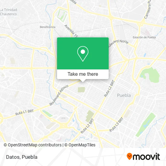
See Datos, San Andrés Cholula, on the map
Public Transit to Datos in San Andrés Cholula
Wondering how to get to Datos in San Andrés Cholula? Moovit helps you find the best way to get to Datos with step-by-step directions from the nearest public transit station.
Moovit provides free maps and live directions to help you navigate through your city. View schedules, routes, timetables, and find out how long does it take to get to Datos in real time.
Looking for the nearest stop or station to Datos? Check out this list of stops closest to your destination: Avenida 9 Poniente; Calle 29 Sur; Juarez-29 Sur; Chipilo; Avenida Juarez-Blvrd. Atlixco; Boulevard Atlixco.
Bus: A3 - A, A6 - A, A9, RUTA 5, RUTA 53 SUR, RUTA 53N, RUTA 61, RUTA MALACATEPEC A, RUTA MALACATEPEC B, A2 - A, TRANSPORTE NOCTURNO, TRANSPORTE NOCTURNO.
Want to see if there’s another route that gets you there at an earlier time? Moovit helps you find alternative routes or times. Get directions from and directions to Datos easily from the Moovit App or Website.
We make riding to Datos easy, which is why over 1.5 million users, including users in San Andrés Cholula, trust Moovit as the best app for public transit. You don’t need to download an individual bus app or train app, Moovit is your all-in-one transit app that helps you find the best bus time or train time available.
For information on prices of bus, costs and ride fares to Datos, please check the Moovit app.
Use the app to navigate to popular places including to the airport, hospital, stadium, grocery store, mall, coffee shop, school, college, and university.
Datos Address: Calle 29 Sur 721, La Paz, 72160 Puebla, Puebla street in San Andrés Cholula
- Syscom Puebla,
- Notaría Pública No 28,
- Soluciones en Computo y Telecomunicaciones,
- Delegacion Sur del IMSS,
- TLA Institute "Escuela de Repostería",
- Macaria Gastronomía de Mercado,
- Uvm,
- Fundación Colegio Americano de Puebla,
- El Negro Mandingo,
- Dra. Mayra Moreno,
- Consultorio Dental y Ortodoncia Petrilli,
- Huwon Restaurante Coreano,
- Papeleria Liberato,
- Papeleria y Snacks Paper,
- Colegio Americano de Puebla,
- Mentor Of the Million Institute,
- Consultorio Oculista,
- Comunicación Aromática,
- Clases de Ingles,
- La Estancia Argentina
Places Near Datos (San Andrés Cholula)
- Secretaria de Finanzas, Puebla,
- 25 Zona Militar, Puebla,
- Tres Cruces, Puebla,
- Ciudad Universitaria, Puebla,
- Plaza Dorada Centro Comercial, Puebla,
- Plaza Las Animas, Puebla,
- SAT, San Andrés Cholula,
- Hospital General Regional 36 IMSS San Alejandro, San Andrés Cholula,
- Parque Ecologico, Pue., San Andrés Cholula,
- Centro Integral de Servicios CIS, San Andrés Cholula,
- Galerías Serdán, San Pedro Cholula,
- Complejo Cultural Universitario, Ocoyucan,
- Estadio Cuauhtémoc, Puebla,
- Hospital Imss La Margarita, Puebla,
- Zona de los Fuertes, Puebla,
- Hospital Traumatología y Ortopedia de Puebla, San Pedro Cholula,
- Ciudad Judicial del Estado de Puebla, San Andrés Cholula,
- Parque Puebla, Puebla,
- Centro de Desarrollo Comunitario Tres Cruces, Puebla,
- Centro Comercial Angelópolis, San Andrés Cholula
How to get to popular places in Puebla with public transit
Get around San Andrés Cholula by public transit!
Traveling around San Andrés Cholula has never been so easy. See step by step directions as you travel to any attraction, street or major public transit station. View bus and train schedules, arrival times, service alerts and detailed routes on a map, so you know exactly how to get to anywhere in San Andrés Cholula.
When traveling to any destination around San Andrés Cholula use Moovit's Live Directions with Get Off Notifications to know exactly where and how far to walk, how long to wait for your line, and how many stops are left. Moovit will alert you when it's time to get off — no need to constantly re-check whether yours is the next stop.
Wondering how to use public transit in San Andrés Cholula or how to pay for public transit in San Andrés Cholula? Moovit public transit app can help you navigate your way with public transit easily, and at minimum cost. It includes public transit fees, ticket prices, and costs. Looking for a map of San Andrés Cholula public transit lines? Moovit public transit app shows all public transit maps in San Andrés Cholula with all bus routes and stops on an interactive map.
Puebla has 1 transit type(s), including: bus, operated by several transit agencies, including RUTA, RUTA Alimentadoras, Rutas Convencionales and Líneas temporales