Directions to Deadmans Island Park (Halifax Armdale) with public transportation
The following transit lines have routes that pass near Deadmans Island Park
How to get to Deadmans Island Park by bus?
Click on the bus route to see step by step directions with maps, line arrival times and updated time schedules.
Bus stations near Deadmans Island Park in Halifax Armdale
- Purcells Cove Rd After Ramsgate Ln (8099), 3 min walk,
- Herring Cove Rd at Winchester Ave (6906), 7 min walk,
- Cowie Hill Rd Before Margate Dr (6514), 8 min walk,
Bus lines to Deadmans Island Park in Halifax Armdale
- 25, Mumford Terminal,
- 415, 415 Purcells Cove,
- 9A, 9a Greystone- Fotherby Via Mumford,
- 9B, 9b Herring Cove Via Mumford Terminal,
- 127, 127 Express To Scotia Square,
- 24, 24 Leiblin Park Via Mumford Term,
What are the closest stations to Deadmans Island Park?
The closest stations to Deadmans Island Park are:
- Purcells Cove Rd After Ramsgate Ln (8099) is 212 meters away, 3 min walk.
- Herring Cove Rd at Winchester Ave (6906) is 480 meters away, 7 min walk.
- Cowie Hill Rd Before Margate Dr (6514) is 575 meters away, 8 min walk.
Which bus lines stop near Deadmans Island Park?
These bus lines stop near Deadmans Island Park: 25, 415, 9A.
What’s the nearest bus stop to Deadmans Island Park in Halifax Armdale?
The nearest bus stop to Deadmans Island Park in Halifax Armdale is Purcells Cove Rd After Ramsgate Ln (8099). It’s a 3 min walk away.
What time is the first bus to Deadmans Island Park in Halifax Armdale?
The 9B is the first bus that goes to Deadmans Island Park in Halifax Armdale. It stops nearby at 5:37 AM.
What time is the last bus to Deadmans Island Park in Halifax Armdale?
The 9B is the last bus that goes to Deadmans Island Park in Halifax Armdale. It stops nearby at 1:31 AM.
See Deadmans Island Park, Halifax Armdale, on the map
Public Transit to Deadmans Island Park in Halifax Armdale
Wondering how to get to Deadmans Island Park in Halifax Armdale, Canada? Moovit helps you find the best way to get to Deadmans Island Park with step-by-step directions from the nearest public transit station.
Moovit provides free maps and live directions to help you navigate through your city. View schedules, routes, timetables, and find out how long does it take to get to Deadmans Island Park in real time.
Looking for the nearest stop or station to Deadmans Island Park? Check out this list of stops closest to your destination: Purcells Cove Rd After Ramsgate Ln (8099); Herring Cove Rd at Winchester Ave (6906); Cowie Hill Rd Before Margate Dr (6514).
Bus: 25, 415, 9A, 9B, 127, 24.
Want to see if there’s another route that gets you there at an earlier time? Moovit helps you find alternative routes or times. Get directions from and directions to Deadmans Island Park easily from the Moovit App or Website.
We make riding to Deadmans Island Park easy, which is why over 1.5 million users, including users in Halifax Armdale, trust Moovit as the best app for public transit. You don’t need to download an individual bus app or train app, Moovit is your all-in-one transit app that helps you find the best bus time or train time available.
For information on prices of bus, costs and ride fares to Deadmans Island Park, please check the Moovit app.
Use the app to navigate to popular places including to the airport, hospital, stadium, grocery store, mall, coffee shop, school, college, and university.
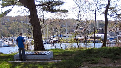
Deadmans Island Park Address: Cedarbank Terrace street in Halifax Armdale
Attractions near Deadmans Island Park
Arborstone Enhanced Care,Nusong Studio,Spinnakers Restaurant,Brairwood Golf Course,Dingle Tower,Jubilee Road Boat Launch,Melville Heights,Regatta Point Playground,Melville Heights Retirement Residence,Melville Heights Beauty Salon,Nova Life Homes,Takeya Japanese Acupuncture,Regatta Point Walkway,Marshall Consulting,Vivo Music Studio,Ecole John W Mcleod Fleming Tower School,Mont Blanc Anchor Memorial Halifax,Melville Lodge,Perfect Spot by Mark Tambal,Herring Cove RD After Brighton Ave (6850)How to get to popular attractions in Halifax Armdale with public transit
Naughty Paw, Halifax Chebucto,Kalisimbi Shop, Fairview-Clayton Park,Spryfield Lions Club Arena, Halifax Atlantic,Point Pleasant Park, Halifax Citadel-Sable Island,McNabs Island Ferry, Cole Harbour-Eastern Passage,Five Island Lake, Timberlea-Prospect,North End Dartmouth, Dartmouth North,Chebucto RD Before Connolly St (6405), Halifax Chebucto,Ultramar Pipeline Cardlock, Dartmouth North,Dartmouth Shopping Centre, Dartmouth North,Belle Vista Dr After Spring Ave (6294), Dartmouth East,Rainbow Gate, Halifax Needham,Parkway Management and Construction Services, Halifax Chebucto,102 HWY Exit 4A, Bedford,West Bedford Park And Ride, Bedford,60 Baker Drive, Dartmouth South,Wheaton's, Sackville-Cobequid,Harbour City Homes-Halifax Non-Profit Housing, Halifax Needham,Ragged Lake Blvd After Prospect RD (8807), Timberlea-Prospect,Concentrix, Dartmouth NorthGet around Halifax by public transit!
Traveling around Halifax has never been so easy. See step by step directions as you travel to any attraction, street or major public transit station. View bus and train schedules, arrival times, service alerts and detailed routes on a map, so you know exactly how to get to anywhere in Halifax.
When traveling to any destination around Halifax use Moovit's Live Directions with Get Off Notifications to know exactly where and how far to walk, how long to wait for your line, and how many stops are left. Moovit will alert you when it's time to get off — no need to constantly re-check whether yours is the next stop.
Wondering how to use public transit in Halifax or how to pay for public transit in Halifax? Moovit public transit app can help you navigate your way with public transit easily, and at minimum cost. It includes public transit fees, ticket prices, and costs. Looking for a map of Halifax public transit lines? Moovit public transit app shows all public transit maps in Halifax with all Bus and Ferry routes and stops on an interactive map.
Halifax has 2 transit type(s), including: Bus and Ferry, operated by several transit agencies, including Halifax Transit