Directions to Delio (Newton) with public transportation
The following transit lines have routes that pass near Delio
 Bus: 504, 558, 57, 59, 71.
- Train: FITCHBURG, FRAMINGHAM/WORCESTER.
- Subway: GREEN LINE B.
How to get to Delio by bus?
Click on the bus route to see step by step directions with maps, line arrival times and updated time schedules.
From Kimpton Marlowe Hotel, Cambridge
72 minFrom Joseph B Martin Conference Center, Boston
63 minFrom The Cheesecake Factory, Boston
36 minFrom Westin Copley Place Hotel Boston, Boston
35 minFrom Wentworth Institute Of Technology, Boston
43 minFrom Arnold Arboretum, Boston
80 minFrom Assembly Square, Somerville
89 minFrom HJB, Boston
38 minFrom The Westin Copley Place, Boston, Boston
35 minFrom Charles River, Boston
58 min
How to get to Delio by train?
Click on the train route to see step by step directions with maps, line arrival times and updated time schedules.
From Kimpton Marlowe Hotel, Cambridge
85 minFrom Joseph B Martin Conference Center, Boston
59 minFrom The Cheesecake Factory, Boston
56 minFrom Westin Copley Place Hotel Boston, Boston
51 minFrom Wentworth Institute Of Technology, Boston
60 minFrom Arnold Arboretum, Boston
150 minFrom HJB, Boston
61 minFrom The Westin Copley Place, Boston, Boston
51 minFrom Charles River, Boston
89 min
Bus stop near Delio in Newton
- Watertown St @ Chapel St, 3 min walk,VIEW
Subway station near Delio in Newton
- Boston College, 58 min walk,VIEW
What are the closest stations to Delio?
The closest stations to Delio are:
- Watertown St @ Chapel St is 230 yards away, 3 min walk.
- Newtonville is 954 yards away, 12 min walk.
- Waverley is 3560 yards away, 43 min walk.
- Boston College is 4855 yards away, 58 min walk.
Which bus lines stop near Delio?
These bus lines stop near Delio: 504, 558, 57, 59, 71.
Which train lines stop near Delio?
These train lines stop near Delio: FITCHBURG, FRAMINGHAM/WORCESTER.
What’s the nearest train station to Delio in Newton?
The nearest train station to Delio in Newton is Newtonville. It’s a 12 min walk away.
What’s the nearest bus station to Delio in Newton?
The nearest bus station to Delio in Newton is Watertown St @ Chapel St. It’s a 3 min walk away.
What time is the first subway to Delio in Newton?
The GREEN LINE B is the first subway that goes to Delio in Newton. It stops nearby at 5:01 AM.
What time is the last subway to Delio in Newton?
The GREEN LINE B is the last subway that goes to Delio in Newton. It stops nearby at 2:39 AM.
What time is the first train to Delio in Newton?
The FRAMINGHAM/WORCESTER is the first train that goes to Delio in Newton. It stops nearby at 5:22 AM.
What time is the last train to Delio in Newton?
The FRAMINGHAM/WORCESTER is the last train that goes to Delio in Newton. It stops nearby at 12:20 AM.
What time is the first bus to Delio in Newton?
The 59 is the first bus that goes to Delio in Newton. It stops nearby at 6:07 AM.
What time is the last bus to Delio in Newton?
The 59 is the last bus that goes to Delio in Newton. It stops nearby at 8:20 PM.
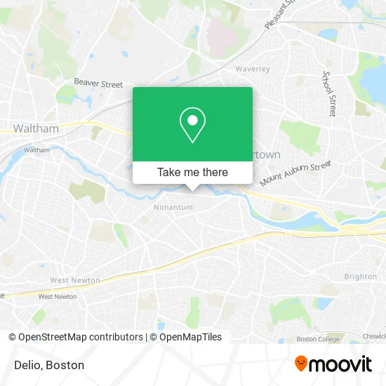
See Delio, Newton, on the map
Public Transit to Delio in Newton
Wondering how to get to Delio in Newton? Moovit helps you find the best way to get to Delio with step-by-step directions from the nearest public transit station.
Moovit provides free maps and live directions to help you navigate through your city. View schedules, routes, timetables, and find out how long does it take to get to Delio in real time.
Looking for the nearest stop or station to Delio? Check out this list of stops closest to your destination: Watertown St @ Chapel St; Newtonville; Waverley; Boston College.
Bus: 504, 558, 57, 59, 71.Train: FITCHBURG, FRAMINGHAM/WORCESTER.Subway: GREEN LINE B.
Want to see if there’s another route that gets you there at an earlier time? Moovit helps you find alternative routes or times. Get directions from and directions to Delio easily from the Moovit App or Website.
We make riding to Delio easy, which is why over 1.7 million users, including users in Newton, trust Moovit as the best app for public transit. You don’t need to download an individual bus app or train app, Moovit is your all-in-one transit app that helps you find the best bus time or train time available.
For information on prices of bus, subway and train, costs and ride fares to Delio, please check the Moovit app.
Use the app to navigate to popular places including to the airport, hospital, stadium, grocery store, mall, coffee shop, school, college, and university.
Delio Address: 227 California St Newton, MA 02458 street in Newton
- Signs by Tomorrow,
- Coppola Studios,
- Turtle Studios Newton,
- Nerd Central,
- Modera Newton,
- The Pappas Company,
- Launch Watertown,
- Cyprotex US,
- USPS Collection Box - Blue Box,
- D and V Realty,
- Exergen Corporation,
- Audio Spotlight by Holosonics,
- Nzuko - Watertown,
- Spindrift Beverage Co (Spindrift Sparkling Water),
- Nonantum,
- Central Rock,
- Mariann Burke Psychotherapy,
- ATM,
- Narinian,
- Clark Reid Co Incorporated Watertown
Places Near Delio (Newton)
- House Of Blues, Boston,
- Isabella Stewart Gardner Museum, Boston,
- North End, Boston,
- Prudential Center, Boston,
- Td Garden, Boston,
- Mgm Music Hall, Boston,
- Wilbur Theatre, Boston,
- Boston Common, Boston,
- Boston Medical Center, Boston,
- Boston Children's Hospital, Boston,
- Wang Theater, Boston,
- Massachusetts General Hospital, Boston,
- Castle Island, Boston,
- Faneuil Hall, Boston,
- Boston Convention & Exhibition Center, Boston,
- Seaport District, Boston,
- Cheers, Boston,
- Museum Of Science, Boston,
- Quincy Market, Boston,
- Leader Bank Pavilion (Leader Bank Pavillion), Boston
How to get to popular places in Boston with public transit
Get around Newton by public transit!
Traveling around Newton has never been so easy. See step by step directions as you travel to any attraction, street or major public transit station. View bus and train schedules, arrival times, service alerts and detailed routes on a map, so you know exactly how to get to anywhere in Newton.
When traveling to any destination around Newton use Moovit's Live Directions with Get Off Notifications to know exactly where and how far to walk, how long to wait for your line, and how many stops are left. Moovit will alert you when it's time to get off — no need to constantly re-check whether yours is the next stop.
Wondering how to use public transit in Newton or how to pay for public transit in Newton? Moovit public transit app can help you navigate your way with public transit easily, and at minimum cost. It includes public transit fees, ticket prices, and costs. Looking for a map of Newton public transit lines? Moovit public transit app shows all public transit maps in Newton with all Bus, Train, Subway and Ferry routes and stops on an interactive map.
Boston has 4 transit type(s), including: Bus, Train, Subway and Ferry, operated by several transit agencies, including MBTA, Southeastern Regional Transit Authority, MetroWest Regional Transit Authority, Rhode Island Public Transit Authority, WRTA, Lowell Regional Transit Authority, Merrimack Valley Transit, Montachusett Regional Transit Authority, Cape Cod Regional Transit Authority, Brockton Area Transit Authority, Martha's Vineyard Transit Authority, the WAVE - Nantucket Regional Transit Authority, GATRA, Cape Ann Transportation Authority and Massport