See Denny Centre, Seattle, on the map
Directions to Denny Centre (Seattle) with public transportation
The following transit lines have routes that pass near Denny Centre
 Bus:
Bus:
How to get to Denny Centre by bus?
Click on the bus route to see step by step directions with maps, line arrival times and updated time schedules.
Light Rail stations near Denny Centre in Seattle
- Westlake Ave & 7th Ave,2 min walk,
Bus stations near Denny Centre in Seattle
- Fairview Ave N & Thomas St,3 min walk,
- 9th & Virginia,3 min walk,
- Denny Way & Stewart St,4 min walk,
- Stewart St & 9th Ave,4 min walk,
- Howell St & Minor Ave,5 min walk,
- Westlake & 9th-Denny,5 min walk,
Bus lines to Denny Centre in Seattle
- 70,U-District Station Eastlake,
- CIRCULATOR,Downtown Circulator Bus,
- 577,Federal Way,
- 578,Puyallup Via Federal Way,
- 8,Seattle Center,
- 218,Issaquah Highlands - Downtown Seattle,
- 257,Brickyard P&R - Downtown Seattle,
- 311,Woodinville - Downtown Seattle,
- 545,Redmond - Seattle,
- 402,Lynnwood - Seattle,
- 405,Edmonds P&R - Seattle,
- 410,Mariner P&R - Seattle,
- 412,Silver Firs - Seattle,
- 413,Swamp Creek P&R - Seattle,
- 415,North Lynnwood - Seattle,
- 416,Edmonds - Seattle,
- 417,Mukilteo - Seattle,
- 421,Marysville - Seattle,
- 422,Stanwood - Seattle,
- 424,Snohomish - Seattle,
What are the closest stations to Denny Centre?
The closest stations to Denny Centre are:
- Westlake Ave & 7th Ave is 124 yards away, 2 min walk.
- Fairview Ave N & Thomas St is 179 yards away, 3 min walk.
- 9th & Virginia is 187 yards away, 3 min walk.
- Denny Way & Stewart St is 259 yards away, 4 min walk.
- Stewart St & 9th Ave is 304 yards away, 4 min walk.
- Howell St & Minor Ave is 334 yards away, 5 min walk.
- Westlake & 9th-Denny is 360 yards away, 5 min walk.
Which bus lines stop near Denny Centre?
These bus lines stop near Denny Centre: 311, 545, 70, 8.
What’s the nearest light rail station to Denny Centre in Seattle?
The nearest light rail station to Denny Centre in Seattle is Westlake Ave & 7th Ave. It’s a 2 min walk away.
What’s the nearest bus stop to Denny Centre in Seattle?
The nearest bus stops to Denny Centre in Seattle are Fairview Ave N & Thomas St and 9th & Virginia. The closest one is a 3 min walk away.
What time is the first light rail to Denny Centre in Seattle?
The SLU is the first light rail that goes to Denny Centre in Seattle. It stops nearby at 5:34 AM.
What time is the last light rail to Denny Centre in Seattle?
The SLU is the last light rail that goes to Denny Centre in Seattle. It stops nearby at 9:33 PM.
What time is the first bus to Denny Centre in Seattle?
The 70 is the first bus that goes to Denny Centre in Seattle. It stops nearby at 3:09 AM.
What time is the last bus to Denny Centre in Seattle?
The 70 is the last bus that goes to Denny Centre in Seattle. It stops nearby at 3:05 AM.
How much is the bus fare to Denny Centre?
The bus fare to Denny Centre costs about $2.75 - $3.25.
See Denny Centre, Seattle, on the map
Public Transit to Denny Centre in Seattle
Wondering how to get to Denny Centre in Seattle, United States? Moovit helps you find the best way to get to Denny Centre with step-by-step directions from the nearest public transit station.
Moovit provides free maps and live directions to help you navigate through your city. View schedules, routes, timetables, and find out how long does it take to get to Denny Centre in real time.
Looking for the nearest stop or station to Denny Centre? Check out this list of stops closest to your destination: Westlake Ave & 7th Ave; Fairview Ave N & Thomas St; 9th & Virginia; Denny Way & Stewart St; Stewart St & 9th Ave; Howell St & Minor Ave; Westlake & 9th-Denny.
Bus:
Want to see if there’s another route that gets you there at an earlier time? Moovit helps you find alternative routes or times. Get directions from and directions to Denny Centre easily from the Moovit App or Website.
We make riding to Denny Centre easy, which is why over 1.5 million users, including users in Seattle, trust Moovit as the best app for public transit. You don’t need to download an individual bus app or train app, Moovit is your all-in-one transit app that helps you find the best bus time or train time available.
For information on prices of bus, costs and ride fares to Denny Centre, please check the Moovit app.
Use the app to navigate to popular places including to the airport, hospital, stadium, grocery store, mall, coffee shop, school, college, and university.
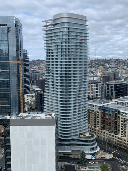
Denny Centre Address: Denny Way street in Seattle
Attractions near Denny Centre
Denny Way & Fairview Ave N,Mirabella Retirement,Mirabella Seattle,Onni South Lake Union,Slu Dental Group,Packetdrivers It Outsourcing,116 Fairview Avenue North,Crosstown Metal Industries ,Cornish College Of The Arts,Mighty O Donuts,Amazon-Kumo,Credit Union 1,Amazon-Low Flying Hawk,Aws,Amazon-Sea81,Amazon-Oscar,Seattle's Best Karaoke (Seattles Best Karaoke),Level 3 Communications (Level 3 Seattle Gateway),Garage Door Repair and Gate Seattle,High End AC Installation SpecialistHow to get to popular attractions in Seattle with public transit
Walmart Supercenter, Lakewood,Downtown Olympia, Olympia,Space Needle, Seattle,Downtown Tacoma, Tacoma,Walmart Supercenter, Puyallup,City of SeaTac, Seatac,Costco Wholesale, Everett,VA Hospital American Lake Bldg 81, North Fort Lewis,Safeway, Seattle,Bellevue Square, Bellevue,I90, Bellevue,Microsoft Visitor Center, Redmond,Red Robin Gourmet Burgers, Bothell,Seattle-Tacoma International Airport, Seatac,Sumner Station, Sumner,Virginia Mason Hospital, Seattle,Edmonds Community College, Lynnwood,Walmart Supercenter,Seattle Premium Outlets,Eastgate Freeway Station, BellevueGet around Seattle by public transit!
Traveling around Seattle has never been so easy. See step by step directions as you travel to any attraction, street or major public transit station. View bus and train schedules, arrival times, service alerts and detailed routes on a map, so you know exactly how to get to anywhere in Seattle.
When traveling to any destination around Seattle use Moovit's Live Directions with Get Off Notifications to know exactly where and how far to walk, how long to wait for your line, and how many stops are left. Moovit will alert you when it's time to get off — no need to constantly re-check whether yours is the next stop.
Wondering how to use public transit in Seattle or how to pay for public transit in Seattle? Moovit public transit app can help you navigate your way with public transit easily, and at minimum cost. It includes public transit fees, ticket prices, and costs. Looking for a map of Seattle public transit lines? Moovit public transit app shows all public transit maps in Seattle with all bus routes and stops on an interactive map.
Seattle has 1 transit type(s), including: bus, operated by several transit agencies, including Sound Transit, Seattle Streetcar, Sound Transit, Metro Transit, Metro Transit, Sound Transit, Whatcom Transportation Authority, Mason Transit Authority, Snoqualmie Valley Transportation (SVT), Snoqualmie Valley Transportation, Amtrak, Island Transit, Kitsap Transit, Intercity Transit and Everett Transit