See Des Plaines River Trail on the map
Directions to Des Plaines River Trail with public transportation
The following transit lines have routes that pass near Des Plaines River Trail
 Bus:
Bus: - Train:
How to get to Des Plaines River Trail by bus?
Click on the bus route to see step by step directions with maps, line arrival times and updated time schedules.
How to get to Des Plaines River Trail by train?
Click on the train route to see step by step directions with maps, line arrival times and updated time schedules.
Bus stations near Des Plaines River Trail
- Dee Rd & Emerson St,23 min walk,
- River Rd & River St/Pearson St,35 min walk,
- Miner St & Pearson St,35 min walk,
Train stations near Des Plaines River Trail
- Des Plaines,37 min walk,
Bus lines to Des Plaines River Trail
- 240,Golf Mill Station,
- 234,Dundee Rd & Wolf Rd,
- PULSE DEMPSTER LINE,Pulse Dempster Line,
- 208,Golf Road,
- 209,Busse Highway,
- 226,Oakton Street,
- 250,Dempster Street,
What are the closest stations to Des Plaines River Trail?
The closest stations to Des Plaines River Trail are:
- Dee Rd & Emerson St is 1900 yards away, 23 min walk.
- River Rd & River St/Pearson St is 2911 yards away, 35 min walk.
- Miner St & Pearson St is 2970 yards away, 35 min walk.
- Des Plaines is 3094 yards away, 37 min walk.
Which bus line stops near Des Plaines River Trail?
208
Which train line stops near Des Plaines River Trail?
UP-NW
See Des Plaines River Trail on the map
Public Transportation to Des Plaines River Trail
Wondering how to get to Des Plaines River Trail, United States? Moovit helps you find the best way to get to Des Plaines River Trail with step-by-step directions from the nearest public transit station.
Moovit provides free maps and live directions to help you navigate through your city. View schedules, routes, timetables, and find out how long does it take to get to Des Plaines River Trail in real time.
Looking for the nearest stop or station to Des Plaines River Trail? Check out this list of stops closest to your destination: Dee Rd & Emerson St; River Rd & River St/Pearson St; Miner St & Pearson St; Des Plaines.
Bus:Train:
Want to see if there’s another route that gets you there at an earlier time? Moovit helps you find alternative routes or times. Get directions from and directions to Des Plaines River Trail easily from the Moovit App or Website.
We make riding to Des Plaines River Trail easy, which is why over 1.5 million users, including users in Des Plaines, trust Moovit as the best app for public transit. You don’t need to download an individual bus app or train app, Moovit is your all-in-one transit app that helps you find the best bus time or train time available.
For information on prices of bus and train, costs and ride fares to Des Plaines River Trail, please check the Moovit app.
Use the app to navigate to popular places including to the airport, hospital, stadium, grocery store, mall, coffee shop, school, college, and university.
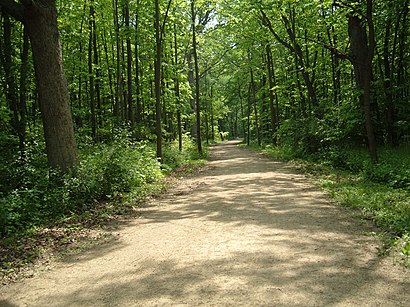
Des Plaines River Trail Address: Des Plaines, IL 60016 street in Des Plaines
Attractions near Des Plaines River Trail
2200 East Golf Road,United Stationers Inc,Golf Road,West Golf Road,E Golf Rd / Des Plaines River Trail,building • G,E Golf Rd / E River Rd,Lake County Fairgrounds,21 E River Rd,Big Bend Lake Picnic Shelter Grove 1,N East River Rd,Golf Rd & East River Rd / Bender Dr,Toll Plaza 28,2111 Golf Road,Big Bend Lake,172 E River Rd,90 S East River Rd,2111 E Golf Rd,183 East River Road,Golf Road Toll PlazaHow to get to popular attractions in Des Plaines with public transit
Elgin O'Hare Expressway, Itasca,Hala Kahiki Tiki Bar & Lounge, River Grove,Metra - Lake Forest, Lake Forest,Metra - Itasca, Itasca,River Grove, River Grove,120 S. LaSalle St., Chicago,Chicago Ridge Mall, Chicago Ridge,Intersection of Algonquin Road & Illinois Route 53, Rolling Meadows,Marian Catholic High School, Chicago Heights,Palos Heights, IL,Chicago Marriott Southwest at Burr Ridge, Burr Ridge,200 W Adams, Chicago,Jewel-Osco,Sabri Nihari, Chicago,Garrett Popcorn Shops, Chicago,Downtown La Grange, La Grange,Metra - 211th Street (Lincoln Highway), Olympia Fields,Portage Park Neighborhood, Chicago,1350 North Lake Shore Drive Apartments, Chicago,Metra - 55th / 56th / 57th St, ChicagoGet around Des Plaines by public transit!
Traveling around Des Plaines has never been so easy. See step by step directions as you travel to any attraction, street or major public transit station. View bus and train schedules, arrival times, service alerts and detailed routes on a map, so you know exactly how to get to anywhere in Des Plaines.
When traveling to any destination around Des Plaines use Moovit's Live Directions with Get Off Notifications to know exactly where and how far to walk, how long to wait for your line, and how many stops are left. Moovit will alert you when it's time to get off — no need to constantly re-check whether yours is the next stop.
Wondering how to use public transit in Des Plaines or how to pay for public transit in Des Plaines? Moovit public transit app can help you navigate your way with public transit easily, and at minimum cost. It includes public transit fees, ticket prices, and costs. Looking for a map of Des Plaines public transit lines? Moovit public transit app shows all public transit maps in Des Plaines with all bus or train routes and stops on an interactive map.
Des Plaines has 2 transit type(s), including: bus or train, operated by several transit agencies, including CTA 'L', Metra, Northern Indiana Commuter Transportation District, CTA, PACE, O'Hare International Airport Shuttle Bus, Gary Public Transit, Amtrak, River Valley Metro, Valpo Transit, DeKalb Public Transit, FlixBus-us, Greyhound-us, Van Galder (Coach USA) and Wisconsin Coach Lines