See Desert Breeze Park, Spring Valley, on the map
Directions to Desert Breeze Park (Spring Valley) with public transportation
The following transit lines have routes that pass near Desert Breeze Park
 Bus:
Bus:
How to get to Desert Breeze Park by bus?
Click on the bus route to see step by step directions with maps, line arrival times and updated time schedules.
Bus stations near Desert Breeze Park in Spring Valley
- Eb Spring Mountain After Cimarron,3 min walk,
- Sb Durango After Desert Inn,10 min walk,
Bus lines to Desert Breeze Park in Spring Valley
- 203,203 Lamb Southbound / Desert Inn & Spring Mtn Westbound,
- 121,121 Durango / Buffalo Northbound,
What are the closest stations to Desert Breeze Park?
The closest stations to Desert Breeze Park are:
- Eb Spring Mountain After Cimarron is 172 yards away, 3 min walk.
- Sb Durango After Desert Inn is 774 yards away, 10 min walk.
Which bus lines stop near Desert Breeze Park?
These bus lines stop near Desert Breeze Park: 121, 203.
What’s the nearest bus stop to Desert Breeze Park in Spring Valley?
The nearest bus stop to Desert Breeze Park in Spring Valley is Eb Spring Mountain After Cimarron. It’s a 3 min walk away.
What time is the first bus to Desert Breeze Park in Spring Valley?
The 203 is the first bus that goes to Desert Breeze Park in Spring Valley. It stops nearby at 3:55 AM.
What time is the last bus to Desert Breeze Park in Spring Valley?
The 203 is the last bus that goes to Desert Breeze Park in Spring Valley. It stops nearby at 1:44 AM.
See Desert Breeze Park, Spring Valley, on the map
Public Transit to Desert Breeze Park in Spring Valley
Wondering how to get to Desert Breeze Park in Spring Valley, United States? Moovit helps you find the best way to get to Desert Breeze Park with step-by-step directions from the nearest public transit station.
Moovit provides free maps and live directions to help you navigate through your city. View schedules, routes, timetables, and find out how long does it take to get to Desert Breeze Park in real time.
Looking for the nearest stop or station to Desert Breeze Park? Check out this list of stops closest to your destination: Eb Spring Mountain After Cimarron; Sb Durango After Desert Inn.
Bus:
Want to see if there’s another route that gets you there at an earlier time? Moovit helps you find alternative routes or times. Get directions from and directions to Desert Breeze Park easily from the Moovit App or Website.
We make riding to Desert Breeze Park easy, which is why over 1.5 million users, including users in Spring Valley, trust Moovit as the best app for public transit. You don’t need to download an individual bus app or train app, Moovit is your all-in-one transit app that helps you find the best bus time or train time available.
For information on prices of bus, costs and ride fares to Desert Breeze Park, please check the Moovit app.
Use the app to navigate to popular places including to the airport, hospital, stadium, grocery store, mall, coffee shop, school, college, and university.
Desert Breeze Park Address: West Spring Mountain Road street in Spring Valley
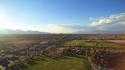
Desert Breeze Park located in Spring Valley, Nevada, is one of the largest parks in the Clark County park system. The regional park is a 240-acre (97 ha) facility that is not fully developed.Wiki
Attractions near Desert Breeze Park
Desert Breeze Park,Clark County Parks & Recreation,Art of Cooking - Las Vegas Catering,The Spot LV,Monti's Smokehouse BBQ,Desert Inn & Durango Commercial,Enational Realty Group,DUNKIN',Pet Health,Teddy Butter House,Teddy Butter House GT Market,98 Cent Super Store, Las Vegas, NV,Tacos by Carmen & Jose 1982,Tacos by Carmen & Jose GT Market,Hoho Crunch,Curry Ya,Halgatteok - Las Vegas,Cheongdam Food Hall,The BX Lee Spa,State FarmHow to get to popular attractions in Spring Valley with public transit
Aria Resort & Casino, Paradise,Red Rock Resort, Summerlin South,Sahara and torrey pines, Spring Valley,Starbucks Coffee Circus Circus, Winchester,Sunset/Annie Oakley, Henderson,Big League Dreams Batting Cages, Las Vegas,95 North And Craig, Las Vegas,Wyndham Desert Blue, Paradise,The Palazzo, Paradise,Target, Las Vegas,Shade Tree Shelter, Las Vegas,Boulevard Mall, Paradise,Sahara And Buffalo, Spring Valley,Desert Rose Adult High School, North Las Vegas,The Meadows Mall, Las Vegas,Skyfall Lounge, Paradise,Red Rock Pavilion Ballroom, Summerlin South,Budget Suites of America North Rancho Drive, Las Vegas,Cheyenne High School, North Las Vegas,The Forum Shops at Caesars, ParadiseGet around Spring Valley by public transit!
Traveling around Spring Valley has never been so easy. See step by step directions as you travel to any attraction, street or major public transit station. View bus and train schedules, arrival times, service alerts and detailed routes on a map, so you know exactly how to get to anywhere in Spring Valley.
When traveling to any destination around Spring Valley use Moovit's Live Directions with Get Off Notifications to know exactly where and how far to walk, how long to wait for your line, and how many stops are left. Moovit will alert you when it's time to get off — no need to constantly re-check whether yours is the next stop.
Wondering how to use public transit in Spring Valley or how to pay for public transit in Spring Valley? Moovit public transit app can help you navigate your way with public transit easily, and at minimum cost. It includes public transit fees, ticket prices, and costs. Looking for a map of Spring Valley public transit lines? Moovit public transit app shows all public transit maps in Spring Valley with all bus routes and stops on an interactive map.
Spring Valley has 1 transit type(s), including: bus, operated by several transit agencies, including RTCSNV, City of Las Vegas, Alvand Transportation, Vegas Airporter, Las Vegas Monorail, Megabus, FlixBus-us and Greyhound-us