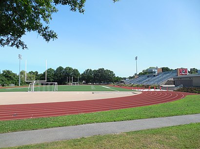
See Dilboy Stadium, Somerville, on the map
Directions to Dilboy Stadium (Somerville) with public transportation
The following transit lines have routes that pass near Dilboy Stadium
 Bus:
Bus: - Train:
- Subway:
How to get to Dilboy Stadium by bus?
Click on the bus route to see step by step directions with maps, line arrival times and updated time schedules.
How to get to Dilboy Stadium by train?
Click on the train route to see step by step directions with maps, line arrival times and updated time schedules.
How to get to Dilboy Stadium by subway?
Click on the subway route to see step by step directions with maps, line arrival times and updated time schedules.
Bus stations near Dilboy Stadium in Somerville
- Broadway Opp Sunnyside Ave,2 min walk,
- Clarendon Hill Busway,3 min walk,
Bus lines to Dilboy Stadium in Somerville
- 87,Arlington Center,
- 88,Lechmere,
- 89,Sullivan,
- 89/93,Haymarket Via Sullivan,
What are the closest stations to Dilboy Stadium?
The closest stations to Dilboy Stadium are:
- Broadway Opp Sunnyside Ave is 112 yards away, 2 min walk.
- Clarendon Hill Busway is 178 yards away, 3 min walk.
Which bus lines stop near Dilboy Stadium?
These bus lines stop near Dilboy Stadium: 87, 89.
Which train line stops near Dilboy Stadium?
LOWELL LINE
Which subway line stops near Dilboy Stadium?
RED LINE
What’s the nearest bus stop to Dilboy Stadium in Somerville?
The nearest bus stop to Dilboy Stadium in Somerville is Broadway Opp Sunnyside Ave. It’s a 2 min walk away.
See Dilboy Stadium, Somerville, on the map
Public Transit to Dilboy Stadium in Somerville
Wondering how to get to Dilboy Stadium in Somerville, United States? Moovit helps you find the best way to get to Dilboy Stadium with step-by-step directions from the nearest public transit station.
Moovit provides free maps and live directions to help you navigate through your city. View schedules, routes, timetables, and find out how long does it take to get to Dilboy Stadium in real time.
Looking for the nearest stop or station to Dilboy Stadium? Check out this list of stops closest to your destination: Broadway Opp Sunnyside Ave; Clarendon Hill Busway.
Bus:Train:Subway:
Want to see if there’s another route that gets you there at an earlier time? Moovit helps you find alternative routes or times. Get directions from and directions to Dilboy Stadium easily from the Moovit App or Website.
We make riding to Dilboy Stadium easy, which is why over 1.5 million users, including users in Somerville, trust Moovit as the best app for public transit. You don’t need to download an individual bus app or train app, Moovit is your all-in-one transit app that helps you find the best bus time or train time available.
For information on prices of bus, subway and train, costs and ride fares to Dilboy Stadium, please check the Moovit app.
Use the app to navigate to popular places including to the airport, hospital, stadium, grocery store, mall, coffee shop, school, college, and university.
Location: Somerville, Boston
Attractions near Dilboy Stadium
Redbox,MBTA Bus Route 194,1372 Broadway,# 1B,Foodmaster Super Markets,Stop & Shop (Stop Shop Store),Stop Shop Store,Styled by Dawn,Coinstar,Clarendon Hill Towers Apartments,Clarendon Hill Towers Apartments (Claredon Hill Towers),Jim S Landscaping,Alewife Brook Pkwy,Somerville Housing Authority,Clarendon Hill Towers Tenants Assoc,2443 Massachusetts Ave,Contan Discount Liquors,Locksmith Somerville Commercial,Spectrum Shelter Care,Shortstop IncHow to get to popular attractions in Somerville with public transit
South Bay Mall, Boston,Dave & Buster's,Staples Corporate HQ, Framingham,Bridgewater, MA, Bridgewater,Hooters, Saugus,Bell In Hand Tavern, Boston,Kings Dining & Entertainment - Boston Back Bay, Boston,Bunker Hill Community College, Boston,Windsor Village at Waltham, Waltham,Walmart Supercenter, Worcester,Apple Providence Place,Samuel Adams Brewery, Boston,I-95,MBTA Commuter Rail South Attleboro, Attleboro,La Famiglia Giorgio's, Boston,Inman Square, Cambridge,Southbridge, MA, Southbridge Town,BonChon Chicken, Boston,Douzo, Boston,Five Horses Tavern, SomervilleGet around Somerville by public transit!
Traveling around Somerville has never been so easy. See step by step directions as you travel to any attraction, street or major public transit station. View bus and train schedules, arrival times, service alerts and detailed routes on a map, so you know exactly how to get to anywhere in Somerville.
When traveling to any destination around Somerville use Moovit's Live Directions with Get Off Notifications to know exactly where and how far to walk, how long to wait for your line, and how many stops are left. Moovit will alert you when it's time to get off — no need to constantly re-check whether yours is the next stop.
Wondering how to use public transit in Somerville or how to pay for public transit in Somerville? Moovit public transit app can help you navigate your way with public transit easily, and at minimum cost. It includes public transit fees, ticket prices, and costs. Looking for a map of Somerville public transit lines? Moovit public transit app shows all public transit maps in Somerville with all bus, subway or train routes and stops on an interactive map.
Somerville has 3 transit type(s), including: bus, subway or train, operated by several transit agencies, including MBTA, MBTA, MBTA, Southeastern Regional Transit Authority, MetroWest Regional Transit Authority, Rhode Island Public Transit Authority, WRTA, Lowell Regional Transit Authority, Merrimack Valley Transit, Montachusett Regional Transit Authority, Cape Cod Regional Transit Authority, Brockton Area Transit Authority, Cape Cod Regional Transit Authority, Martha's Vineyard Transit Authority and the WAVE - Nantucket Regional Transit Authority