Directions to Dirty Lettuce (Portland) with public transportation
The following transit lines have routes that pass near Dirty Lettuce
How to get to Dirty Lettuce by bus?
Click on the bus route to see step by step directions with maps, line arrival times and updated time schedules.
Bus stations near Dirty Lettuce in Portland
- NE Fremont & 48th (West), 1 min walk,
- NE 42nd & Fremont (North), 7 min walk,
Light Rail stations near Dirty Lettuce in Portland
- NE 82nd Ave Max Station, 15 min walk,
Streetcar stations near Dirty Lettuce in Portland
- NE 7th & Halsey (South), 63 min walk,
Bus lines to Dirty Lettuce in Portland
- 24, SW Columbia & 18th (East),
- 75, Pier Park (East),
What are the closest stations to Dirty Lettuce?
The closest stations to Dirty Lettuce are:
- NE Fremont & 48th (West) is 52 yards away, 1 min walk.
- NE 42nd & Fremont (North) is 477 yards away, 7 min walk.
- NE 82nd Ave Max Station is 1172 yards away, 15 min walk.
- NE 7th & Halsey (South) is 5339 yards away, 63 min walk.
Which bus lines stop near Dirty Lettuce?
These bus lines stop near Dirty Lettuce: 24, 71, 75.
What’s the nearest light rail station to Dirty Lettuce in Portland?
The nearest light rail station to Dirty Lettuce in Portland is NE 82nd Ave Max Station. It’s a 15 min walk away.
What’s the nearest bus stop to Dirty Lettuce in Portland?
The nearest bus stop to Dirty Lettuce in Portland is NE Fremont & 48th (West). It’s a 1 min walk away.
What time is the first light rail to Dirty Lettuce in Portland?
The GREEN is the first light rail that goes to Dirty Lettuce in Portland. It stops nearby at 3:23 AM.
What time is the last light rail to Dirty Lettuce in Portland?
The BLUE is the last light rail that goes to Dirty Lettuce in Portland. It stops nearby at 1:58 AM.
What time is the first bus to Dirty Lettuce in Portland?
The 75 is the first bus that goes to Dirty Lettuce in Portland. It stops nearby at 5:21 AM.
What time is the last bus to Dirty Lettuce in Portland?
The 75 is the last bus that goes to Dirty Lettuce in Portland. It stops nearby at 1:23 AM.
What time is the first Streetcar to Dirty Lettuce in Portland?
The A is the first Streetcar that goes to Dirty Lettuce in Portland. It stops nearby at 6:20 AM.
What time is the last Streetcar to Dirty Lettuce in Portland?
The A is the last Streetcar that goes to Dirty Lettuce in Portland. It stops nearby at 10:21 PM.
See Dirty Lettuce, Portland, on the map
Public Transit to Dirty Lettuce in Portland
Wondering how to get to Dirty Lettuce in Portland, United States? Moovit helps you find the best way to get to Dirty Lettuce with step-by-step directions from the nearest public transit station.
Moovit provides free maps and live directions to help you navigate through your city. View schedules, routes, timetables, and find out how long does it take to get to Dirty Lettuce in real time.
Looking for the nearest stop or station to Dirty Lettuce? Check out this list of stops closest to your destination: NE Fremont & 48th (West); NE 42nd & Fremont (North); NE 82nd Ave Max Station; NE 7th & Halsey (South).
Bus: 24, 71, 75.Streetcar: A.
Want to see if there’s another route that gets you there at an earlier time? Moovit helps you find alternative routes or times. Get directions from and directions to Dirty Lettuce easily from the Moovit App or Website.
We make riding to Dirty Lettuce easy, which is why over 1.5 million users, including users in Portland, trust Moovit as the best app for public transit. You don’t need to download an individual bus app or train app, Moovit is your all-in-one transit app that helps you find the best bus time or train time available.
For information on prices of bus and light rail, costs and ride fares to Dirty Lettuce, please check the Moovit app.
Use the app to navigate to popular places including to the airport, hospital, stadium, grocery store, mall, coffee shop, school, college, and university.
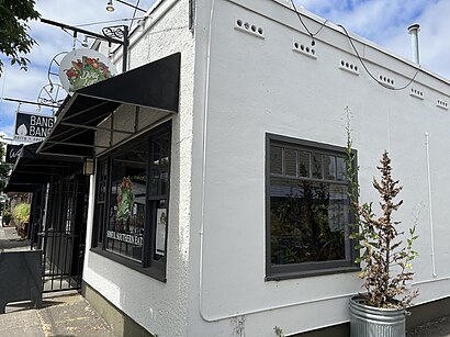
Dirty Lettuce Address: 4727 NE Fremont St Portland, OR 97213 street in Portland
Attractions near Dirty Lettuce
All In One Locksmith Shop,Amalfis,Premiere Property Group,Pip's Original Doughnuts,Pip's Mobile Main,Deeply Rooted,Nacheaux,Defining Image Salon (We See You Image Consultants),Amplitude Design, Inc.,Arcanna,Hey Sugar,Wright & McTaggart,Parecki Counseling,Acupuncturist Wo Borders,Columbia Redevelopment,Equilibrium Massage (Midnight Sun Massage),Three Lanterns Acupuncture (Clear Heart Acupuncture),LMFT MFT Edelstein Bob,Jerome Craig, DC,A la Carte FitnessHow to get to popular attractions in Portland with public transit
TriMet E 162nd Ave MAX Station, Gresham,Oregon City Transit Center, Oregon City,Cedar Mill, Beaverton,Bob's Red Mill Whole Grain Store, Milwaukie,Intel - JF4, Hillsboro,Edith Green-Wendell Wyatt Federal Building, Portland,La Carreta Mexican Restaurant, Portland,Intel - RA3 Cafe, Hillsboro,Johns Landing Water Tower, Portland,TriMet Cascades MAX Station, Portland,Tanasbourne, Hillsboro,Breakside Brewery Slabtown, Portland,Lincoln High School, Portland,Mississippi Pizza Pub, Portland,Irvington Neighborhood, Portland,Lloyd Center / Northeast 11th Avenue, Portland,TriMet Mt Hood Ave MAX Station, Portland,Hazel Dell, Hazel Dell,TriMet SE Powell Blvd MAX Station, Portland,Alphabet District, PortlandGet around Portland, OR by public transit!
Traveling around Portland, OR has never been so easy. See step by step directions as you travel to any attraction, street or major public transit station. View bus and train schedules, arrival times, service alerts and detailed routes on a map, so you know exactly how to get to anywhere in Portland, OR.
When traveling to any destination around Portland, OR use Moovit's Live Directions with Get Off Notifications to know exactly where and how far to walk, how long to wait for your line, and how many stops are left. Moovit will alert you when it's time to get off — no need to constantly re-check whether yours is the next stop.
Wondering how to use public transit in Portland, OR or how to pay for public transit in Portland, OR? Moovit public transit app can help you navigate your way with public transit easily, and at minimum cost. It includes public transit fees, ticket prices, and costs. Looking for a map of Portland, OR public transit lines? Moovit public transit app shows all public transit maps in Portland, OR with all Bus, Train, Light Rail, Ferry, Streetcar and Gondola routes and stops on an interactive map.
Portland, OR has 6 transit type(s), including: Bus, Train, Light Rail, Ferry, Streetcar and Gondola, operated by several transit agencies, including Mount Adams Transportation Service, RiverCities Transit, TriMet , TriMet , TriMet, Portland Streetcar, Portland Aerial Tram, C-TRAN, Multnomah County Job Connector Shuttles, Washington Park Shuttle, SMART, Canby Area Transit, South Clackamas Transportation District, The Wave, Lincoln County Transit