Directions to Discovery District (Toronto) with public transportation
The following transit lines have routes that pass near Discovery District
How to get to Discovery District by bus?
Click on the bus route to see step by step directions with maps, line arrival times and updated time schedules.
How to get to Discovery District by train?
Click on the train route to see step by step directions with maps, line arrival times and updated time schedules.
How to get to Discovery District by subway?
Click on the subway route to see step by step directions with maps, line arrival times and updated time schedules.
Bus stations near Discovery District in Toronto
- University Ave At Gerrard St West, 1 min walk,
- Gerrard St East At University Ave, 2 min walk,
Bus lines to Discovery District in Toronto
- 13B, Elm St at University Ave East Side,
- 13, Eglinton Station,
What are the closest stations to Discovery District?
The closest stations to Discovery District are:
- University Ave At Gerrard St West is 54 meters away, 1 min walk.
- Gerrard St East At University Ave is 67 meters away, 2 min walk.
Which bus lines stop near Discovery District?
These bus lines stop near Discovery District: 142, 5, 505.
Which train lines stop near Discovery District?
These train lines stop near Discovery District: BR, ST, UP.
Which subway line stops near Discovery District?
1
What’s the nearest bus stop to Discovery District in Toronto?
The nearest bus stop to Discovery District in Toronto is University Ave At Gerrard St West. It’s a 1 min walk away.
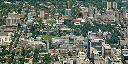
See Discovery District, Toronto, on the map
Public Transit to Discovery District in Toronto
Wondering how to get to Discovery District in Toronto, Canada? Moovit helps you find the best way to get to Discovery District with step-by-step directions from the nearest public transit station.
Moovit provides free maps and live directions to help you navigate through your city. View schedules, routes, timetables, and find out how long does it take to get to Discovery District in real time.
Looking for the nearest stop or station to Discovery District? Check out this list of stops closest to your destination: University Ave At Gerrard St West; Gerrard St East At University Ave.
Bus: 142, 5, 505, 13B, 13.Train: BR, ST, UP.Subway: 1.
Want to see if there’s another route that gets you there at an earlier time? Moovit helps you find alternative routes or times. Get directions from and directions to Discovery District easily from the Moovit App or Website.
We make riding to Discovery District easy, which is why over 1.5 million users, including users in Toronto, trust Moovit as the best app for public transit. You don’t need to download an individual bus app or train app, Moovit is your all-in-one transit app that helps you find the best bus time or train time available.
For information on prices of subway, bus and train, costs and ride fares to Discovery District, please check the Moovit app.
Use the app to navigate to popular places including to the airport, hospital, stadium, grocery store, mall, coffee shop, school, college, and university.
Discovery District Address: Gerrard Street West street in Toronto
Attractions near Discovery District
Mount Sinai Ultrasound Department 5th floor,Blood Clinic,University Avenue & Gerrard Street West,Sick Kids Hospital Farmer's Market,Mount Sinai Hospital - Room 548,Indigo,Rexall Pharma Plus,Rexall,Mt Sinai Medical Imaging,Transplant Clinic, Toronto General Hospital,Bain, J MD,Baker, Gerald DDS,Wolfson, Elie M DDS,Freeman, Jeremy MD,Endodontic Associates,D R Josephson Opticians Ltd,Rosen, Irving B MD,Ontario Mri Image Corp,Hurwitz, J J MD,Feldman, Fredrick MDHow to get to popular attractions in Toronto with public transit
Subway, Brampton,Streetsville GO Station, Mississauga,21 Iceboat Ter, Toronto,Stanley Avenue, Niagara Falls,Bramalea GO Station, Brampton,Princess Of Wales Theatre, Toronto,250 Yonge, Toronto,Scarborough Health Network - Centenary Hospital, Toronto,Long Branch TTC Loop, Toronto,GO Transit Cambridge, Cambridge,600 Sherbourne Street, Toronto,Avenue Road, Toronto,28 Vanley Crescent, Toronto,Vaughan Mills, Vaughan,Roselawn Ave, Toronto,20 Dundas Street West, Toronto,801 Eglinton Avenue West, Toronto,1880 Sismet Road, Mississauga,Hwy 401 at Weston Rd., Toronto,Woodbridge, VaughanGet around Toronto by public transit!
Traveling around Toronto has never been so easy. See step by step directions as you travel to any attraction, street or major public transit station. View bus and train schedules, arrival times, service alerts and detailed routes on a map, so you know exactly how to get to anywhere in Toronto.
When traveling to any destination around Toronto use Moovit's Live Directions with Get Off Notifications to know exactly where and how far to walk, how long to wait for your line, and how many stops are left. Moovit will alert you when it's time to get off — no need to constantly re-check whether yours is the next stop.
Wondering how to use public transit in Toronto or how to pay for public transit in Toronto? Moovit public transit app can help you navigate your way with public transit easily, and at minimum cost. It includes public transit fees, ticket prices, and costs. Looking for a map of Toronto public transit lines? Moovit public transit app shows all public transit maps in Toronto with all Bus, Train, Subway, Streetcar and Ferry routes and stops on an interactive map.
Toronto has 5 transit type(s), including: Bus, Train, Subway, Streetcar and Ferry, operated by several transit agencies, including TTC, TTC Streetcar, Toronto Subway, GO Transit Bus, GO Transit, Amtrak, York Region Transit, Grand River Transit, Guelph Transit, grt, Hamilton Street Railway, MiWay, Brampton Transit, Burlington Transit, Oakville Transit