How to get to Doce Pares Boston by bus?
Click on the bus route to see step by step directions with maps, line arrival times and updated time schedules.
From AMC Theatres, Boston
59 minFrom Home2 Suites-Boston South Bay (Home2 Stes by Hilton Boston S Bay), Boston
57 minFrom Home2 Suites-Boston South Bay, Boston
57 minFrom JFK Library, Boston
73 minFrom Dolphin Day Surgery Waiting Area, Weymouth Town
62 minFrom Hingham, MA, Hingham
60 minFrom Boston Latin Academy, Boston
50 minFrom Milton Academy, Milton
31 minFrom Courtyard South Boston (COURTYARD by Marriott), Boston
57 min
How to get to Doce Pares Boston by train?
Click on the train route to see step by step directions with maps, line arrival times and updated time schedules.
How to get to Doce Pares Boston by subway?
Click on the subway route to see step by step directions with maps, line arrival times and updated time schedules.
From AMC Theatres, Boston
50 minFrom Home2 Suites-Boston South Bay (Home2 Stes by Hilton Boston S Bay), Boston
49 minFrom Home2 Suites-Boston South Bay, Boston
48 minFrom JFK Library, Boston
59 minFrom Boston Latin Academy, Boston
82 minFrom Milton Academy, Milton
78 minFrom Courtyard South Boston (COURTYARD by Marriott), Boston
47 min
Bus stops near Doce Pares Boston in Quincy
Subway station near Doce Pares Boston in Quincy
- Wollaston, 49 min walk,VIEW
Bus lines to Doce Pares Boston in Quincy
What are the closest stations to Doce Pares Boston?
The closest stations to Doce Pares Boston are:
- Copeland St @ Granite St is 245 yards away, 3 min walk.
- Centre St @ Kent St is 313 yards away, 4 min walk.
- Granite St @ Packards Lane is 355 yards away, 5 min walk.
- Wollaston is 4175 yards away, 49 min walk.
Which bus lines stop near Doce Pares Boston?
These bus lines stop near Doce Pares Boston: 215, 238, 245.
Which train line stops near Doce Pares Boston?
GREENBUSH (#1061 | Greenbush)
Which subway line stops near Doce Pares Boston?
RED LINE (Ashmont/Braintree)
What’s the nearest bus station to Doce Pares Boston in Quincy?
The nearest bus station to Doce Pares Boston in Quincy is Copeland St @ Granite St. It’s a 3 min walk away.
What time is the first subway to Doce Pares Boston in Quincy?
The RED LINE is the first subway that goes to Doce Pares Boston in Quincy. It stops nearby at 5:18 AM.
What time is the last subway to Doce Pares Boston in Quincy?
The RED LINE is the last subway that goes to Doce Pares Boston in Quincy. It stops nearby at 1:49 AM.
What time is the first bus to Doce Pares Boston in Quincy?
The 215 is the first bus that goes to Doce Pares Boston in Quincy. It stops nearby at 5:09 AM.
What time is the last bus to Doce Pares Boston in Quincy?
The 215 is the last bus that goes to Doce Pares Boston in Quincy. It stops nearby at 1:14 AM.
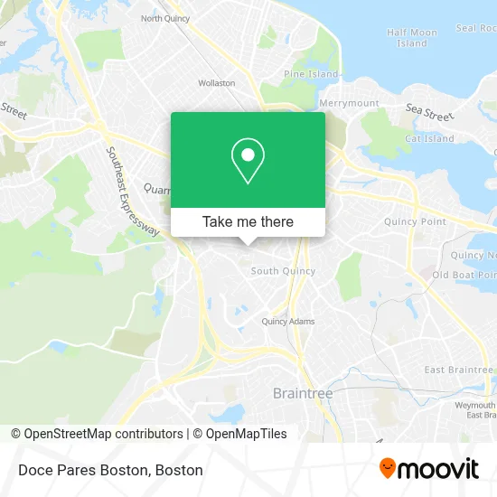
See Doce Pares Boston, Quincy, on the map
Public Transit to Doce Pares Boston in Quincy
Wondering how to get to Doce Pares Boston in Quincy? Moovit helps you find the best way to get to Doce Pares Boston with step-by-step directions from the nearest public transit station.
Moovit provides free maps and live directions to help you navigate through your city. View schedules, routes, timetables, and find out how long does it take to get to Doce Pares Boston in real time.
Looking for the nearest stop or station to Doce Pares Boston? Check out this list of stops closest to your destination: Copeland St @ Granite St; Centre St @ Kent St; Granite St @ Packards Lane; Wollaston.
Bus: 215, 238, 245.Train: GREENBUSH.Subway: RED LINE.
Want to see if there’s another route that gets you there at an earlier time? Moovit helps you find alternative routes or times. Get directions from and directions to Doce Pares Boston easily from the Moovit App or Website.
We make riding to Doce Pares Boston easy, which is why over 1.7 million users, including users in Quincy, trust Moovit as the best app for public transit. You don’t need to download an individual bus app or train app, Moovit is your all-in-one transit app that helps you find the best bus time or train time available.
For information on prices of bus, subway and train, costs and ride fares to Doce Pares Boston, please check the Moovit app.
Use the app to navigate to popular places including to the airport, hospital, stadium, grocery store, mall, coffee shop, school, college, and university.
Doce Pares Boston Address: 5 Grossman St street in Quincy
- Alpha Doce Pares Eskrima Boston,
- Chan Karate,
- Ids Construction,
- Quincy Fast Locksmith,
- Hegarty Plumbing,
- Qcap Main Office,
- Three Guys Smoke Shop,
- Pizza Town,
- Advanced Business Logics,
- Bond Brothers,
- South-West Middle Parent Teacher Org,
- Beacon Masonry and Construction,
- Stephanie Abayon,
- Lincoln Heights Apartments,
- Dermasap,
- Integrated Dermatology,
- Edible Arrangements,
- Credit Union 1,
- Amazon Locker-Bagpipe,
- McGowan Associates
Places Near Doce Pares Boston (Quincy)
- Boston Medical Center, Boston,
- North End, Boston,
- Seaport District, Boston,
- House Of Blues, Boston,
- Cheers, Boston,
- Castle Island, Boston,
- Wang Theater, Boston,
- Isabella Stewart Gardner Museum, Boston,
- Quincy Market, Boston,
- Wilbur Theatre, Boston,
- Massachusetts General Hospital, Boston,
- Td Garden, Boston,
- Boston Children's Hospital, Boston,
- Leader Bank Pavilion (Leader Bank Pavillion), Boston,
- Faneuil Hall, Boston,
- Museum Of Science, Boston,
- Boston Convention & Exhibition Center, Boston,
- Boston Common, Boston,
- Prudential Center, Boston,
- Mgm Music Hall, Boston
How to get to popular places in Boston with public transit
Get around Quincy by public transit!
Traveling around Quincy has never been so easy. See step by step directions as you travel to any attraction, street or major public transit station. View bus and train schedules, arrival times, service alerts and detailed routes on a map, so you know exactly how to get to anywhere in Quincy.
When traveling to any destination around Quincy use Moovit's Live Directions with Get Off Notifications to know exactly where and how far to walk, how long to wait for your line, and how many stops are left. Moovit will alert you when it's time to get off — no need to constantly re-check whether yours is the next stop.
Wondering how to use public transit in Quincy or how to pay for public transit in Quincy? Moovit public transit app can help you navigate your way with public transit easily, and at minimum cost. It includes public transit fees, ticket prices, and costs. Looking for a map of Quincy public transit lines? Moovit public transit app shows all public transit maps in Quincy with all Bus, Train, Subway and Ferry routes and stops on an interactive map.
Boston has 4 transit type(s), including: Bus, Train, Subway and Ferry, operated by several transit agencies, including MBTA, Southeastern Regional Transit Authority, MetroWest Regional Transit Authority, Rhode Island Public Transit Authority, WRTA, Lowell Regional Transit Authority, Merrimack Valley Transit, Montachusett Regional Transit Authority, Cape Cod Regional Transit Authority, Brockton Area Transit Authority, Martha's Vineyard Transit Authority, the WAVE - Nantucket Regional Transit Authority, GATRA, Cape Ann Transportation Authority and Massport