Directions to Doherty Park (Norwood) with public transportation
The following transit lines have routes that pass near Doherty Park
 Bus: 34E.
- Train: FRANKLIN/FOXBORO, PROVIDENCE/STOUGHTON.
How to get to Doherty Park by bus?
Click on the bus route to see step by step directions with maps, line arrival times and updated time schedules.
What are the closest stations to Doherty Park?
The closest stations to Doherty Park are:
- Norwood Central is 501 yards away, 6 min walk.
- Sharon is 4939 yards away, 58 min walk.
Which bus line stops near Doherty Park?
34E (Walpole Center Via Washington St)
What’s the nearest train station to Doherty Park in Norwood?
The nearest train station to Doherty Park in Norwood is Norwood Central. It’s a 6 min walk away.
What time is the first train to Doherty Park in Norwood?
The PROVIDENCE/STOUGHTON is the first train that goes to Doherty Park in Norwood. It stops nearby at 4:51 AM.
What time is the last train to Doherty Park in Norwood?
The PROVIDENCE/STOUGHTON is the last train that goes to Doherty Park in Norwood. It stops nearby at 12:31 AM.
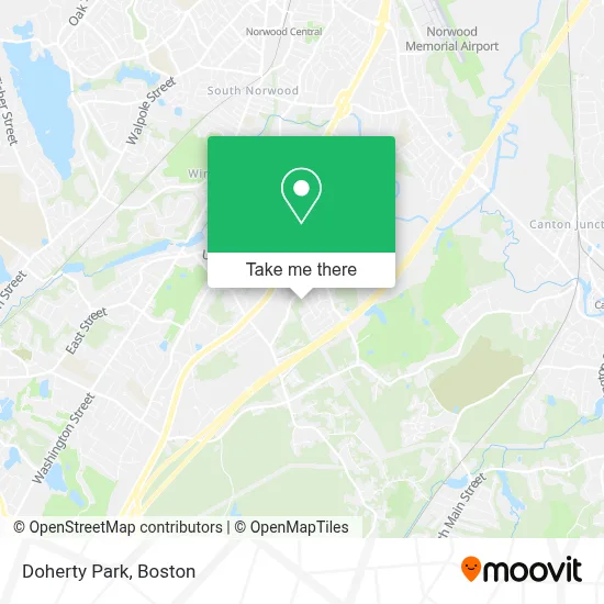
See Doherty Park, Norwood, on the map
Public Transit to Doherty Park in Norwood
Wondering how to get to Doherty Park in Norwood? Moovit helps you find the best way to get to Doherty Park with step-by-step directions from the nearest public transit station.
Moovit provides free maps and live directions to help you navigate through your city. View schedules, routes, timetables, and find out how long does it take to get to Doherty Park in real time.
Looking for the nearest stop or station to Doherty Park? Check out this list of stops closest to your destination: Norwood Central; Sharon.
Bus: 34E.Train: FRANKLIN/FOXBORO, PROVIDENCE/STOUGHTON.
Want to see if there’s another route that gets you there at an earlier time? Moovit helps you find alternative routes or times. Get directions from and directions to Doherty Park easily from the Moovit App or Website.
We make riding to Doherty Park easy, which is why over 1.7 million users, including users in Norwood, trust Moovit as the best app for public transit. You don’t need to download an individual bus app or train app, Moovit is your all-in-one transit app that helps you find the best bus time or train time available.
For information on prices of bus and train, costs and ride fares to Doherty Park, please check the Moovit app.
Use the app to navigate to popular places including to the airport, hospital, stadium, grocery store, mall, coffee shop, school, college, and university.
Doherty Park Address: 33 Brewster Dr street in Norwood
- Joann Fabric and Craft Stores,
- Panda Express,
- Petsmart,
- Monster Mini-Golf,
- Friendly's (Friendlys Restuarants),
- Spring Valley Country Club,
- Walpole Norwood Line,
- Laura Dalrymple,
- USPS Collection Box - Blue Box,
- Carmax,
- Perez, Joseph,
- DC Photography Boston,
- Residence Inn Boston Norwood,
- Adzap,
- Holiday Inn Express & Suites Norwood-Boston Area, an Ihg Hotel,
- Listing Courtesy of Listing Agent,
- Credit Union 1,
- Scu Credit Union,
- Hamilton Tree Experts,
- Courtney Saulnier Doherty Photography
Places Near Doherty Park (Norwood)
- Prudential Center, Boston,
- Leader Bank Pavilion (Leader Bank Pavillion), Boston,
- Td Garden, Boston,
- Wang Theater, Boston,
- Massachusetts General Hospital, Boston,
- Isabella Stewart Gardner Museum, Boston,
- Museum Of Science, Boston,
- Boston Children's Hospital, Boston,
- Mgm Music Hall, Boston,
- Quincy Market, Boston,
- Wilbur Theatre, Boston,
- Boston Convention & Exhibition Center, Boston,
- North End, Boston,
- Cheers, Boston,
- Seaport District, Boston,
- Faneuil Hall, Boston,
- House Of Blues, Boston,
- Boston Medical Center, Boston,
- Boston Common, Boston,
- Castle Island, Boston
How to get to popular places in Boston with public transit
Get around Norwood by public transit!
Traveling around Norwood has never been so easy. See step by step directions as you travel to any attraction, street or major public transit station. View bus and train schedules, arrival times, service alerts and detailed routes on a map, so you know exactly how to get to anywhere in Norwood.
When traveling to any destination around Norwood use Moovit's Live Directions with Get Off Notifications to know exactly where and how far to walk, how long to wait for your line, and how many stops are left. Moovit will alert you when it's time to get off — no need to constantly re-check whether yours is the next stop.
Wondering how to use public transit in Norwood or how to pay for public transit in Norwood? Moovit public transit app can help you navigate your way with public transit easily, and at minimum cost. It includes public transit fees, ticket prices, and costs. Looking for a map of Norwood public transit lines? Moovit public transit app shows all public transit maps in Norwood with all Bus, Train, Subway and Ferry routes and stops on an interactive map.
Boston has 4 transit type(s), including: Bus, Train, Subway and Ferry, operated by several transit agencies, including MBTA, Southeastern Regional Transit Authority, MetroWest Regional Transit Authority, Rhode Island Public Transit Authority, WRTA, Lowell Regional Transit Authority, Merrimack Valley Transit, Montachusett Regional Transit Authority, Cape Cod Regional Transit Authority, Brockton Area Transit Authority, Martha's Vineyard Transit Authority, the WAVE - Nantucket Regional Transit Authority, GATRA, Cape Ann Transportation Authority and Massport