How to get to Doinet Couvertures by bus?
Click on the bus route to see step by step directions with maps, line arrival times and updated time schedules.
From Fermiers de l'Artois, Gavrelle
60 minFrom Foodtruck Big Marcel Hauts de France, Willerval
56 minFrom Wancourt, Wancourt
71 minFrom E.S.A.T. De Saint-Laurent-Blangy, Saint-Laurent-Blangy
33 minFrom Cote France, Wancourt
66 minFrom ChargePoint Europe BV, Wancourt
48 minFrom Carrefour, Reux
51 minFrom Roeux, Reux
53 minFrom Bibliothèque de Wancourt, Wancourt
67 minFrom Actiparc-Magna Park, Saint-Laurent-Blangy
35 min
Bus stops near Doinet Couvertures in Arras
Bus lines to Doinet Couvertures in Arras
- C6, Les Saules,VIEW
- C8, Robespierre,VIEW
- C24, Collège Louez Dieu,VIEW
- L2, Varlet,VIEW
- LD1, Arras - Centre Commercial,VIEW
- L1, St-Nicolas Cruppes,VIEW
- L6, Docteur Forgeois,VIEW
- L18, Rue De La Liberté,VIEW
- C10, Collège Peguy,VIEW
- C39, Le Bois Du Perroy D'Acq,VIEW
- C40, Pont Du Gy Etrun,VIEW
- C41, La Montagne,VIEW
- C4W, Collège Diderot,VIEW
- C4D, Collège Diderot - Dainville,VIEW
- L4, Ligne 4,VIEW
- LD2, Ligne D2,VIEW
What are the closest stations to Doinet Couvertures?
The closest stations to Doinet Couvertures are:
- Verlaine is 177 meters away, 3 min walk.
- Hôpital is 275 meters away, 4 min walk.
- Collège Peguy is 335 meters away, 5 min walk.
- Courbet is 706 meters away, 10 min walk.
- Tour Courbet is 851 meters away, 11 min walk.
Which bus lines stop near Doinet Couvertures?
These bus lines stop near Doinet Couvertures: L1, L18.
What’s the nearest bus station to Doinet Couvertures in Arras?
The nearest bus station to Doinet Couvertures in Arras is Verlaine. It’s a 3 min walk away.
What time is the first bus to Doinet Couvertures in Arras?
The L4 is the first bus that goes to Doinet Couvertures in Arras. It stops nearby at 6:18 AM.
What time is the last bus to Doinet Couvertures in Arras?
The L1 is the last bus that goes to Doinet Couvertures in Arras. It stops nearby at 9:15 PM.
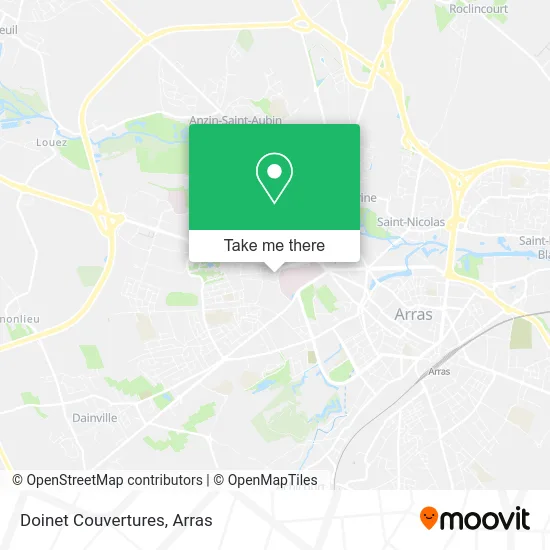
See Doinet Couvertures, Arras, on the map
Public Transit to Doinet Couvertures in Arras
Wondering how to get to Doinet Couvertures in Arras? Moovit helps you find the best way to get to Doinet Couvertures with step-by-step directions from the nearest public transit station.
Moovit provides free maps and live directions to help you navigate through your city. View schedules, routes, timetables, and find out how long does it take to get to Doinet Couvertures in real time.
Looking for the nearest stop or station to Doinet Couvertures? Check out this list of stops closest to your destination: Verlaine; Hôpital; Collège Peguy; Courbet; Tour Courbet.
Bus: L1, L18, C6, C8, C24, L2, LD1, L6, C10, C39, C40, C41, C4W, C4D, L4, LD2.
Want to see if there’s another route that gets you there at an earlier time? Moovit helps you find alternative routes or times. Get directions from and directions to Doinet Couvertures easily from the Moovit App or Website.
We make riding to Doinet Couvertures easy, which is why over 1.5 million users, including users in Arras, trust Moovit as the best app for public transit. You don’t need to download an individual bus app or train app, Moovit is your all-in-one transit app that helps you find the best bus time or train time available.
For information on prices of bus, costs and ride fares to Doinet Couvertures, please check the Moovit app.
Use the app to navigate to popular places including to the airport, hospital, stadium, grocery store, mall, coffee shop, school, college, and university.
Doinet Couvertures Address: 16 Rue des Blancs Monts 62000 Arras street in Arras
- Ecurie Siauve - Loubaud,
- Forêt d'Encres,
- Andy Messiant Tattoo,
- Mondial Pare-Brise,
- Arras Online,
- Groupement d'Imagerie Medicale Artois,
- Chaufferie,
- 58 Avenue Winston Churchill,
- Orthoway,
- Bioshop Arras,
- L'Incroyable,
- Pfg,
- École Maternelle Publique Suzanne Lacorre,
- Flowers Flower,
- 47 Av. Winston Churchill,
- Hopital,
- DRIVECO,
- Gendarmerie Nationale-Brigade Motorisée,
- Centre Hospitalier D'Arras,
- Ô Spa
Places Near Doinet Couvertures (Arras)
- Citadelle D'Arras, Arras,
- Hôpital Privé Arras Les Bonnettes, Arras,
- Main Square Festival, Arras,
- Centre Commercial Auchan, Arras,
- Auchan Arras, Arras,
- Lycée Robespierre, Arras,
- Université D'Artois, Arras,
- Lfb Group Arras, Bailleul-Sir-Berthoult,
- Artois-Expo, Saint-Laurent-Blangy,
- Grand'Place, Arras,
- Lycée Polyvalent Guy Mollet, Arras,
- Centre Hospitalier D'Arras, Arras,
- Le Set Famous Club Roclincourt, Arras,
- Lycée Général Gambetta Carnot, Arras,
- Lycée Du Bâtiment Jacques Le Caron, Arras,
- Marché De Noël, Arras,
- lycée Baudimont St-Charles, Arras,
- Lycée Professionnel Alain Savary, Arras,
- Lycée Privé Baudimont Saint-Charles, Arras,
- Caf, Arras
How to get to popular places in Arras with public transit
Get around Arras by public transit!
Traveling around Arras has never been so easy. See step by step directions as you travel to any attraction, street or major public transit station. View bus and train schedules, arrival times, service alerts and detailed routes on a map, so you know exactly how to get to anywhere in Arras.
When traveling to any destination around Arras use Moovit's Live Directions with Get Off Notifications to know exactly where and how far to walk, how long to wait for your line, and how many stops are left. Moovit will alert you when it's time to get off — no need to constantly re-check whether yours is the next stop.
Wondering how to use public transit in Arras or how to pay for public transit in Arras? Moovit public transit app can help you navigate your way with public transit easily, and at minimum cost. It includes public transit fees, ticket prices, and costs. Looking for a map of Arras public transit lines? Moovit public transit app shows all public transit maps in Arras with all bus routes and stops on an interactive map.
Arras has 1 transit type(s), including: bus, operated by several transit agencies, including Artis