Directions to Dolany Nad Vltavou (Mělník) with public transportation
The following transit lines have routes that pass near Dolany Nad Vltavou
How to get to Dolany Nad Vltavou by bus?
Click on the bus route to see step by step directions with maps, line arrival times and updated time schedules.
How to get to Dolany Nad Vltavou by train?
Click on the train route to see step by step directions with maps, line arrival times and updated time schedules.
Train stations near Dolany Nad Vltavou in Mělník
- Libčice Nad Vltavou, 42 min walk,
- Kralupy Nad Vltavou, 50 min walk,
What are the closest stations to Dolany Nad Vltavou?
The closest stations to Dolany Nad Vltavou are:
- Libčice Nad Vltavou is 3266 meters away, 42 min walk.
- Kralupy Nad Vltavou is 3945 meters away, 50 min walk.
Which bus line stops near Dolany Nad Vltavou?
370
Which train line stops near Dolany Nad Vltavou?
S4
See Dolany Nad Vltavou, Mělník, on the map
Public Transit to Dolany Nad Vltavou in Mělník
Wondering how to get to Dolany Nad Vltavou in Mělník, Czech Republic? Moovit helps you find the best way to get to Dolany Nad Vltavou with step-by-step directions from the nearest public transit station.
Moovit provides free maps and live directions to help you navigate through your city. View schedules, routes, timetables, and find out how long does it take to get to Dolany Nad Vltavou in real time.
Looking for the nearest stop or station to Dolany Nad Vltavou? Check out this list of stops closest to your destination: Libčice Nad Vltavou; Kralupy Nad Vltavou.
Bus: 370.Train: S4, R44, OS 109784, OS 109787, S43, R15, R20, S40, S43.
Want to see if there’s another route that gets you there at an earlier time? Moovit helps you find alternative routes or times. Get directions from and directions to Dolany Nad Vltavou easily from the Moovit App or Website.
We make riding to Dolany Nad Vltavou easy, which is why over 1.5 million users, including users in Mělník, trust Moovit as the best app for public transit. You don’t need to download an individual bus app or train app, Moovit is your all-in-one transit app that helps you find the best bus time or train time available.
For information on prices of train, bus, subway and light rail, costs and ride fares to Dolany Nad Vltavou, please check the Moovit app.
Use the app to navigate to popular places including to the airport, hospital, stadium, grocery store, mall, coffee shop, school, college, and university.
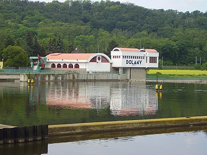
Dolany Nad Vltavou Address: Ke Hřišti street in Mělník
Attractions near Dolany Nad Vltavou
Železniční zastávka Dolany nad Vltavou,Obecní úřad Dolany nad Vltavou,Vltavske tune,Dolánky,Hospoda u Gdera, Dolanky,Dětské hřiště Zlončice,Informační Centrum Cyklotrasy Praha - Drážďany,Hlaváčková Stráň,Železniční stanice Chvatěruby,Chvatěruby,Fotbalový hřiště TJ Vltavan Chvatěruby,Na Konci Světa (chatova osada),U Dýhárny,Kozomín,Sedna, Planetární Stezka,Libčice Nad Vltavou - Přívoz,Hrubymoving S.R.O.,VALSABBIA PRAHA s.r.o.,Mariánský sloup,Výzkumný ústav včelařský DolHow to get to popular attractions in Mělník with public transit
Mánes, Praha 2,Sedlec, Praha - Východ,Labská vyhlídka, Děčín,Hudební Divadlo Karlín, Praha 8,Bunkr Drnov, Kladno,Dolní Chabry, Praha-Dolní Chabry,Zličín, Praha-Zličín,filmová studia Barrandov - Kotelna - Boiler room, Praha 5,Quadrio, Praha 1,Lukoil Accounting and Finance Europe s.r.o., Praha 5,Klamovka, Praha 5,samoobslužná myčka tixExpress, Mělník,Bosal, Praha - Východ,Hotel Adeba, Praha 8,Royal Court Hotel, Praha 2,Stavovské Divadlo, Praha 1,Lexus Praha Pruhonice, Praha - Západ,Jinočany, Praha - Západ,Slavia, Praha 10,Tornero, Ústí Nad LabemGet around Prague by public transit!
Traveling around Prague has never been so easy. See step by step directions as you travel to any attraction, street or major public transit station. View bus and train schedules, arrival times, service alerts and detailed routes on a map, so you know exactly how to get to anywhere in Prague.
When traveling to any destination around Prague use Moovit's Live Directions with Get Off Notifications to know exactly where and how far to walk, how long to wait for your line, and how many stops are left. Moovit will alert you when it's time to get off — no need to constantly re-check whether yours is the next stop.
Wondering how to use public transit in Prague or how to pay for public transit in Prague? Moovit public transit app can help you navigate your way with public transit easily, and at minimum cost. It includes public transit fees, ticket prices, and costs. Looking for a map of Prague public transit lines? Moovit public transit app shows all public transit maps in Prague with all Bus, Train, Subway, Light Rail, Ferry, Trolleybus and Gondola routes and stops on an interactive map.
Prague has 7 transit type(s), including: Bus, Train, Subway, Light Rail, Ferry, Trolleybus and Gondola, operated by several transit agencies, including Dopravní podnik měst Liberce a Jablonce nad Nisou, a.s., BusLine jižní Čechy s.r.o., Railway Capital a.s., Dopravní společnost Ústeckého kraje, příspěvková organizace, DPP, České dráhy, a.s., KŽC Doprava,s.r.o., České dráhy a.s., ARRIVA vlaky s.r.o., KAD BUS spol. s r.o., ARRIVA PRAHA s.r.o, ARRIVA CITY s.r.o., CSAD Stredni Cechy, a.s., ČSAD AUTOBUSY České Budějovice a.s., ČSAD Jindřichův Hradec s.r.o.