How to get to Doors Open Lowell by bus?
Click on the bus route to see step by step directions with maps, line arrival times and updated time schedules.
How to get to Doors Open Lowell by train?
Click on the train route to see step by step directions with maps, line arrival times and updated time schedules.
Bus stops near Doors Open Lowell
Bus lines to Doors Open Lowell
What are the closest stations to Doors Open Lowell?
The closest stations to Doors Open Lowell are:
- Merrimack St & John St is 9 yards away, 1 min walk.
- Dummer St & Broadway St (Hellenic Cultural Center) is 56 yards away, 1 min walk.
- Dutton St And Broadway St is 200 yards away, 3 min walk.
- Dutton St & Broadway St is 212 yards away, 3 min walk.
- Middlesex & Elliot St is 562 yards away, 7 min walk.
Which bus lines stop near Doors Open Lowell?
These bus lines stop near Doors Open Lowell: 12, 24.
Which train line stops near Doors Open Lowell?
LOWELL (#331 | Lowell)
What’s the nearest bus station to Doors Open Lowell?
The nearest bus stations to Doors Open Lowell are Merrimack St & John St and Dummer St & Broadway St (Hellenic Cultural Center). The closest one is a 1 min walk away.
What time is the first bus to Doors Open Lowell?
The 18 is the first bus that goes to Doors Open Lowell. It stops nearby at 5:50 AM.
What time is the last bus to Doors Open Lowell?
The 7 is the last bus that goes to Doors Open Lowell. It stops nearby at 8:09 PM.
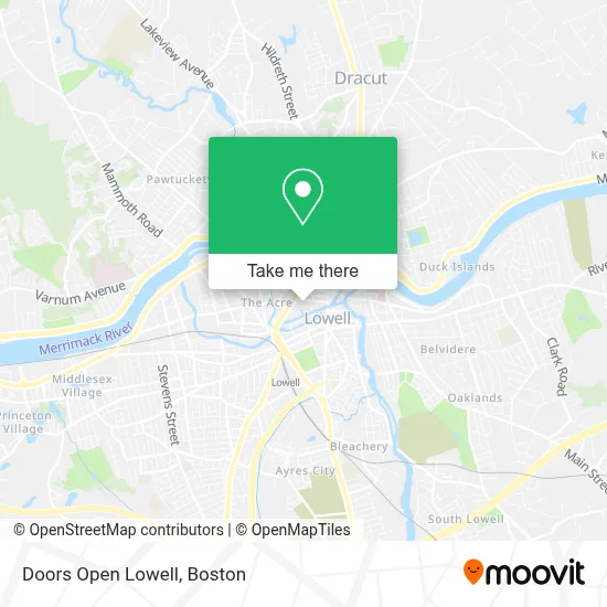
See Doors Open Lowell on the map
Public Transportation to Doors Open Lowell
Wondering how to get to Doors Open Lowell? Moovit helps you find the best way to get to Doors Open Lowell with step-by-step directions from the nearest public transit station.
Moovit provides free maps and live directions to help you navigate through your city. View schedules, routes, timetables, and find out how long does it take to get to Doors Open Lowell in real time.
Looking for the nearest stop or station to Doors Open Lowell? Check out this list of stops closest to your destination: Merrimack St & John St; Dummer St & Broadway St (Hellenic Cultural Center); Dutton St And Broadway St; Dutton St & Broadway St; Middlesex & Elliot St.
Bus: 12, 24, 1, 8, 9, 10, 18, 6, 7, 20, 2, 11.Train: LOWELL.
Want to see if there’s another route that gets you there at an earlier time? Moovit helps you find alternative routes or times. Get directions from and directions to Doors Open Lowell easily from the Moovit App or Website.
We make riding to Doors Open Lowell easy, which is why over 1.7 million users, including users in Lowell, trust Moovit as the best app for public transit. You don’t need to download an individual bus app or train app, Moovit is your all-in-one transit app that helps you find the best bus time or train time available.
For information on prices of bus and train, costs and ride fares to Doors Open Lowell, please check the Moovit app.
Use the app to navigate to popular places including to the airport, hospital, stadium, grocery store, mall, coffee shop, school, college, and university.
Doors Open Lowell Address: Lowell National Historical Park Visitor Center, 246 Market St street in Lowell
- Howland Greene Consulting,
- Balefire Productions,
- American Locksmith Company,
- Elaine Wood, Aobta C.P., Emotional Freedom Techniques,
- Khan, Moiz S, DMD,
- Mochinut,
- Century 21 North Shore / Rivera Group,
- Thirsty First,
- Lowell Ma Municipal Employees Federal Credit Union,
- Laser Cut Car Keys Locksmith,
- Eleni's Fashion & Art Studio,
- Push 978 Radio,
- Lowell, Massachusetts,
- VIP Tires & Service,
- Kyle St Martin,
- Ameriprise Financial,
- Lowell Connector,
- Sac Club Bar & Restaurant,
- El Bunker,
- Dignity Hospice Care
Places Near Doors Open Lowell
- Faneuil Hall, Boston,
- Mgm Music Hall, Boston,
- North End, Boston,
- Boston Common, Boston,
- House Of Blues, Boston,
- Leader Bank Pavilion (Leader Bank Pavillion), Boston,
- Boston Medical Center, Boston,
- Massachusetts General Hospital, Boston,
- Castle Island, Boston,
- Wang Theater, Boston,
- Seaport District, Boston,
- Isabella Stewart Gardner Museum, Boston,
- Prudential Center, Boston,
- Boston Children's Hospital, Boston,
- Museum Of Science, Boston,
- Td Garden, Boston,
- Wilbur Theatre, Boston,
- Quincy Market, Boston,
- Cheers, Boston,
- Boston Convention & Exhibition Center, Boston
How to get to popular places in Boston with public transit
Get around Lowell by public transit!
Traveling around Lowell has never been so easy. See step by step directions as you travel to any attraction, street or major public transit station. View bus and train schedules, arrival times, service alerts and detailed routes on a map, so you know exactly how to get to anywhere in Lowell.
When traveling to any destination around Lowell use Moovit's Live Directions with Get Off Notifications to know exactly where and how far to walk, how long to wait for your line, and how many stops are left. Moovit will alert you when it's time to get off — no need to constantly re-check whether yours is the next stop.
Wondering how to use public transit in Lowell or how to pay for public transit in Lowell? Moovit public transit app can help you navigate your way with public transit easily, and at minimum cost. It includes public transit fees, ticket prices, and costs. Looking for a map of Lowell public transit lines? Moovit public transit app shows all public transit maps in Lowell with all Bus, Train, Subway and Ferry routes and stops on an interactive map.
Boston has 4 transit type(s), including: Bus, Train, Subway and Ferry, operated by several transit agencies, including MBTA, Southeastern Regional Transit Authority, MetroWest Regional Transit Authority, Rhode Island Public Transit Authority, WRTA, Lowell Regional Transit Authority, Merrimack Valley Transit, Montachusett Regional Transit Authority, Cape Cod Regional Transit Authority, Brockton Area Transit Authority, Martha's Vineyard Transit Authority, the WAVE - Nantucket Regional Transit Authority, GATRA, Cape Ann Transportation Authority and Massport