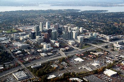
See Downtown Bellevue on the map
Directions to Downtown Bellevue with public transportation
The following transit lines have routes that pass near Downtown Bellevue
 Bus:
Bus:
How to get to Downtown Bellevue by bus?
Click on the bus route to see step by step directions with maps, line arrival times and updated time schedules.
Bus stations near Downtown Bellevue
- NE 10th St & 110th Ave NE,3 min walk,
- Bellevue Tc - Bays 5,8 & 9,4 min walk,
- Bellevue Tc - Bays 3 & 4,5 min walk,
- Bellevue Tc - Bays 11 & 12,6 min walk,
Bus lines to Downtown Bellevue
- 226,Eastgate P&R Crossroads,
- 250,Avondale Bear Creek P&R,
- 271,Issaquah - University District,
- 550,Bellevue - Seattle,
- 556,Issaquah - Northgate,
- 532,Everett - Bellevue,
- 535,Lynnwood - Bellevue,
- B LINE,Redmond Transit Center Overlake,
- 241,Bellevue Transit Center Factoria,
- 246,Clyde Hill,
- 249,Redmond Technology Station S Kirkland P&R,
- 566,Redmond Technology Station,
What are the closest stations to Downtown Bellevue?
The closest stations to Downtown Bellevue are:
- NE 10th St & 110th Ave NE is 231 yards away, 3 min walk.
- Bellevue Tc - Bays 5,8 & 9 is 299 yards away, 4 min walk.
- Bellevue Tc - Bays 3 & 4 is 342 yards away, 5 min walk.
- Bellevue Tc - Bays 11 & 12 is 420 yards away, 6 min walk.
Which bus lines stop near Downtown Bellevue?
These bus lines stop near Downtown Bellevue: 271, 535, 550, 555.
What’s the nearest bus stop to Downtown Bellevue?
The nearest bus stop to Downtown Bellevue is NE 10th St & 110th Ave NE. It’s a 3 min walk away.
See Downtown Bellevue on the map
Public Transportation to Downtown Bellevue
Wondering how to get to Downtown Bellevue, United States? Moovit helps you find the best way to get to Downtown Bellevue with step-by-step directions from the nearest public transit station.
Moovit provides free maps and live directions to help you navigate through your city. View schedules, routes, timetables, and find out how long does it take to get to Downtown Bellevue in real time.
Looking for the nearest stop or station to Downtown Bellevue? Check out this list of stops closest to your destination: NE 10th St & 110th Ave NE; Bellevue Tc - Bays 5,8 & 9; Bellevue Tc - Bays 3 & 4; Bellevue Tc - Bays 11 & 12.
Bus:
Want to see if there’s another route that gets you there at an earlier time? Moovit helps you find alternative routes or times. Get directions from and directions to Downtown Bellevue easily from the Moovit App or Website.
We make riding to Downtown Bellevue easy, which is why over 1.5 million users, including users in Bellevue, trust Moovit as the best app for public transit. You don’t need to download an individual bus app or train app, Moovit is your all-in-one transit app that helps you find the best bus time or train time available.
For information on prices of bus and light rail, costs and ride fares to Downtown Bellevue, please check the Moovit app.
Use the app to navigate to popular places including to the airport, hospital, stadium, grocery store, mall, coffee shop, school, college, and university.
Downtown Bellevue Address: Bellevue street in Bellevue
Attractions near Downtown Bellevue
110th 8th St,HNN Associates,Wyman Law Firm,Richard C Martin Attorney,Martin Financial Group,Washington Astructure Services,Richard M Stephens Attorney,Comprehensive Estate Planning Services,Plaza Salon,Plaza Center Property,Newton & Hall Attorneys at Law,RSM US,Coleman Mental Health,Slick Development,SNS Towing,Asix,Westec,Washington Criminal Defense-Bellevue Law,Richardson Law Office,Christopher Thomas McGahan - Loan SimpleHow to get to popular attractions in Bellevue with public transit
Safeway, Seattle,Marysville, WA,I90, Bellevue,Renton Highlands Connector Stop, Renton,Doc's Marina Grill in Bainbridge Island, Bainbridge Island,Walmart Supercenter,Northwest Detention Center, Tacoma,Northgate Mall, Seattle,Tavolàta, Seattle,Dick's Drive-In, Seattle,Crossroads Bellevue, Bellevue,Starbucks, Seattle,Fremont Troll, Seattle,TCC Transit Center, Tacoma,Phinney Ridge Neighborhood, Seattle,Seattle Central College, Seattle,Fred Meyer, Everett,Everett, WA, Everett,Industrial District, Seattle,Bellevue Square, BellevueGet around Bellevue by public transit!
Traveling around Bellevue has never been so easy. See step by step directions as you travel to any attraction, street or major public transit station. View bus and train schedules, arrival times, service alerts and detailed routes on a map, so you know exactly how to get to anywhere in Bellevue.
When traveling to any destination around Bellevue use Moovit's Live Directions with Get Off Notifications to know exactly where and how far to walk, how long to wait for your line, and how many stops are left. Moovit will alert you when it's time to get off — no need to constantly re-check whether yours is the next stop.
Wondering how to use public transit in Bellevue or how to pay for public transit in Bellevue? Moovit public transit app can help you navigate your way with public transit easily, and at minimum cost. It includes public transit fees, ticket prices, and costs. Looking for a map of Bellevue public transit lines? Moovit public transit app shows all public transit maps in Bellevue with all bus or light rail routes and stops on an interactive map.
Bellevue has 2 transit type(s), including: bus or light rail, operated by several transit agencies, including Sound Transit, Seattle Streetcar, Sound Transit, Metro Transit, Metro Transit, Sound Transit, Whatcom Transportation Authority, Mason Transit Authority, Snoqualmie Valley Transportation (SVT), Snoqualmie Valley Transportation, Amtrak, Island Transit, Kitsap Transit, Intercity Transit and Everett Transit