Directions to Downtown Guelph with public transportation
The following transit lines have routes that pass near Downtown Guelph
How to get to Downtown Guelph by bus?
Click on the bus route to see step by step directions with maps, line arrival times and updated time schedules.
How to get to Downtown Guelph by train?
Click on the train route to see step by step directions with maps, line arrival times and updated time schedules.
Bus stops near Downtown Guelph
- Wyndham at Quebec Northbound, 3 min walk,
- Macdonell at Wilson Westbound, 3 min walk,
- Wyndham at Cork Southbound, 3 min walk,
- Macdonell at Wilson Eastbound, 3 min walk,
- Guelph Central Go Bus, 8 min walk,
Train stations near Downtown Guelph
- Guelph, 16 min walk,
- Guelph Central Go, 20 min walk,
Bus lines to Downtown Guelph
- 13, 13 Eastview,
- 11, 11 Silvercreek,
- 99, 99 Mainline Southbound,
- 3, 3 Westmount,
- 10, 10 Paisley,
- 12, 12 General Hospital,
- 20, 20 Northwest Industrial To Imperial at Galaxy Cinema,
- 9, 9 Waterloo,
- 17, 17 - U Of Waterloo,
- 29, 29 - Kipling Bus Terminal,
- 31, 31b - Bramalea Go,
- 33, 33 - York Mills Term,
What are the closest stations to Downtown Guelph?
The closest stations to Downtown Guelph are:
- Wyndham at Quebec Northbound is 166 meters away, 3 min walk.
- Macdonell at Wilson Westbound is 168 meters away, 3 min walk.
- Wyndham at Cork Southbound is 171 meters away, 3 min walk.
- Macdonell at Wilson Eastbound is 185 meters away, 3 min walk.
- Guelph Central Go Bus is 581 meters away, 8 min walk.
- Guelph is 1238 meters away, 16 min walk.
- Guelph Central Go is 1543 meters away, 20 min walk.
Which bus lines stop near Downtown Guelph?
These bus lines stop near Downtown Guelph: 17, 29, 31.
Which train line stops near Downtown Guelph?
KI
What’s the nearest train station to Downtown Guelph?
The nearest train station to Downtown Guelph is Guelph. It’s a 16 min walk away.
What’s the nearest bus stop to Downtown Guelph?
The nearest bus stops to Downtown Guelph are Wyndham at Quebec Northbound, Macdonell at Wilson Westbound, Wyndham at Cork Southbound and Macdonell at Wilson Eastbound. The closest one is a 3 min walk away.
What time is the first train to Downtown Guelph?
The KI is the first train that goes to Downtown Guelph. It stops nearby at 5:30 AM.
What time is the last train to Downtown Guelph?
The KI is the last train that goes to Downtown Guelph. It stops nearby at 12:01 AM.
What time is the first bus to Downtown Guelph?
The 33 is the first bus that goes to Downtown Guelph. It stops nearby at 4:30 AM.
What time is the last bus to Downtown Guelph?
The 29 is the last bus that goes to Downtown Guelph. It stops nearby at 1:35 AM.
How much is the train fare to Downtown Guelph?
The train fare to Downtown Guelph costs about $3.70 - $16.35.
How much is the Streetcar fare to Downtown Guelph?
The Streetcar fare to Downtown Guelph costs about $3.75.
How much is the bus fare to Downtown Guelph?
The bus fare to Downtown Guelph costs about $3.70 - $14.41.
See Downtown Guelph on the map
Public Transportation to Downtown Guelph
Wondering how to get to Downtown Guelph, Canada? Moovit helps you find the best way to get to Downtown Guelph with step-by-step directions from the nearest public transit station.
Moovit provides free maps and live directions to help you navigate through your city. View schedules, routes, timetables, and find out how long does it take to get to Downtown Guelph in real time.
Looking for the nearest stop or station to Downtown Guelph? Check out this list of stops closest to your destination: Wyndham at Quebec Northbound; Macdonell at Wilson Westbound; Wyndham at Cork Southbound; Macdonell at Wilson Eastbound; Guelph Central Go Bus; Guelph; Guelph Central Go.
Bus: 17, 29, 31, 13, 11, 99, 3, 10, 12, 20, 9.Train: KI, VIA RAIL.
Want to see if there’s another route that gets you there at an earlier time? Moovit helps you find alternative routes or times. Get directions from and directions to Downtown Guelph easily from the Moovit App or Website.
We make riding to Downtown Guelph easy, which is why over 1.5 million users, including users in Guelph, trust Moovit as the best app for public transit. You don’t need to download an individual bus app or train app, Moovit is your all-in-one transit app that helps you find the best bus time or train time available.
For information on prices of bus, train and Streetcar, costs and ride fares to Downtown Guelph, please check the Moovit app.
Use the app to navigate to popular places including to the airport, hospital, stadium, grocery store, mall, coffee shop, school, college, and university.
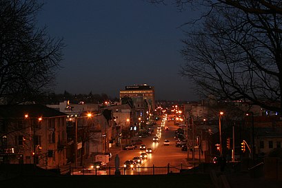
Downtown Guelph Address: Quebec Street street in Guelph
Attractions near Downtown Guelph
Rbc,Quebec at Wyndham Westbound,RBC Dominion Securities,Wyndham at Cork Southbound,Business Centre Guelph-Wellington,CIBC Wood Gundy,Downtown Guelph Business Association,BMO Bank of Montreal,RBC Royal Bank,Bisson Andre Dr,Knar Jewellery,The Family,Saint George's Square,Guelph Community Foundation,Community Information Guelph,Longfield Lloyd MP,Soccer Fanatic,Wyndham at Quebec Northbound,Liberty Staffing Services,Weinberg Shael JHow to get to popular attractions in Guelph with public transit
Finch Avenue West, Toronto,Richmond Hill Centre Terminal, Richmond Hill,Molson Canadian Amphitheatre, Toronto,Niagara College - NOTL Campus, Niagara-On-The-Lake,Eglinton East, Toronto,Ikea Shuttle Bus, Toronto,OLG Slots at Woodbine, Toronto,Promenade Mall, Vaughan,Angus, Ontario, Essa,Markham & Eglinton, Toronto,Metropolitan United Church, Toronto,Art Gallery Of Ontario, Toronto,900 DRT PULSE Oshawa To U Of T Scarborough, Ajax,2075 Bayview Avenue, Toronto,Safeway Tours Fallsview Casino, Niagara Falls,Sickkids, Toronto,ScotiaBank Arena, Toronto,University of Waterloo GO Bus Stop, Waterloo,Rogers Centre, Toronto,Keele & Sheppard, TorontoGet around Toronto by public transit!
Traveling around Toronto has never been so easy. See step by step directions as you travel to any attraction, street or major public transit station. View bus and train schedules, arrival times, service alerts and detailed routes on a map, so you know exactly how to get to anywhere in Toronto.
When traveling to any destination around Toronto use Moovit's Live Directions with Get Off Notifications to know exactly where and how far to walk, how long to wait for your line, and how many stops are left. Moovit will alert you when it's time to get off — no need to constantly re-check whether yours is the next stop.
Wondering how to use public transit in Toronto or how to pay for public transit in Toronto? Moovit public transit app can help you navigate your way with public transit easily, and at minimum cost. It includes public transit fees, ticket prices, and costs. Looking for a map of Toronto public transit lines? Moovit public transit app shows all public transit maps in Toronto with all Bus, Train, Subway, Streetcar and Ferry routes and stops on an interactive map.
Toronto has 5 transit type(s), including: Bus, Train, Subway, Streetcar and Ferry, operated by several transit agencies, including TTC, TTC Streetcar, Toronto Subway, GO Transit Bus, GO Transit, Amtrak, York Region Transit, Grand River Transit, Guelph Transit, grt, Hamilton Street Railway, MiWay, Brampton Transit, Burlington Transit, Oakville Transit