See Downtown Santa Rosa on the map
Directions to Downtown Santa Rosa with public transportation
The following transit lines have routes that pass near Downtown Santa Rosa
 Bus:
Bus: - Train:
How to get to Downtown Santa Rosa by bus?
Click on the bus route to see step by step directions with maps, line arrival times and updated time schedules.
How to get to Downtown Santa Rosa by train?
Click on the train route to see step by step directions with maps, line arrival times and updated time schedules.
Bus stations near Downtown Santa Rosa
- B St & Ross St,6 min walk,
- Santa Rosa Ave & Maple Ave,15 min walk,
Bus lines to Downtown Santa Rosa
- 20,Russian River Area, Forestville, Sebastopol, Santa Rosa,
- 20X,Russian River Area, Santa Rosa,
- 30,Santa Rosa, Sonoma Valley,
- 30X,Santa Rosa, Sonoma Valley,
- 44,Petaluma, JC, SSU, Santa Rosa,
- 48,Santa Rosa, Rohnert Park, Cotati, Petaluma,
- 60,Cloverdale, Healdsburg, Windsor, Santa Rosa,
- 62,Santa Rosa, County Airport,
- 1,Mendocino Ave - Coddingtown Mall,
- 42,Industry West Park / Santa Rosa,
- 3,Santa Rosa Avenue,
- 5,Petaluma Hill Road,
What are the closest stations to Downtown Santa Rosa?
The closest stations to Downtown Santa Rosa are:
- B St & Ross St is 397 yards away, 6 min walk.
- Santa Rosa Ave & Maple Ave is 1175 yards away, 15 min walk.
Which bus lines stop near Downtown Santa Rosa?
These bus lines stop near Downtown Santa Rosa: 101, 44, 46, 62.
Which train line stops near Downtown Santa Rosa?
SMART
What’s the nearest bus stop to Downtown Santa Rosa?
The nearest bus stop to Downtown Santa Rosa is B St & Ross St. It’s a 6 min walk away.
See Downtown Santa Rosa on the map
Public Transportation to Downtown Santa Rosa
Wondering how to get to Downtown Santa Rosa, United States? Moovit helps you find the best way to get to Downtown Santa Rosa with step-by-step directions from the nearest public transit station.
Moovit provides free maps and live directions to help you navigate through your city. View schedules, routes, timetables, and find out how long does it take to get to Downtown Santa Rosa in real time.
Looking for the nearest stop or station to Downtown Santa Rosa? Check out this list of stops closest to your destination: B St & Ross St; Santa Rosa Ave & Maple Ave.
Bus:Train:
Want to see if there’s another route that gets you there at an earlier time? Moovit helps you find alternative routes or times. Get directions from and directions to Downtown Santa Rosa easily from the Moovit App or Website.
We make riding to Downtown Santa Rosa easy, which is why over 1.5 million users, including users in Santa Rosa, trust Moovit as the best app for public transit. You don’t need to download an individual bus app or train app, Moovit is your all-in-one transit app that helps you find the best bus time or train time available.
For information on prices of bus and train, costs and ride fares to Downtown Santa Rosa, please check the Moovit app.
Use the app to navigate to popular places including to the airport, hospital, stadium, grocery store, mall, coffee shop, school, college, and university.
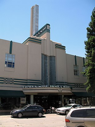
Downtown Santa Rosa Address: 4th Street street in Santa Rosa
Attractions near Downtown Santa Rosa
Fourth St Deli,Mary's Pizza,Chalk Bradley S Attorney,Tiburon Design Automation,Ironwood Management,Sweet Spot,The Sweet Spot,Steve Maderious - Acacia Creek Realty,Acre Coffee,Fisher Town Design,William RL Klippert Est,El Palomar,Santa Rosa Business & Commercial,Treehorn,Mark Quattrocchi American Institute of Architects,Premier Lending & Real Estate,Honeycomb Salon,Academy of Leather Arts,Flower and Bone (Flower + Bone),La VeraHow to get to popular attractions in Santa Rosa with public transit
Safeway, Rohnert Park,Googleplex,440 Castro, Castro/Upper Market,Googleplex - Charlie's Cafe,Alcatraz Cruises, North Beach, Sf,Japantown (日本町), San Jose,BJ's Restaurant and Brewhouse, Cupertino,Tamien Caltrain Station, San Jose,Sunnyvale, CA, Sunnyvale,City of San José, San Jose,Serramonte Center, Daly City,PayPal, San Jose,Mountain View Caltrain Station,Westgate Shopping Center, San Jose,Safeway, Hayward,LinkedIn,West Dublin / Pleasanton BART Station, Pleasanton,California's Great America, Santa Clara,City of Pinole, Pinole,Campbell, CA, CampbellGet around Santa Rosa by public transit!
Traveling around Santa Rosa has never been so easy. See step by step directions as you travel to any attraction, street or major public transit station. View bus and train schedules, arrival times, service alerts and detailed routes on a map, so you know exactly how to get to anywhere in Santa Rosa.
When traveling to any destination around Santa Rosa use Moovit's Live Directions with Get Off Notifications to know exactly where and how far to walk, how long to wait for your line, and how many stops are left. Moovit will alert you when it's time to get off — no need to constantly re-check whether yours is the next stop.
Wondering how to use public transit in Santa Rosa or how to pay for public transit in Santa Rosa? Moovit public transit app can help you navigate your way with public transit easily, and at minimum cost. It includes public transit fees, ticket prices, and costs. Looking for a map of Santa Rosa public transit lines? Moovit public transit app shows all public transit maps in Santa Rosa with all bus or train routes and stops on an interactive map.
Santa Rosa has 2 transit type(s), including: bus or train, operated by several transit agencies, including BART, Bay Area Rapid Transit, Muni Metro, Caltrain, VTA, Capitol Corridor, Sonoma Marin Area Rail Transit, MUNI, VTA, SF Cable Car, AC Transit, Dumbarton Express, Golden Gate Transit, County Connection and SamTrans