Directions to Driebergen-Rijsenburg (Utrechtse Heuvelrug) with public transportation
The following transit lines have routes that pass near Driebergen-Rijsenburg
 Bus:
Bus: - Train:
How to get to Driebergen-Rijsenburg by bus?
Click on the bus route to see step by step directions with maps, line arrival times and updated time schedules.
How to get to Driebergen-Rijsenburg by train?
Click on the train route to see step by step directions with maps, line arrival times and updated time schedules.
Which bus line stops near Driebergen-Rijsenburg?
50
Which train line stops near Driebergen-Rijsenburg?
INTERCITY
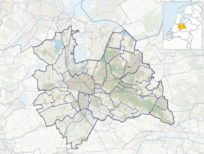
See Driebergen-Rijsenburg, Utrechtse Heuvelrug, on the map
Public Transit to Driebergen-Rijsenburg in Utrechtse Heuvelrug
Wondering how to get to Driebergen-Rijsenburg in Utrechtse Heuvelrug, Netherlands? Moovit helps you find the best way to get to Driebergen-Rijsenburg with step-by-step directions from the nearest public transit station.
Moovit provides free maps and live directions to help you navigate through your city. View schedules, routes, timetables, and find out how long does it take to get to Driebergen-Rijsenburg in real time.
Bus:Train:
Want to see if there’s another route that gets you there at an earlier time? Moovit helps you find alternative routes or times. Get directions from and directions to Driebergen-Rijsenburg easily from the Moovit App or Website.
We make riding to Driebergen-Rijsenburg easy, which is why over 1.5 million users, including users in Utrechtse Heuvelrug, trust Moovit as the best app for public transit. You don’t need to download an individual bus app or train app, Moovit is your all-in-one transit app that helps you find the best bus time or train time available.
For information on prices of bus and train, costs and ride fares to Driebergen-Rijsenburg, please check the Moovit app.
Use the app to navigate to popular places including to the airport, hospital, stadium, grocery store, mall, coffee shop, school, college, and university.
Driebergen-Rijsenburg Address: 3972 ZE street in Utrechtse Heuvelrug
Driebergen-Rijsenburg is a town in the municipality Utrechtse Heuvelrug in the central Netherlands, in the province of Utrecht. It is the home of Michelin starred restaurant La Provence.Wiki
Attractions near Driebergen-Rijsenburg
Quint Boomverzorging Boy,Fysiotherapie Valkenkamp,kot der Belgen,Hoge Licht,Reset National B.V.,Abbeyfield,Klaproos,'t Hoge Licht,Protestanse Kerk 't Hoge Licht,A. Bode Assurantien,Fotostudio BeeldKracht,Valkenkamp 47,Pixelpraktijk, De,Damhertlaan,Aukema,Driebergen, Damhertlaan,Klaproos 20,Huisartsenpraktijk Van Grondelle en Lottooij,Kardinaal Alfrinklaan 17,De GruttoHow to get to popular attractions in Utrechtse Heuvelrug with public transit
Van der Valk, Houten,Station Baarn, Baarn,SnowWorld, Landgraaf,Belgisch Biercafé Olivier, Utrecht,Station Delft Zuid, Delft,Safaripark Beekse Bergen, Hilvarenbeek,Kinepolis, Enschede,Euroscoop, Tilburg,Tilburg University, Tilburg,Martinus Nijhoffbrug, Zaltbommel,Veerdienst Schoonhoven - Gelkenes, Schoonhoven,Duinrell, Wassenaar,Brouwerij 't IJ, Amsterdam,TESO-Veerboot Den Helder → Texel, Den Helder,Pathé Schouwburgplein, Rotterdam,Station Amersfoort Schothorst, Amersfoort,Capgemini, Utrecht,Station Hengelo, Hengelo,Scheveningse Strand, 'S-Gravenhage,Ministerie van Buitenlandse Zaken, 'S-GravenhageGet around Utrechtse Heuvelrug by public transit!
Traveling around Utrechtse Heuvelrug has never been so easy. See step by step directions as you travel to any attraction, street or major public transit station. View bus and train schedules, arrival times, service alerts and detailed routes on a map, so you know exactly how to get to anywhere in Utrechtse Heuvelrug.
When traveling to any destination around Utrechtse Heuvelrug use Moovit's Live Directions with Get Off Notifications to know exactly where and how far to walk, how long to wait for your line, and how many stops are left. Moovit will alert you when it's time to get off — no need to constantly re-check whether yours is the next stop.
Wondering how to use public transit in Utrechtse Heuvelrug or how to pay for public transit in Utrechtse Heuvelrug? Moovit public transit app can help you navigate your way with public transit easily, and at minimum cost. It includes public transit fees, ticket prices, and costs. Looking for a map of Utrechtse Heuvelrug public transit lines? Moovit public transit app shows all public transit maps in Utrechtse Heuvelrug with all bus or train routes and stops on an interactive map.
Utrechtse Heuvelrug has 2 transit type(s), including: bus or train, operated by several transit agencies, including NS, NS International, GVB, GVB, GVB, GVB, U-OV, U-OV, Overal, HTM, R-net, RET, RET, De Lijn and Connexxion